
Images


May 21, 2015 - Northeastern United States
 Tweet
Tweet
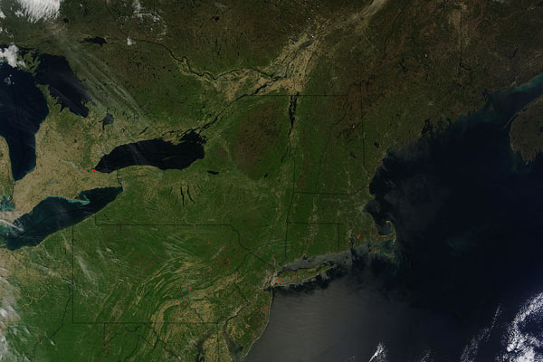
On May 14, 2015 the Moderate Resolution Imaging Spectroradiometer (MODIS) aboard NASA’s Terra satellite captured this true-color image of a clear-sky spring day in the northeastern United States.
Fourteen states are visible in this view, as well as two Canadian provinces. In the north, the province of Ontario sits in the west, with Quebec, Canada in the east. Further east, bordering the Atlantic Ocean, lies the state of Maine. Moving from east to west from the border of Maine are New Hampshire, Vermont and New York. The long, thin, roughly parallel bodies of water in New York State are the Finger Lakes. On its western border, New York contains parts of both Lake Ontario (north) and Lake Erie. Both of these Great Lakes now appear fully free of winter’s ice.
Below New Hampshire and Vermont lies Massachusetts, with the hook-shaped peninsula of Cape Cod jutting into the Atlantic Ocean. South of that state lies tiny Rhode Island (east) and Connecticut (west). South of New York the large, square state of Pennsylvania lies inland, with Ohio on its western border and New Jersey along its eastern border. The shape of Pennsylvania has been likened to that of a Great Dane, with a broad, square head, short ears and large nose and jowls. Along the southern border of Pennsylvania lies, from west to east, West Virginia, Maryland, and Delaware. Virginia is the southernmost of the fourteen states.
Image Facts
Satellite:
Terra
Date Acquired: 5/14/2015
Resolutions:
1km (431.1 KB), 500m (1.7 MB), 250m (4.4 MB)
Bands Used: 1,4,3
Image Credit:
Jeff Schmaltz, MODIS Land Rapid Response Team, NASA GSFC
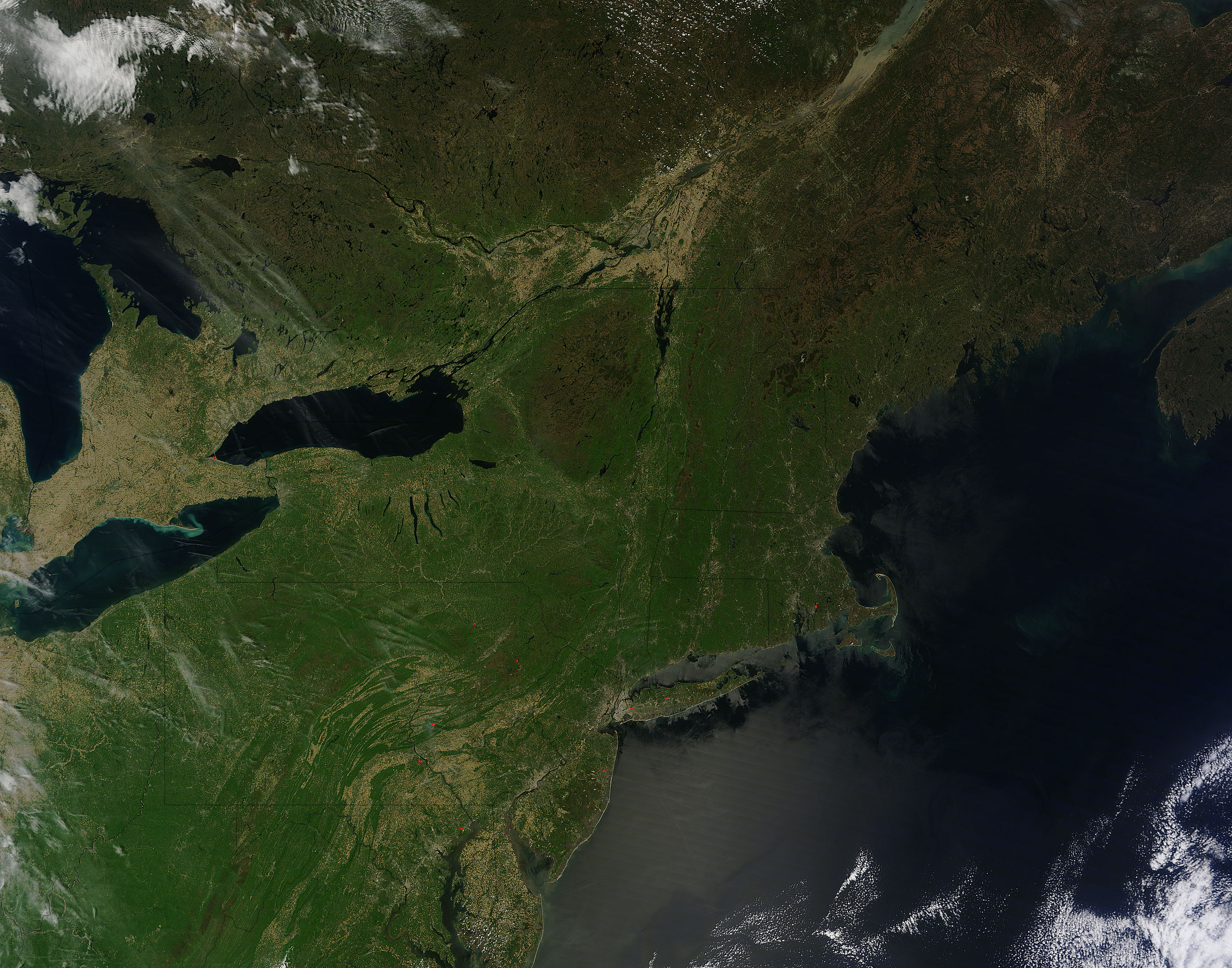
