
Images


June 23, 2015 - Southern Alaska
 Tweet
Tweet
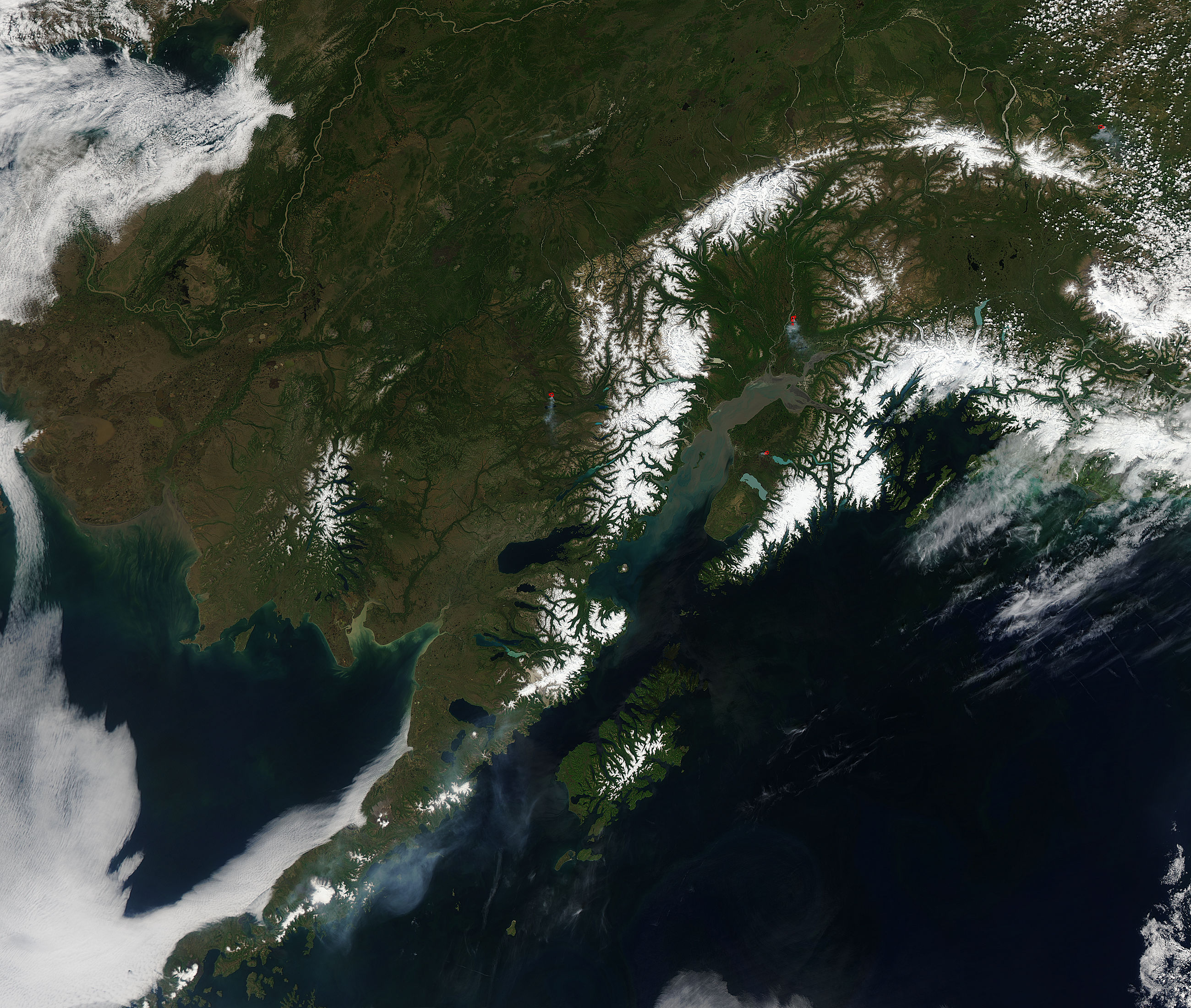
A clear spring day across southern Alaska allowed the Moderate Resolution Imaging Spectroradiometer (MODIS) aboard the Aqua satellite to capture this expansive view on June 15, 2015.
Clear skies are unusual for this part of the world – the south coast of Alaska has the distinction of being the cloudiest region of the United States, with some areas averaging more than 340 cloudy days per year. Alaska’s landscape is very beautiful – with green boreal forests, long rivers, and tall mountains.
The Chugach Mountains, hugging the coast, and the Alaska Range arcing inland wear a thick blanket of white snow. Near the top of the image, the Yukon River enters Alaska from British Columbia, Canada (east), and winds through the green boreal forests as it heads towards the Bering Sea. Tan sediment fills the Cook Inlet, south of Anchorage. A long bank of low clouds (fog) hugs the western coast of the Alaskan Peninsula and over Bristol Bay.
Red hotspots combined with smoke mark actively burning fires. The Sockeye Fire, located about 40 miles north of Anchorage had burned approximately 6,500 acres by June 15. The fire had expanded to 7,264 acres by June 22 and was 79% contained. A warm, dry spring has caused a difficult fire season through many parts of Alaska. On June 19, Alaska Governor Bill Walker declared a state of emergency due to multiple wildfires, which were especially fierce on the Kenai Peninsula.
Image Facts
Satellite:
Aqua
Date Acquired: 6/15/2015
Resolutions:
1km (380.6 KB), 500m (1.3 MB), 250m (3.3 MB)
Bands Used: 1,4,3
Image Credit:
Jeff Schmaltz, MODIS Land Rapid Response Team, NASA GSFC
