
Images


July 3, 2015 - Lake Fire, southern California
 Tweet
Tweet
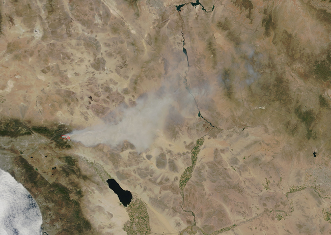
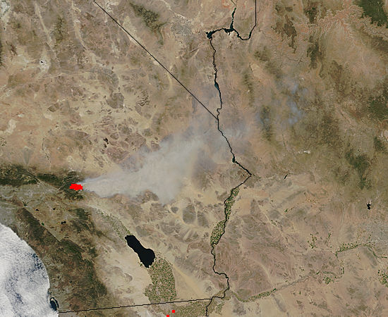
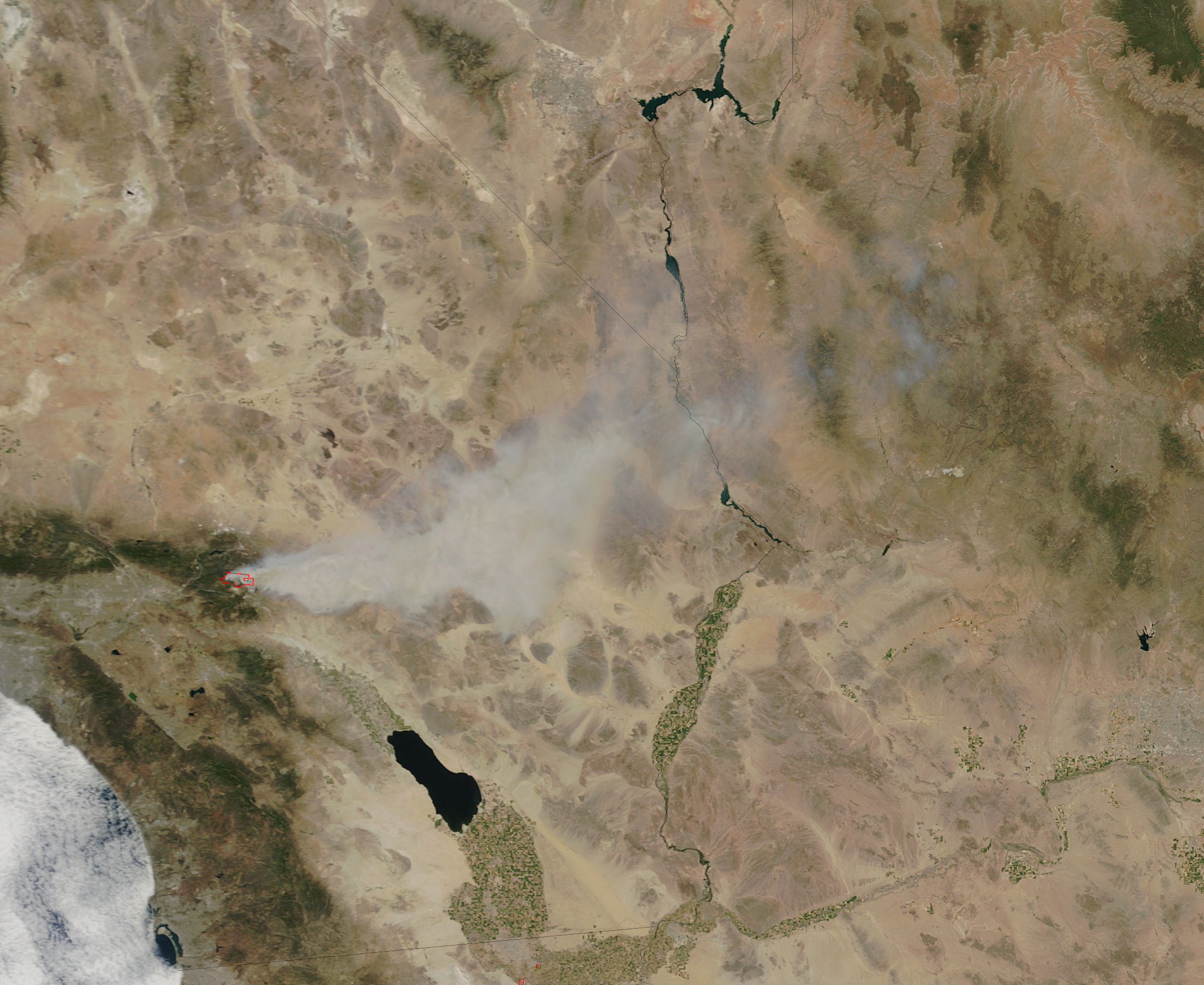
At 11:10 a.m. local time (1810 Universal) on June 18, 2015, the Moderate Resolution Imaging Spectroradiometer (MODIS) aboard the Terra satellite acquired this true-color image of smoke from California’s Lake fire streaming east toward Arizona. The fire was burning in southern California near the San Bernardino National Forest. Red outlines indicate hot spots where MODIS detected unusually warm surface temperatures associated with fire activity.
The Lake fire was reported on the afternoon of June 17, but it expanded rapidly on June 18, growing from about 1,500 acres (600 hectares) in the afternoon to 10,000 acres (4,000 hectares) in the evening. Hot, dry winds have helped fuel the blaze. More than 150 structures, mainly cabins, are threatened by the fire, according to news reports.
Buy July 2, the fire had destroyed about 31,359 acres (12,690.5 hectares) of timberland. It was reported to be 75% contained, with no perimeter growth reported on that day. Resources on the scene fighting the fire included 25 engines, 2 air tankers, 13 helicopters, 36 crews, 5 water tenders, and 1 dozer. 1,225 personnel have been assigned to the fire. One structure and three outbuildings have been destroyed, and five minor firefighter injuries.
Image Facts
Satellite:
Terra
Date Acquired: 6/18/2015
Resolutions:
1km (71.6 KB), 500m (238.2 KB), 250m (560.2 KB)
Bands Used: 1,4,3
Image Credit:
Jeff Schmaltz, MODIS Land Rapid Response Team, NASA GSFC
