
Images


July 4, 2015 - Fires in southwestern United States
 Tweet
Tweet
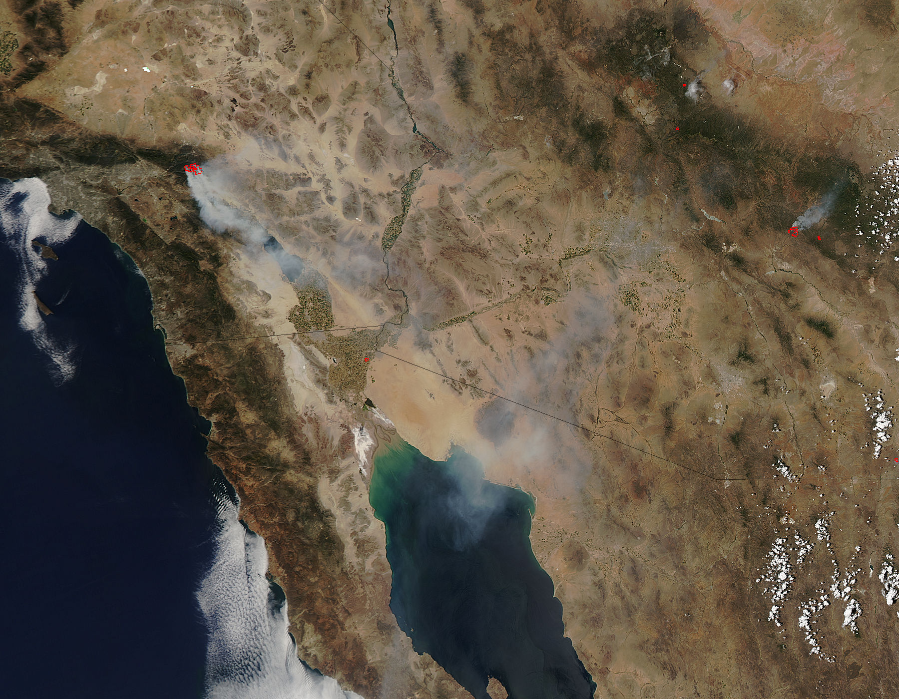
The fire season in the southwestern United States was off to a roaring start by mid-June, 2015. The Moderate Resolution Imaging Spectroradiometer (MODIS) aboard NASA’s Aqua satellite captured this true-color image on June 19.
Red hotspots mark areas where the thermal bands on the instrument detected high temperatures. Combined with typical smoke, as can be seen in this image, such hotspots are diagnostic for actively burning fires.
The large fire in the west of the image is the Lake Fire. Located in the rugged terrain of California’s San Bernardino Mountains, the blaze was first reported on June 17. Fueled by unusually warm air temperatures and strong winds have fueled the blaze, and by July 3 it had consumed 31,359 acres of timberland. The cost of this fire is already estimated at $37.8 million, according to Inciweb. One structure was burned, and five people have been injured. The blaze is considered 80% contained, and has not grown in the last 24 hours.
Several active fires are seen in Arizona. The largest appears to be the Whitetail Fire which ignited on June 16 in the San Carlos Reservation. As of June 27, the fire had consumed about 33,633 Acres of grass, oak, juniper, chaparral, and Ponderosa Pine.
Image Facts
Satellite:
Aqua
Date Acquired: 6/19/2015
Resolutions:
1km (174.4 KB), 500m (597.5 KB), 250m (1.4 MB)
Bands Used: 1,4,3
Image Credit:
Jeff Schmaltz, MODIS Land Rapid Response Team, NASA GSFC
The fire season in the southwestern United States was off to a roaring start by mid-June, 2015. The Moderate Resolution Imaging Spectroradiometer (MODIS) aboard NASA’s Aqua satellite captured this true-color image on June 19.
Red hotspots mark areas where the thermal bands on the instrument detected high temperatures. Combined with typical smoke, as can be seen in this image, such hotspots are diagnostic for actively burning fires. The large fire in the west of the image is the Lake Fire. Located in the rugged terrain of California’s San Bernardino Mountains, the blaze was first reported on June 17. Fueled by unusually warm air temperatures and strong winds have fueled the blaze, and by July 3 it had consumed 31,359 acres of timberland. The cost of this fire is already estimated at $37.8 million, according to Inciweb. One structure was burned, and five people have been injured. The blaze is considered 80% contained, and has not grown in the last 24 hours.
Several active fires are seen in Arizona. The largest appears to be the Whitetail Fire which ignited on June 16 in the San Carlos Reservation. As of June 27, the fire had consumed about 33,633 Acres of grass, oak, juniper, chaparral, and Ponderosa Pine.
Image Facts
Satellite:
Aqua
Date Acquired: 6/19/2015
Resolutions:
1km (174.4 KB), 500m (597.5 KB), 250m (1.4 MB)
Bands Used: 1,4,3
Image Credit:
Jeff Schmaltz, MODIS Land Rapid Response Team, NASA GSFC
