
Images


July 7, 2015 - Fires in northern Australia
 Tweet
Tweet
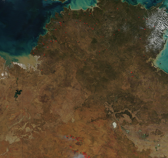
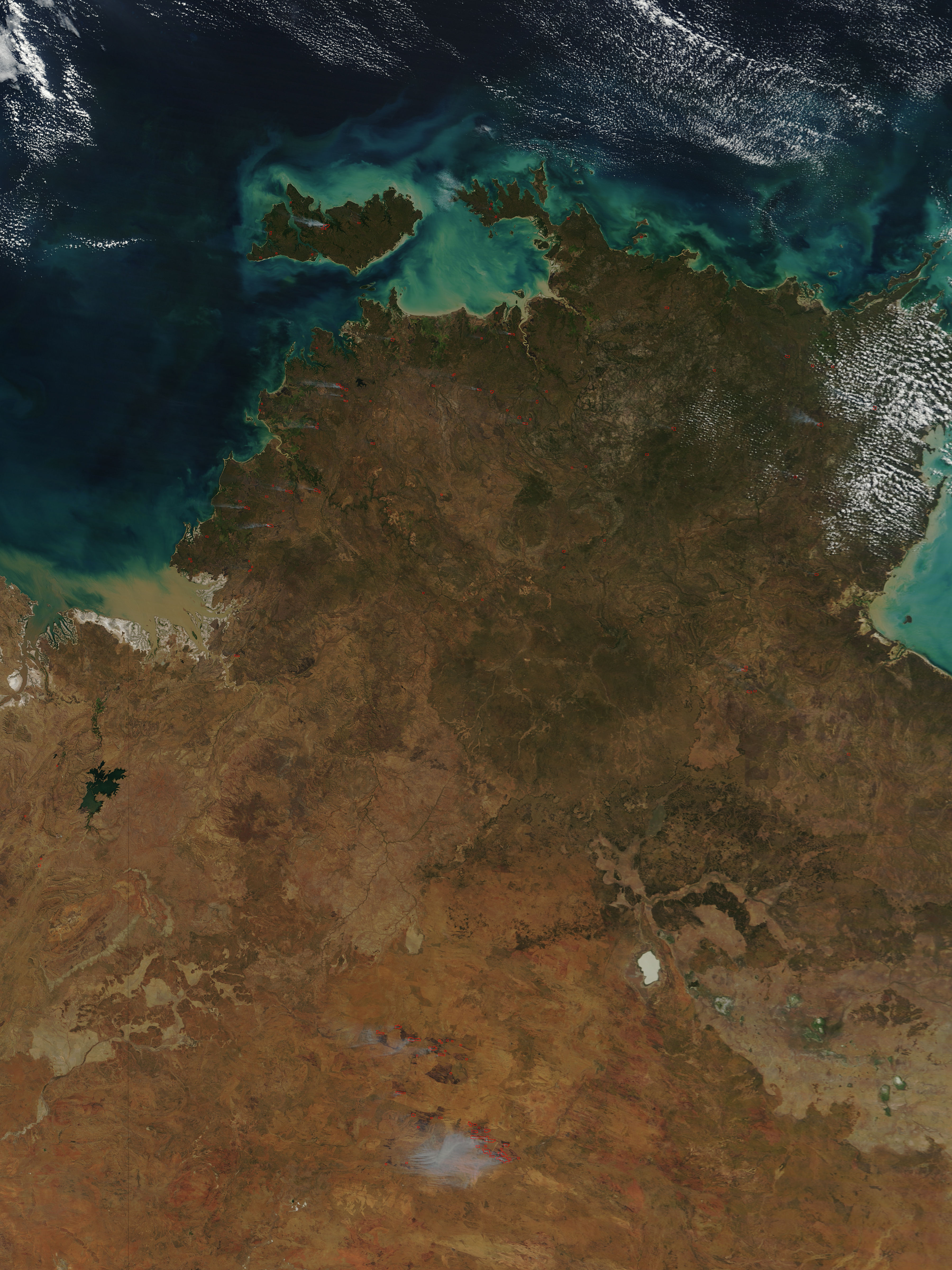
Fires were scattered across Australia’s Top End in late June, 2015. The Moderate Resolution Imaging Spectroradiometer (MODIS) aboard NASA’s Terra satellite captured this true-color image on June 22 as it passed over the region.
Each red hotspot marks an area where the thermal detectors on the instrument noticed areas hotter than the background. When accompanied by typical smoke, as are most in this image, such hotspots are diagnostic for actively burning fire. The fires are scattered throughout Australia’s Northern Territory, including a particularly large area found on Tiwi Islands. According to the Northern Territory Fire and Rescue Service, the fires around Darwin were “grass and scrub fires”. Darwin is located on the mainland, south of the large Tiwi Island.
Image Facts
Satellite:
Terra
Date Acquired: 6/27/2015
Resolutions:
1km (312.3 KB), 500m (1.1 MB), 250m (2.7 MB)
Bands Used: 1,4,3
Image Credit:
Jeff Schmaltz, MODIS Land Rapid Response Team, NASA GSFC
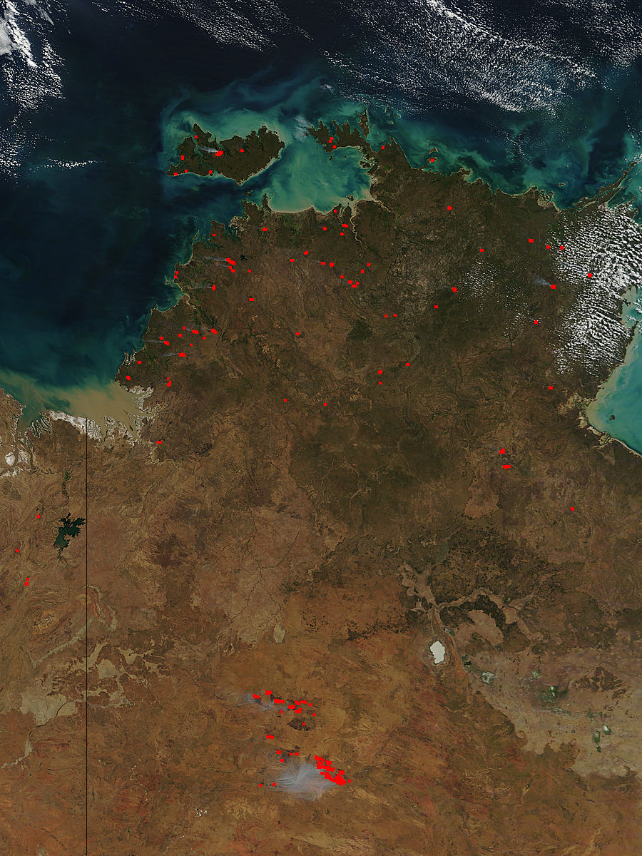
