
Images


July 29, 2015 - Super Typhoon Nangka (11W) over the Marianas Islands
 Tweet
Tweet
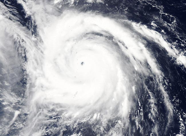
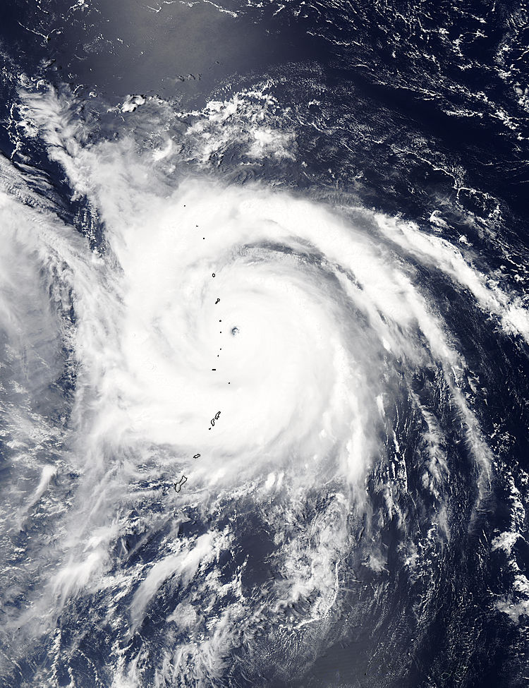
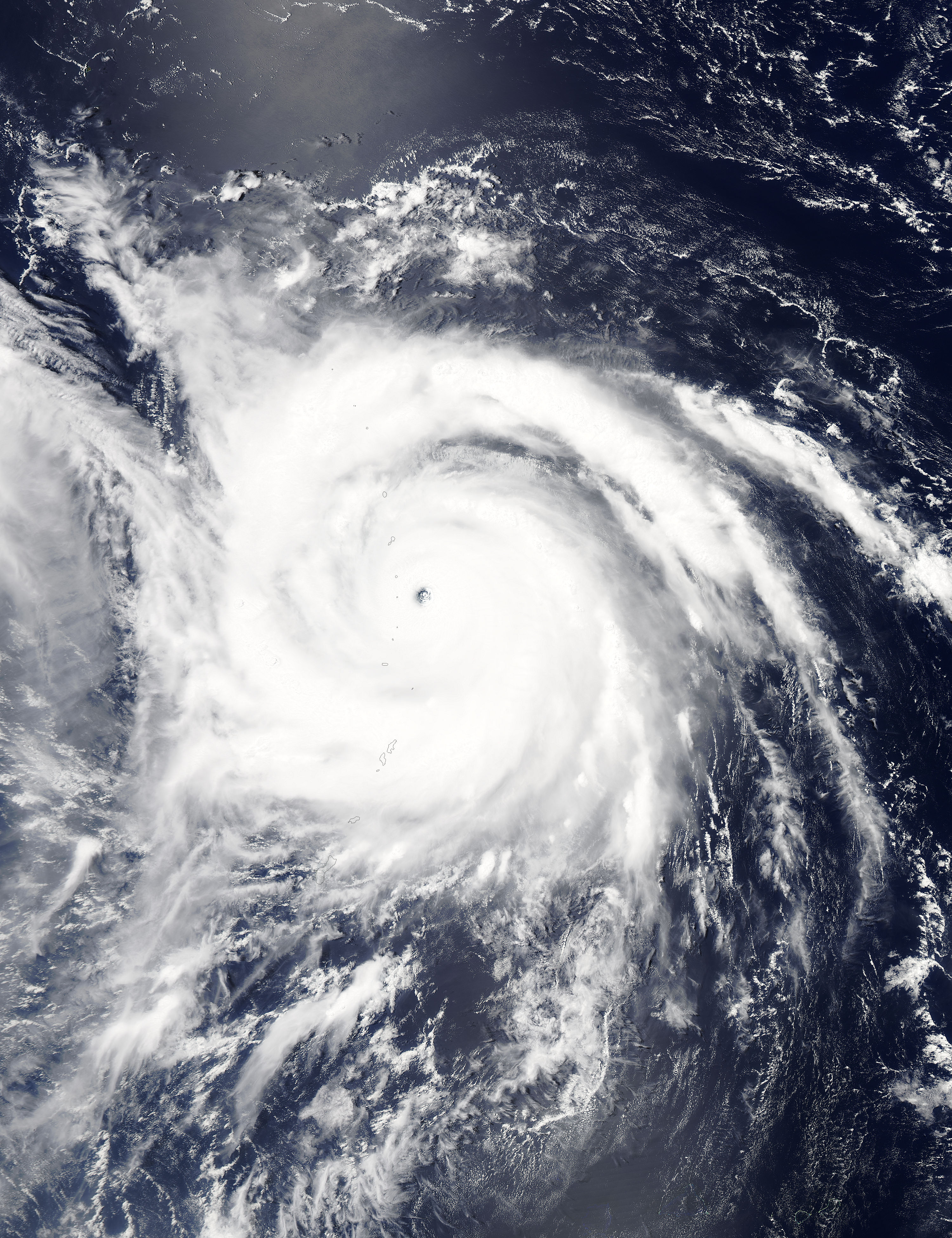
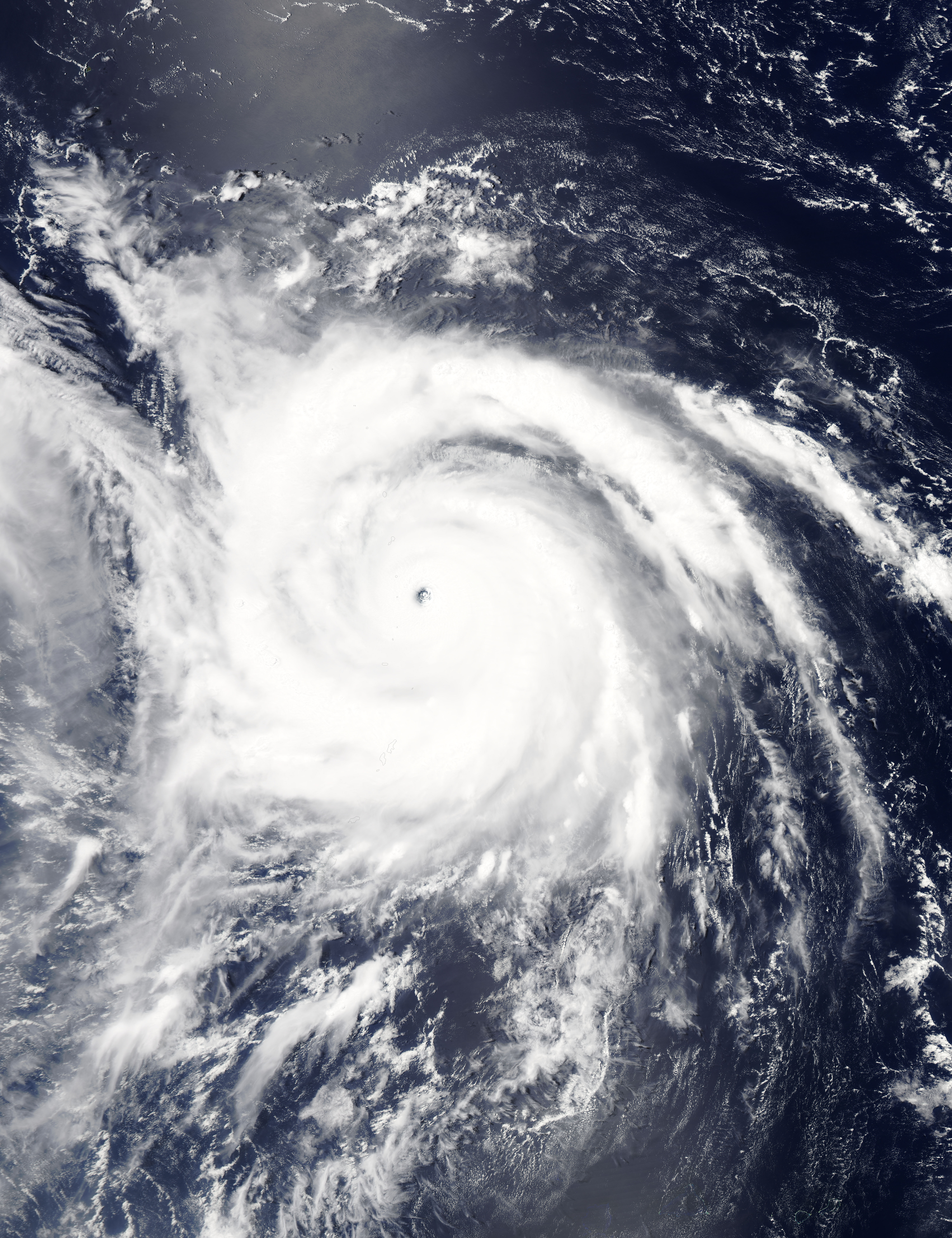
On July 9, 2015 the Moderate Resolution Imaging Spectroradiometer (MODIS) aboard NASA�s Aqua satellite captured this true-color image of the massive Typhoon Nangka moving out of the Marianas Islands. At the time the image was captured, 3:30 UTC (11:00 pm July 8 EDT), the storm had a cloud-filled eye and a slightly elongated shape, suggestive of interaction with the reported northerly vertical wind shear.
Nangka was a Super typhoon, but weakened to typhoon status. "Super-typhoon" is a term utilized by the U.S. Joint Typhoon Warning Center for typhoons that reach maximum sustained 1-minute surface winds of at least 150 mph (241 km/h). This is the equivalent of a strong Saffir-Simpson category 4 or category 5 hurricane in the Atlantic basin or a category 5 severe tropical cyclone in the Australian basin. Nangka peaked on July 9 with maximum sustained wind speeds of approximately 155 mph (250 km/h).
On July 9 at 1500 UTC (11 a.m. EDT), Typhoon Nangka had maximum sustained dropped to near 126.6 mph (203.7 km/h) It was centered 18.3 North latitude and 140.9 East longitude, about 890 nautical miles (1,024 miles/1,648 km) east-southeast of Kadena Air Force Base, Japan. It was moving to the west at 8 knots (9.2 mph/14.8 km/h) and is generating rough seas with waves to 40 feet (12.1 meters).
After leaving the Marianas Islands, Typhoon Nangka headed towards Japan. Even though it had weakened considerably, the storm caused the evacuation of over 200,000 people and caused flooding. At least two deaths and thirty injuries were reported due to the storm.
Nangka made landfall near Cape Muroto on Shikoku Island late July 16 (local time). It then tracked over Japan's main island of Honshu with wind gusts to 78.2 mph (126 km/h) according to the Japan Meteorological Agency. By Friday, July 17 at noon (local time), Nangka was moving near western Japan's Tottori Prefecture and into the Sea of Japan. By July 19 the storm withered to a tropical depression with no further damage.
Image Facts
Satellite:
Aqua
Date Acquired: 7/29/2015
Resolutions:
1km (233.1 KB), 500m (2.9 MB), 250m (6.9 MB)
Bands Used: 1,4,3
Image Credit:
Jeff Schmaltz, MODIS Land Rapid Response Team, NASA GSFC
