
Images


September 27, 2015 - Fires in central Brazil
 Tweet
Tweet
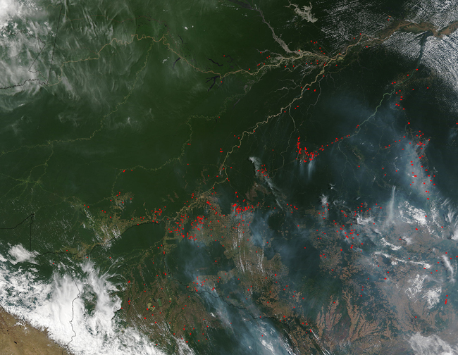
Earlier this year researchers and scientists at NASA and UC-Irvine predicted that the wildfire risk for the western Amazon Basin should be lower in 2015 than in past years. However, they also projected that the risk for the eastern part will be higher.
The Moderate Resolution Imaging Spectroradiometer (MODIS) aboard NASAÆs Terra satellite acquired this true-color image of fires centered in Brazil. In the state of Amazonas, the fire activity is low, but in Acre, Mato Grosso, Para, and Rodonia, the fire activity appears to be much higher.
The study goes on to say the reason has to do with the El Ni±o event which developed earlier this year and in currently in full effect. According to the study, "Sea surface temperatures in the Pacific Ocean are warmer than normal ¢ El Ni±o conditions ¢ which suppress rainfall in the eastern Amazon. The three regions at highest risk are Brazil states MaranhŃo, Mato Grosso and Parß. Meanwhile, sea surface temperatures in the tropical North Atlantic are average or cooler than average, keeping higher amounts of rainfall in the south and southwestern Amazon."
Image Facts
Satellite:
Terra
Date Acquired: 9/10/2015
Resolutions:
1km (783.4 KB), 500m (2.6 MB), 250m (6.1 MB)
Bands Used: 1,4,3
Image Credit:
Jeff Schmaltz, MODIS Land Rapid Response Team, NASA GSFC
