
Images


October 13, 2015 - Fires in eastern China
 Tweet
Tweet
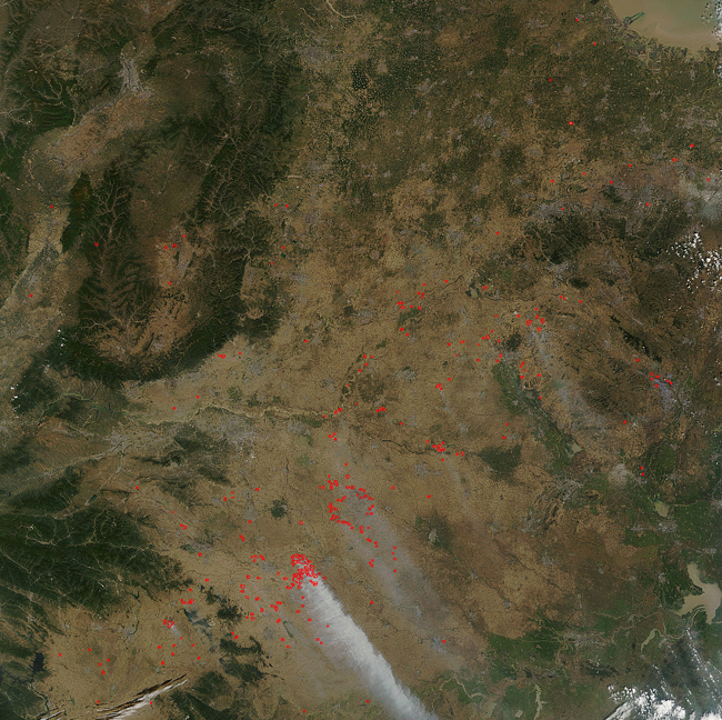
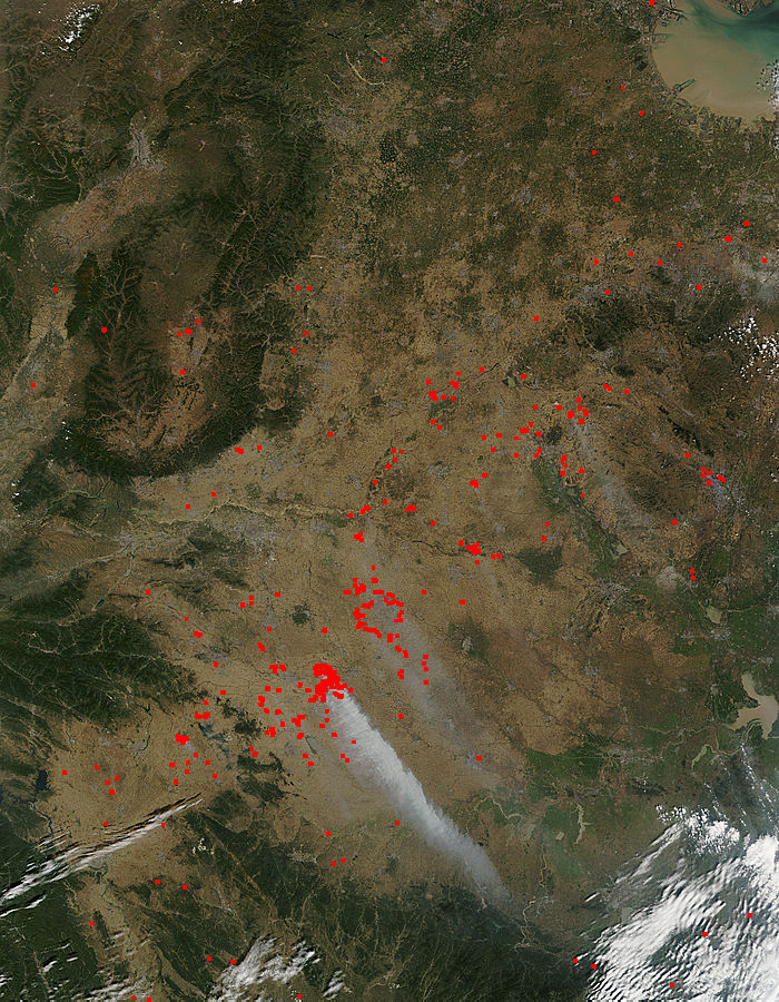
The Moderate Resolution Imaging Spectroradiometer (MODIS) on NASA's Terra satellite collected this true-color image which detected dozens of fires burning in the Henan region of China on October 01, 2015. The location, widespread nature, and number of fires suggest that these fires were deliberately set to manage land. Farmers often use fire to return nutrients to the soil and to clear the ground of unwanted plants. The country of China uses biomass burning in agricultural use more than most other countries.
While fire helps enhance crops and grasses for pasture, the fires also produce smoke that degrades air quality. Each hot spot, which appears as a red mark, is an area where the thermal detectors on the MODIS instrument recognized temperatures higher than background. When accompanied by plumes of smoke, as in this image, such hot spots are diagnostic for fire. The smoke released by any type of fire (forest, brush, crop, structure, tires, waste or wood burning) is a mixture of particles and chemicals produced by incomplete burning of carbon-containing materials. All smoke contains carbon monoxide, carbon dioxide and particulate matter or soot. As such the smoke produced by these fires is a health hazard, especially to those with respiratory ailments and to children and the elderly. Smoke tends to drift on jet streams to other areas of the world affecting a large population.
Image Facts
Satellite:
Terra
Date Acquired: 10/1/2015
Resolutions:
1km (233 KB), 500m (949.3 KB), 250m (2.4 MB)
Bands Used: 1,4,3
Image Credit:
Jeff Schmaltz, MODIS Land Rapid Response Team, NASA GSFC
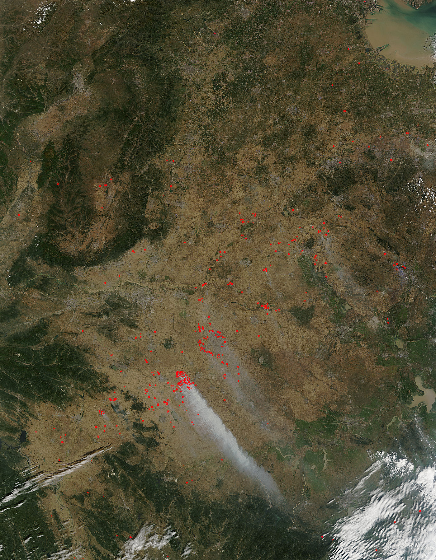
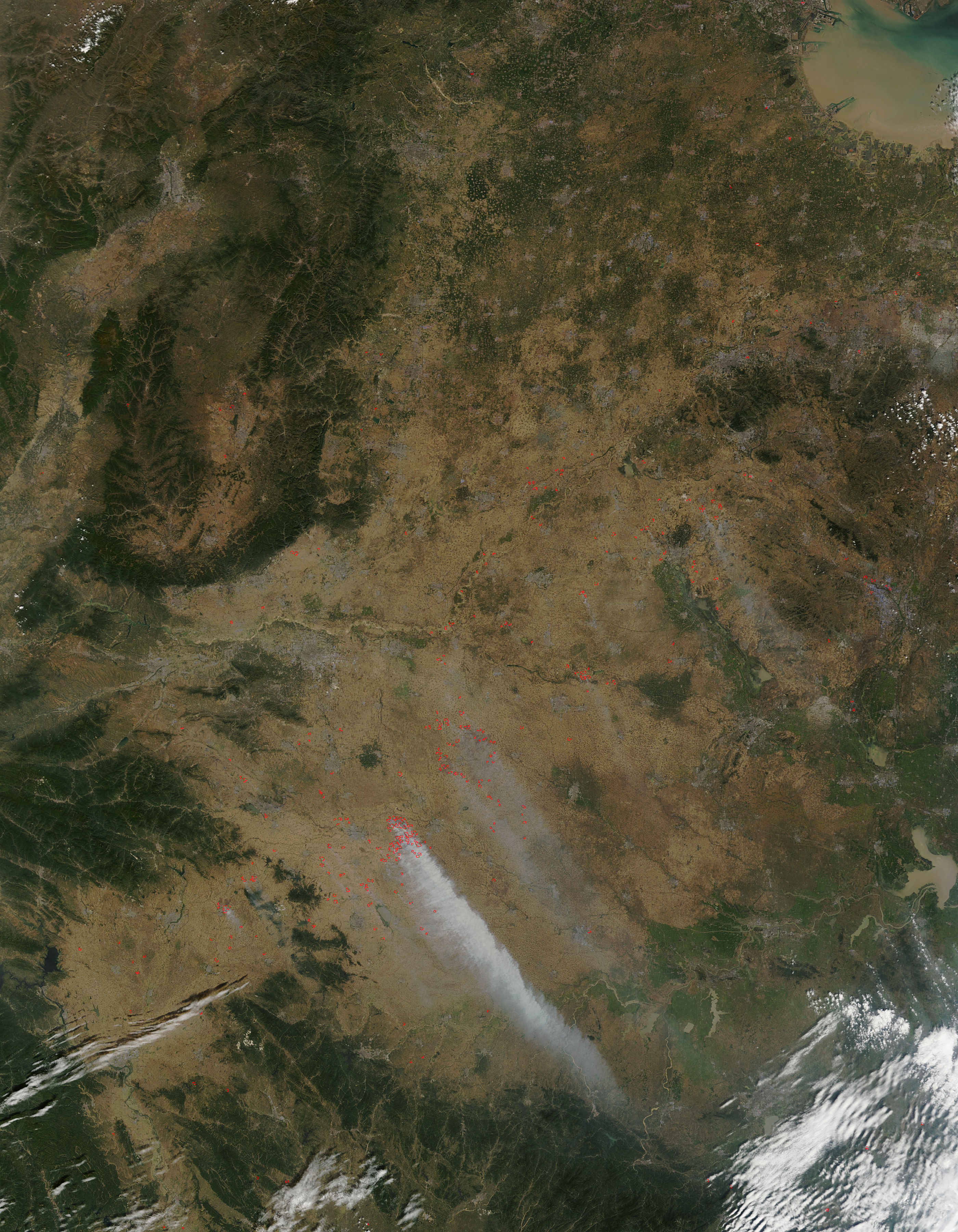
