
Images


November 19, 2015 - Cloud vortices off Saint Helena Island, South Atlantic Ocean
 Tweet
Tweet
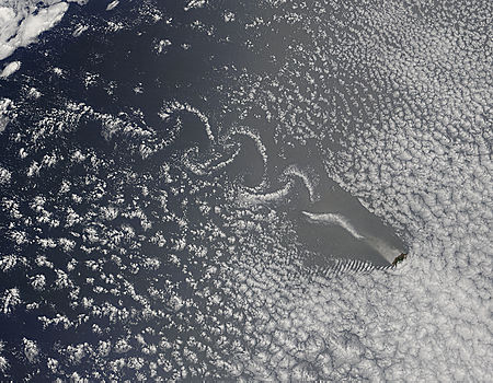
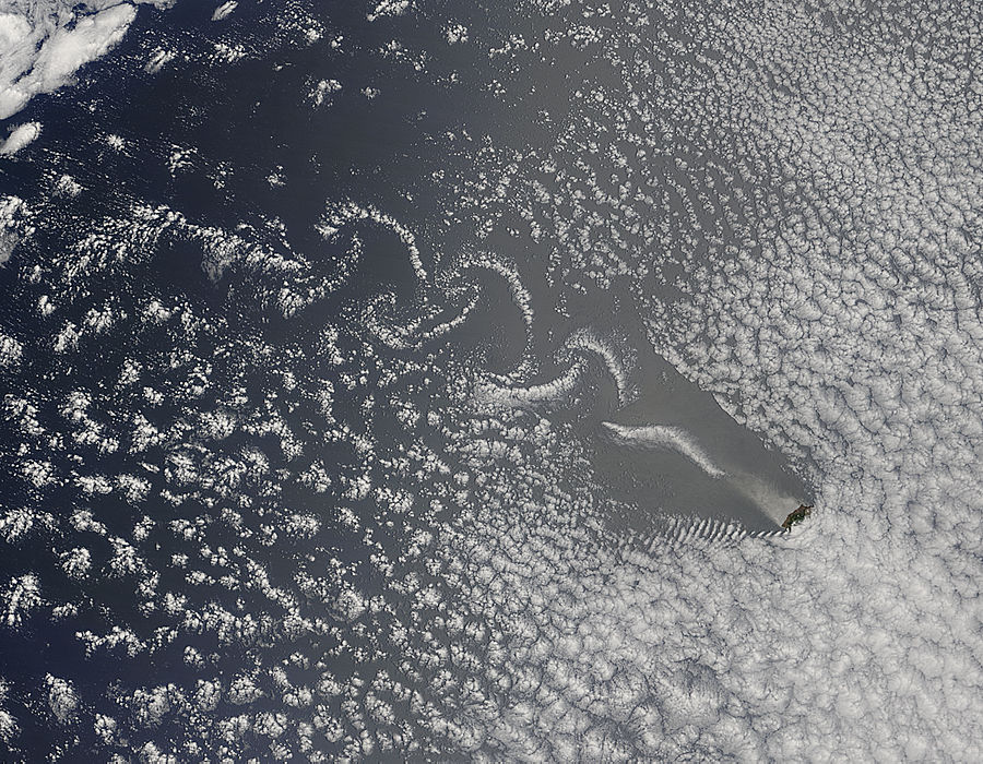
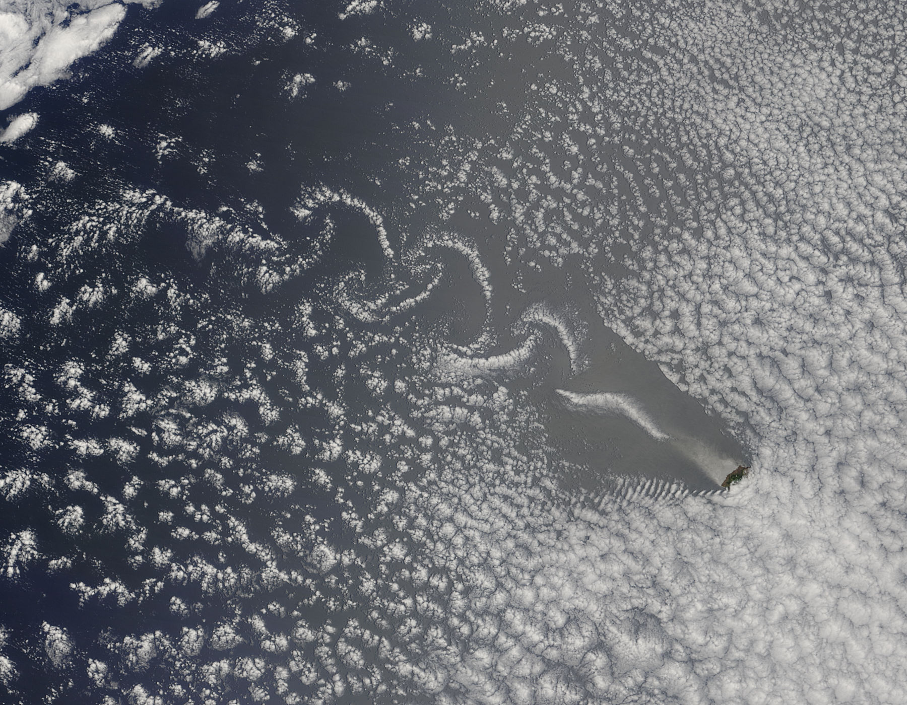
In early November 2015 NASA’s Terra satellite flew over St. Helena Island as wind was writing its movements in the clouds. The Moderate Resolution Imaging Spectroradiometer (MODIS) aboard that satellite looked down on the scene and captured this beautiful image on November 10.
St. Helena is a volcanic island in the South Atlantic Ocean with a rugged topography. The tallest point is Mount Actaeon, which rises 2,684 feet (818 meters) above sea level. The island also sits in the southeasterly trade winds, so they are exposed to steady winds of 10-20 mph (16-30 km/h) with gusts higher at times. The winds can blow unimpeded across the open waters of the ocean for hundreds of miles, but when it strikes the face of the mountains its flow is disrupted. As wind blows around the island, the turbulent air creates eddies on the leeward side, but like a flowing river forms eddies on the downriver side of a piling. The spinning winds form mathematically predictable patterns called von Karma vortices. When clouds are in the sky, these vortices become visible from above.
Image Facts
Satellite:
Terra
Date Acquired: 11/10/2015
Resolutions:
1km (69.5 KB), 500m (255.9 KB), 250m (592.1 KB)
Bands Used: 1,4,3
Image Credit:
Jeff Schmaltz, MODIS Land Rapid Response Team, NASA GSFC
