
Images


November 26, 2015 - Tropical Storm Kate (12L) over the Bahamas
 Tweet
Tweet
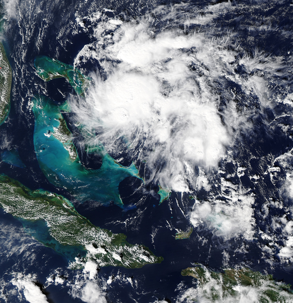
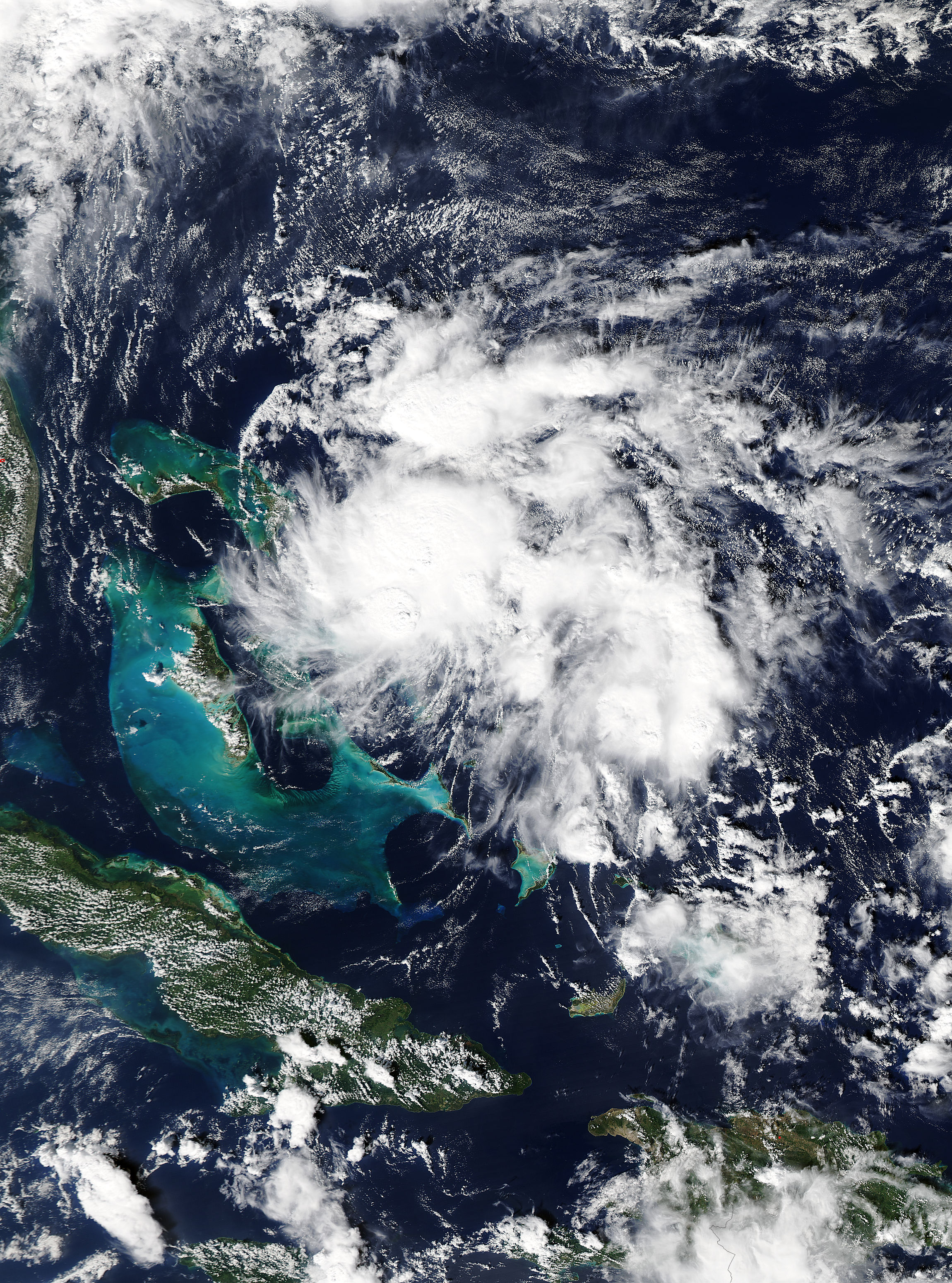
Tropical Storm Warnings were in effect for central and northwestern Bahamas as Tropical Storm Kate approached the Bahamas in early November 2015. The Moderate Resolution Imaging Spectroradiometer (MODIS) aboard NASA's Aqua satellite captured this true-color image on November 9.
Kate first formed as a tropical depression on November 8 about 115 miles (190 km) southeast of San Salvador. By the morning of November 9 the system had strengthened to tropical storm strength with maximum sustained winds of about 40 mph (65 km/h). By 10 a.m. EST (1500 UTC) on November 9 the center of Tropical Storm Kate was located near 24.5 North, longitude 75.3 West or just 15 miles (25 km) east-northeast of Cat Island. After passing close to Cat Island, Kate tracked northeast to become the season’s fourth hurricane on November 11 and dissipated over the northern Atlantic Ocean on November 12. Remnants of the storm brought rain to the United Kingdom on November 14.
Image Facts
Satellite:
Aqua
Date Acquired: 11/9/2015
Resolutions:
1km (690.9 KB), 500m (2.3 MB), 250m (5.4 MB)
Bands Used: 1,4,3
Image Credit:
Jeff Schmaltz, MODIS Land Rapid Response Team, NASA GSFC
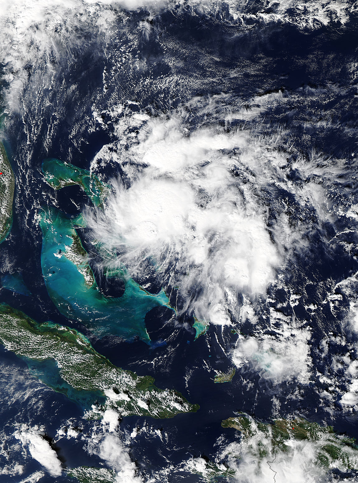
