
Images


January 30, 2016 - Snow across eastern United States
 Tweet
Tweet
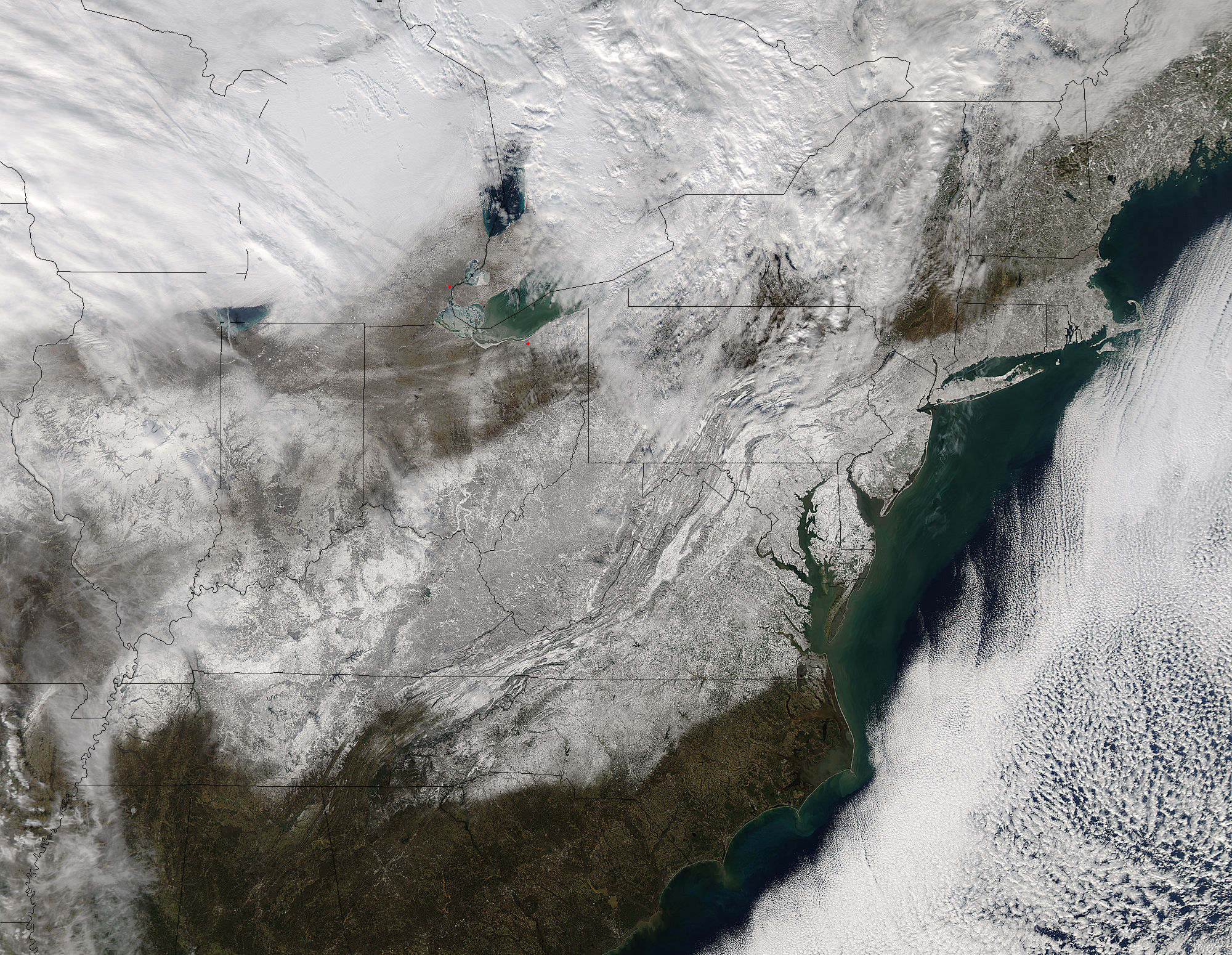
In late January 2016, two low-pressure systems merged into a potent nor'easter, creating a massive winter storm that pummeled the northeastern United States. The massive storm, named Winter Storm Jonas by The Weather Channel and dubbed Snowzilla by local media, was responsible for at least fourteen storm-related deaths, some due to accidents, some to hypothermia and some to shoveling the heavy snow from sidewalks and driveways. It also was responsible for the cancellation of at least 9,500 flights and the stranding of thousands in cars and trucks on highways in Pennsylvania and Kentucky. Hurricane-force winds battered the coastlines, leading to serious flooding and beach erosion.
The Moderate Resolution Imaging Spectroradiometer (MODIS) aboard NASA's Aqua satellite captured this true-color image of the aftermath of the storm at 18:30 UTC (1:30 p.m. EST) on January 24. Snow lies on the ground in a huge swath from Missouri to Maine, as well as southern Canada.
Snow totals topped 30 inches (76 cm) in at least four states, with accumulations of 2 � 3 feet (0.6 � 0.9 meters) being common in the heaviest-hit areas. The storm set quite a number of snowfall records in the Mid-Atlantic north to New York City. In the Baltimore/Washington area, all three airports received record snowfall according to NOAA's National Weather Service, with Baltimore Washington International (BWI) recording 29.2 inches (74.2 cm) by January 24. The most extreme snowfall was 42 in (106.7 cm) in Glengary, West Virginia.
Image Facts
Satellite:
Aqua
Date Acquired: 1/24/2016
Resolutions:
1km (1019.4 KB), 500m (3.7 MB), 250m (9.1 MB)
Bands Used: 1,4,3
Image Credit:
Jeff Schmaltz, MODIS Land Rapid Response Team, NASA GSFC
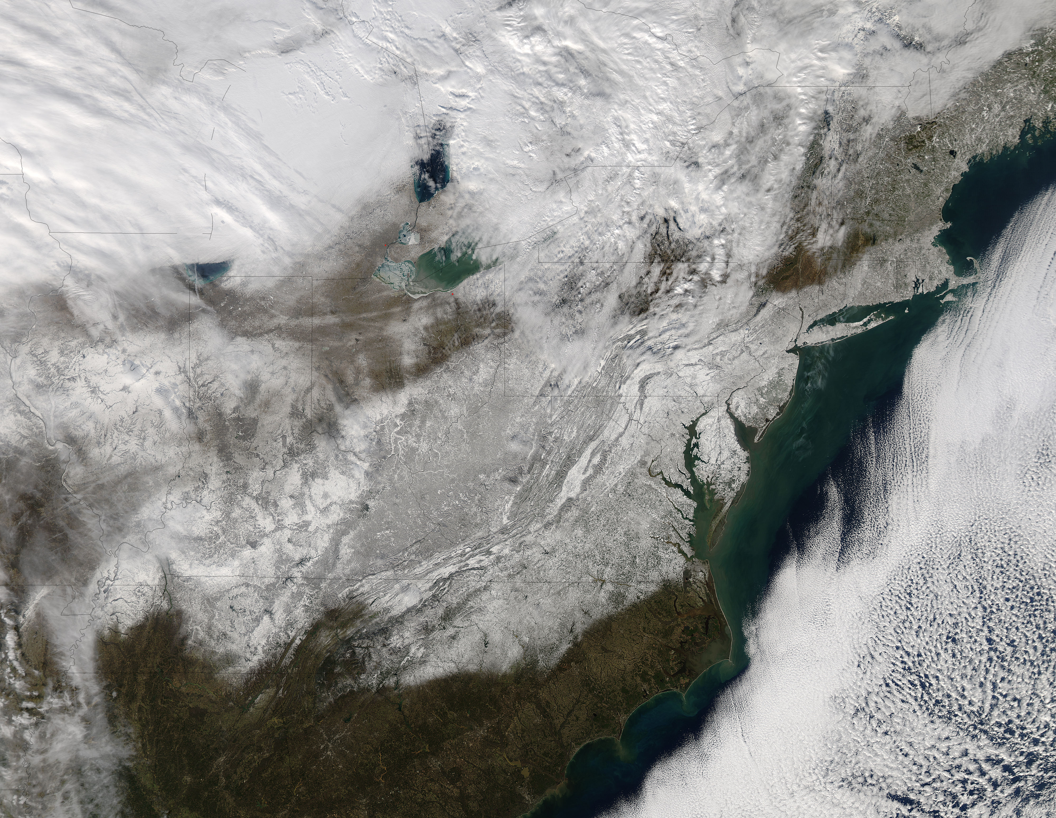
