
Images


February 2, 2016 - Wave clouds over the Central African Republic
 Tweet
Tweet
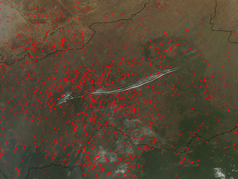
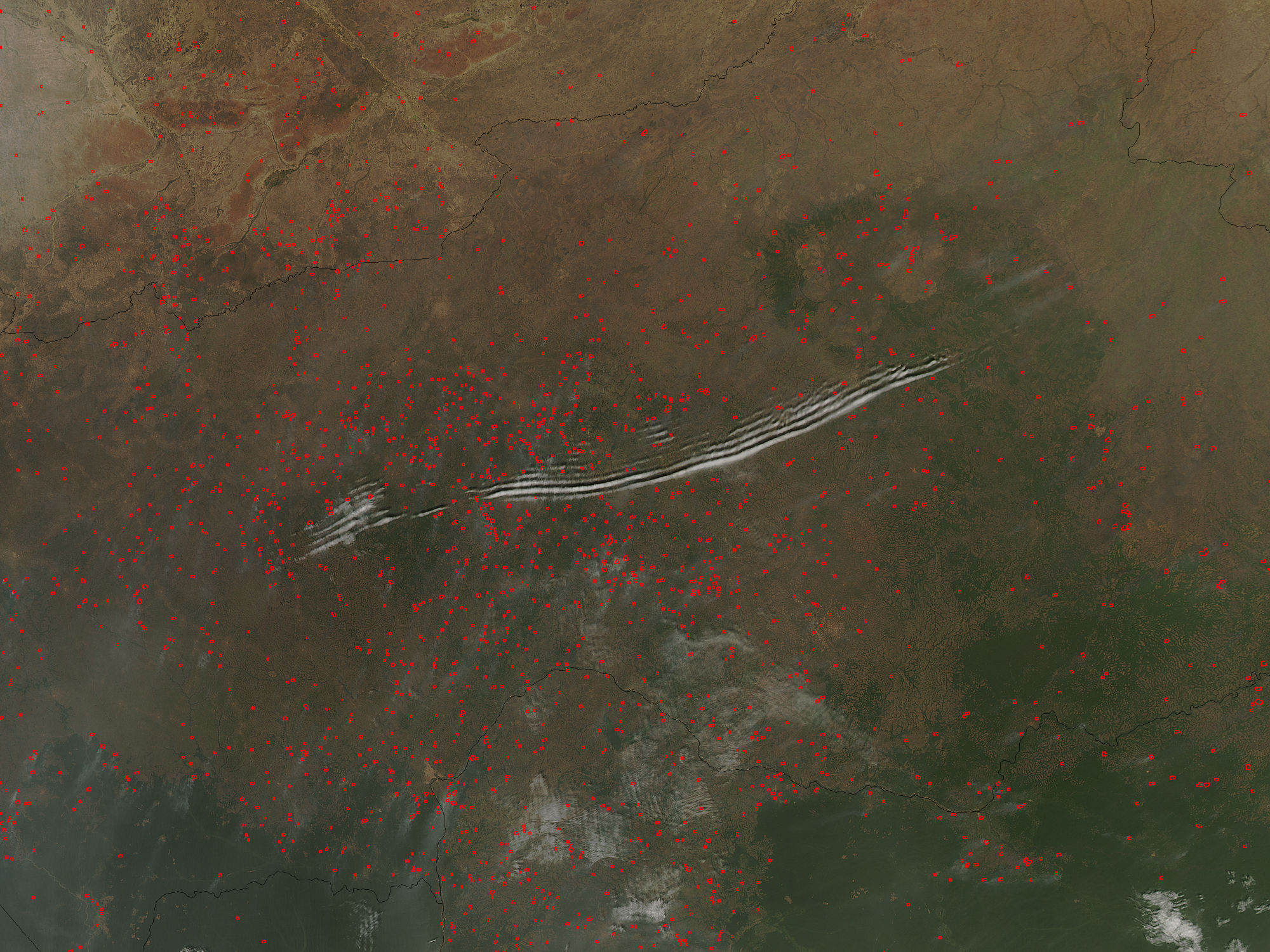
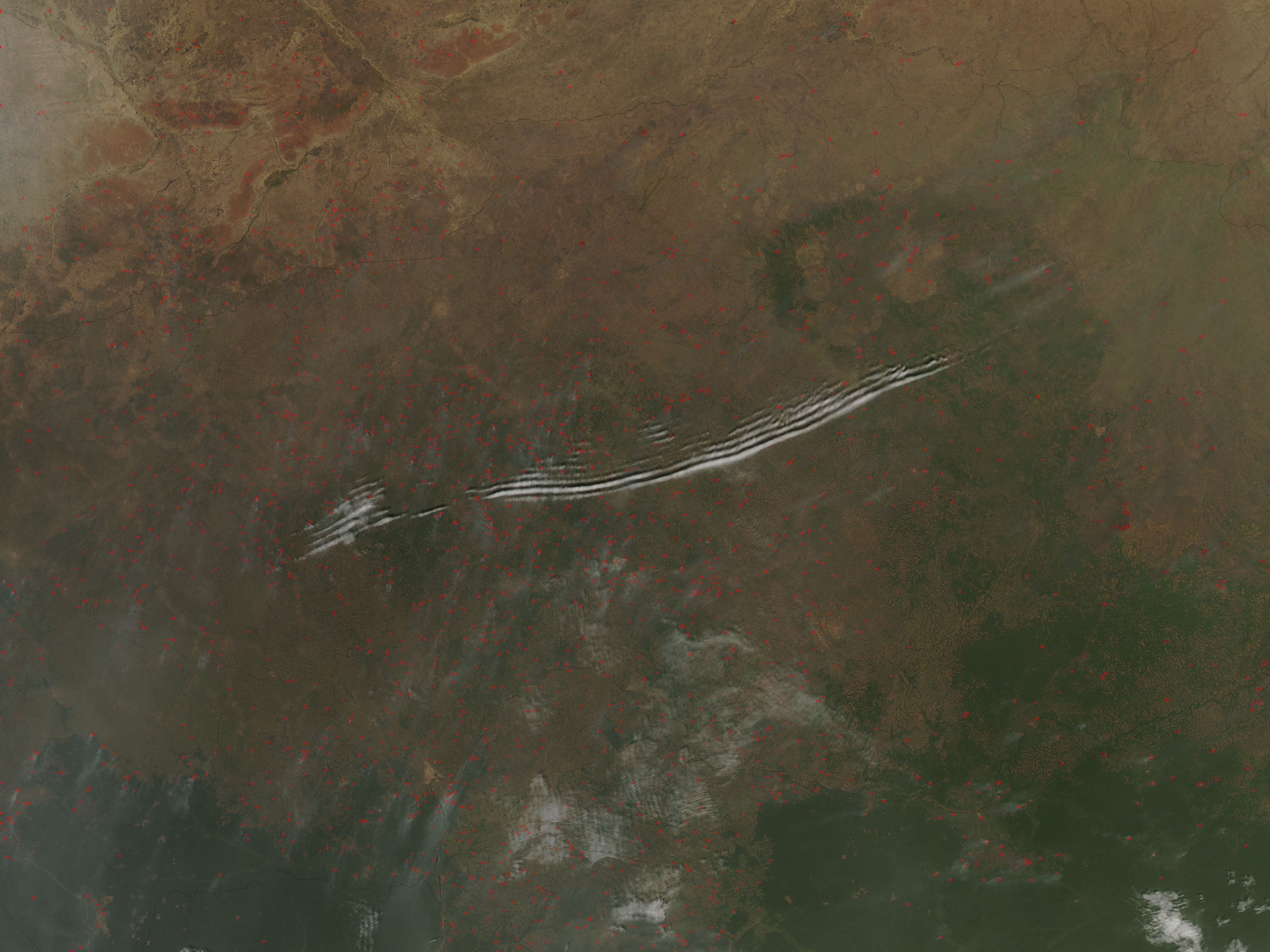
On January 27, 2016, the Moderate Resolution Imaging Spectroradiometer (MODIS) aboard NASA’s Aqua satellite passed over the Central African Republic and captured a true-color image of wave clouds rippling over a fire-speckled landscape.
Wave clouds typically form when a mountain, island, or even another mass of air forces an air mass to rise, then fall again, in a wave pattern. The air cools as it rises, and if there is moisture in the air, the water condenses into clouds at the top of the wave. As the air begins to sink, the air warms and the cloud dissipates. The result is a line of clouds marking the crests of the wave separated by clear areas in the troughs of the wave.
In addition to the long lines of clouds stretching across the central section of the country, clouds appear to line up in parallel rows near the border of the Democratic Republic of the Congo. In this area, small sets of grayish cloud appear to be lined up with the prevailing wind, judging by the plumes of smoke rising from red hotspots near each set of clouds. Clouds like this, that line in parallel rows parallel with the prevailing wind, are known as “cloud streets”.
Each red “hotspot” marks an area where the thermal sensors on the MODIS instrument detected high temperatures. When accompanied by typical smoke, such hotspots are diagnostic for actively burning fires. Given the time of the year, the widespread nature, and the location of the fires, they are almost certainly agricultural fires that have been deliberately set to manage land.
Image Facts
Satellite:
Aqua
Date Acquired: 1/27/2016
Resolutions:
1km (207 KB), 500m (663.9 KB), 250m (1.6 MB)
Bands Used: 1,4,3
Image Credit:
Jeff Schmaltz, MODIS Land Rapid Response Team, NASA GSFC
