
Images


February 3, 2016 - Sediment off southern Alaska
 Tweet
Tweet
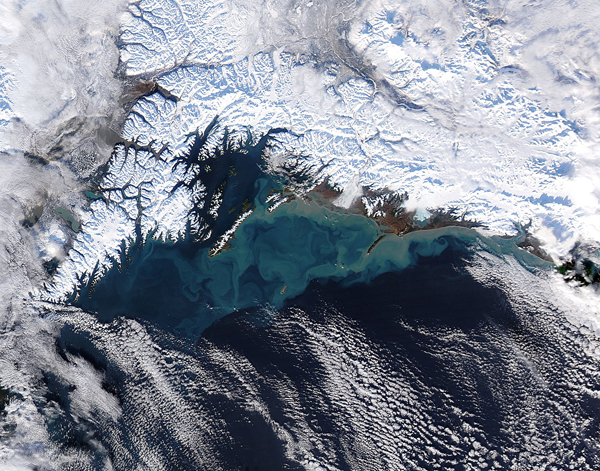
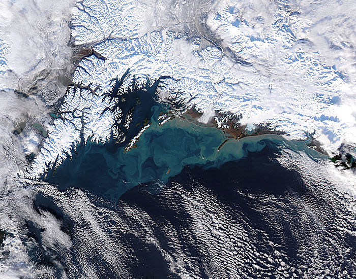
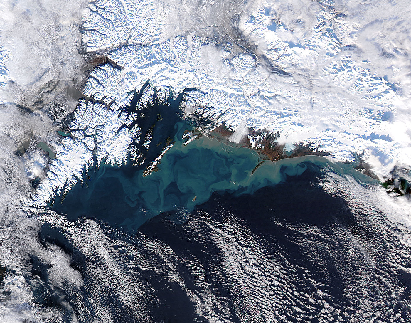
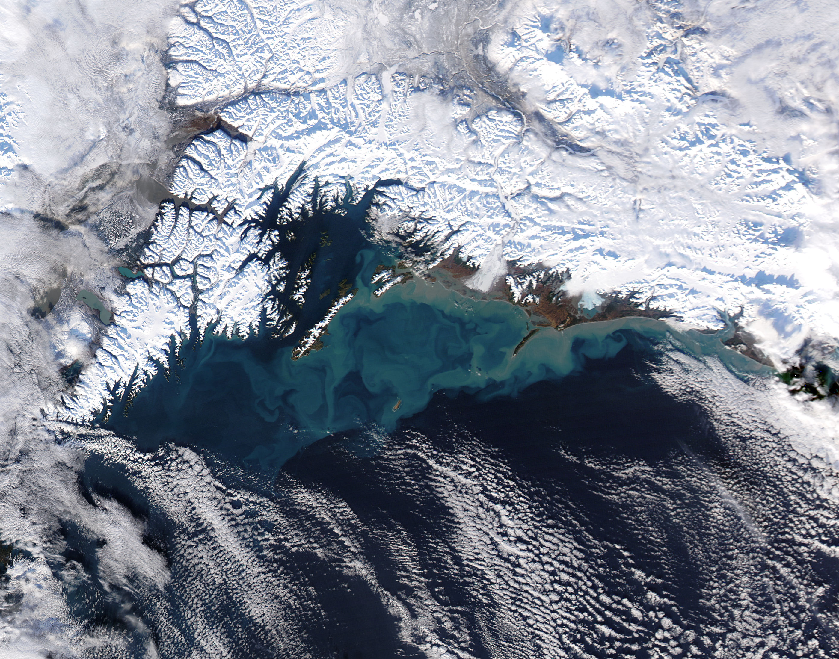
On January 30, 2016, the Moderate Resolution Imaging Spectroradiometer (MODIS) aboard NASA’s Aqua satellite flew above southcentral Alaska and captured this striking true-color image of a winter’s day along the coast.
Snow covers the Chugach Mountains (north) and the Kenai Mountains (west) while clouds hang over the Gulf of Alaska and also over the land in the east and west of the image. Sediment is suspended in the blue waters of the Gulf of Alaska. The sediment is tan near the coast, where it floats near the surface. As the sediment sinks its reflectivity changes, and this creates changes in the color as seen from space.
Most of this sediment likely flows into the Gulf from the Copper River. Upstream, glaciers slowly grind bedrock into a fine powder as they slowly creep through mountain valleys. Such fine sediment is easily carried by moving water, primarily by the Copper River.
Image Facts
Satellite:
Aqua
Date Acquired: 1/30/2016
Resolutions:
1km (191.8 KB), 500m (675.9 KB), 250m (1.6 MB)
Bands Used: 1,4,3
Image Credit:
Jeff Schmaltz, MODIS Land Rapid Response Team, NASA GSFC
