
Images


February 5, 2016 - Oil fire in Libya
 Tweet
Tweet
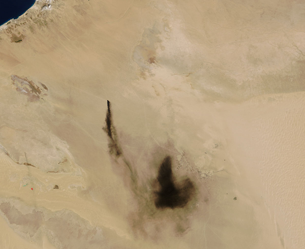
When the Moderate Resolution Imaging Spectroradiometer (MODIS) aboard NASA’s Terra satellite passed over northern Libya on February 1, 2016, it captured a true-color image of a black cloud of smoke hanging over the pale tan sands of the region.
Fires were ignited after battles on January 4-6 at oil production and storage facilities near Sidra, on the coast between Sirte and Benghazi. Despite reports that the fires had been extinguished by January 9, satellite imagery captured continuing burning into late January. On February 2, USA Today reported that militants were attempting to expand into Ras Lanuf and Brega, which are large refinery and export facilities east of Sirte.
This image shows heavy smoke, but the source is not clear. There appears to be no heat signature (red “hotspot”) which would indicate high temperatures expected to accompany actively burning fire near this smoke. Therefore, the smoke has likely drifted some distance from the fire.
Image Facts
Satellite:
Terra
Date Acquired: 2/1/2016
Resolutions:
1km (19.6 KB), 500m (68.3 KB), 250m (177.2 KB)
Bands Used: 1,4,3
Image Credit:
Jeff Schmaltz, MODIS Land Rapid Response Team, NASA GSFC
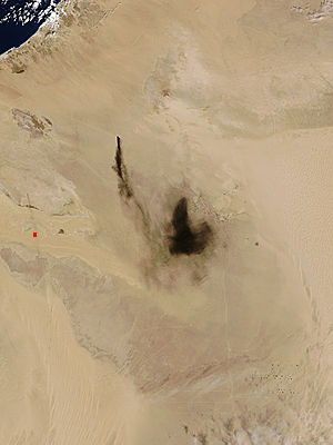
