
Images


February 13, 2016 - Northeastern United States
 Tweet
Tweet
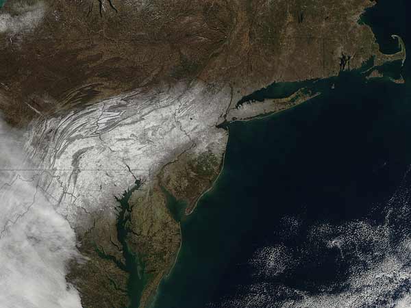
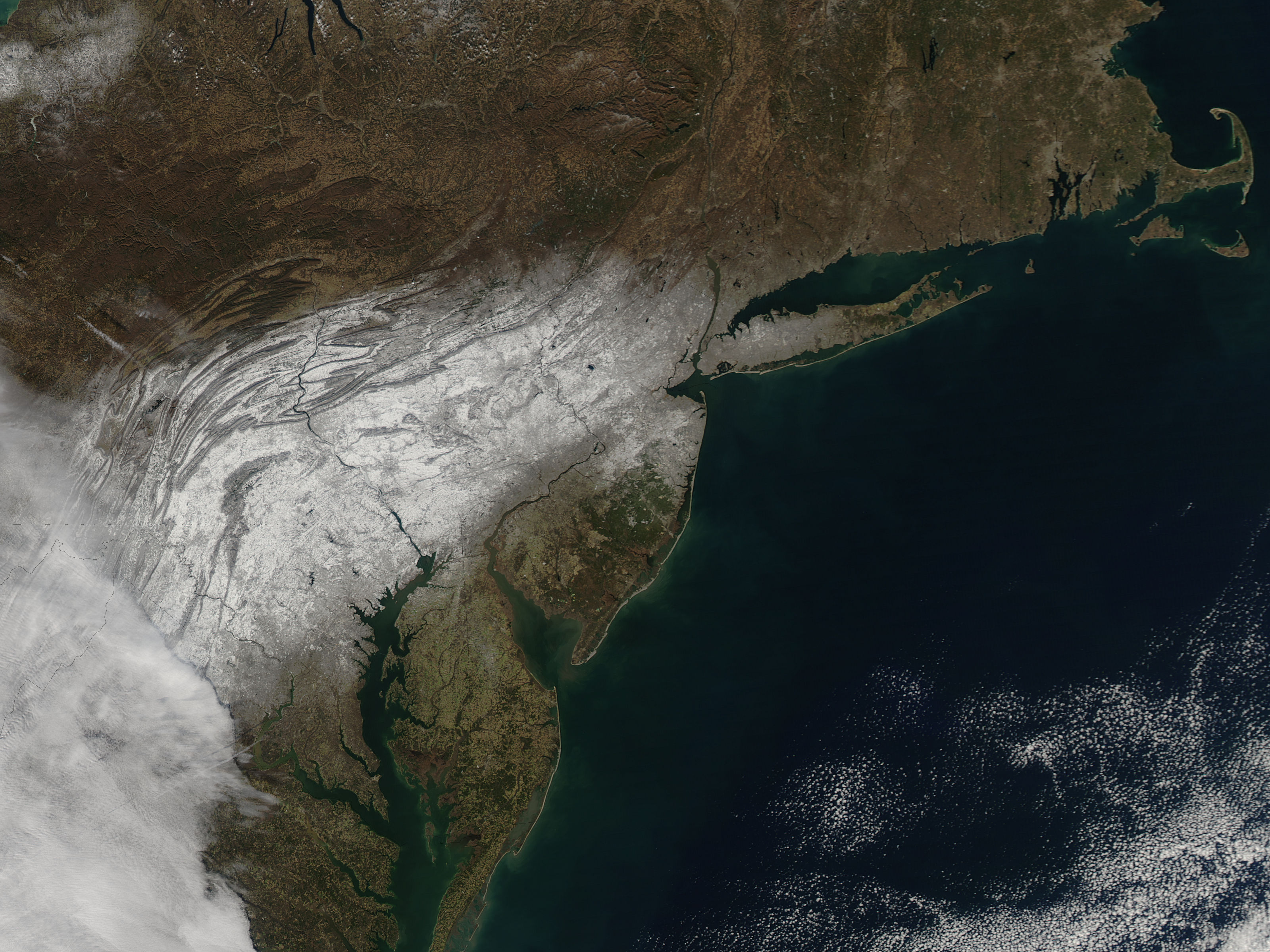
On January 31, 2016, a low pressure system tracking out of the central plains of the United States intensified as it merged with an upper level system dropping southeast out of Canada, bringing substantial snow to Ohio and the northeast over the next several days. According to the National Weather Service (NWS), snow began in northwest Ohio during the early morning hours of February 1 and quickly spread eastward.
The Moderate Resolution Imaging Spectroradiometer (MODIS) aboard NASA’s Aqua satellite captured this true-color image of the northeastern United State on February 2. Although Ohio lies to the west of this image, a swath of snow from the storm can be seen covering parts of Pennsylvania, Maryland, West Virginia, northern Virginia, New Jersey and a dusting in New York.
Image Facts
Satellite:
Aqua
Date Acquired: 2/2/2016
Resolutions:
1km (143.8 KB), 500m (564.3 KB), 250m (1.4 MB)
Bands Used: 1,4,3
Image Credit:
Jeff Schmaltz, MODIS Land Rapid Response Team, NASA GSFC
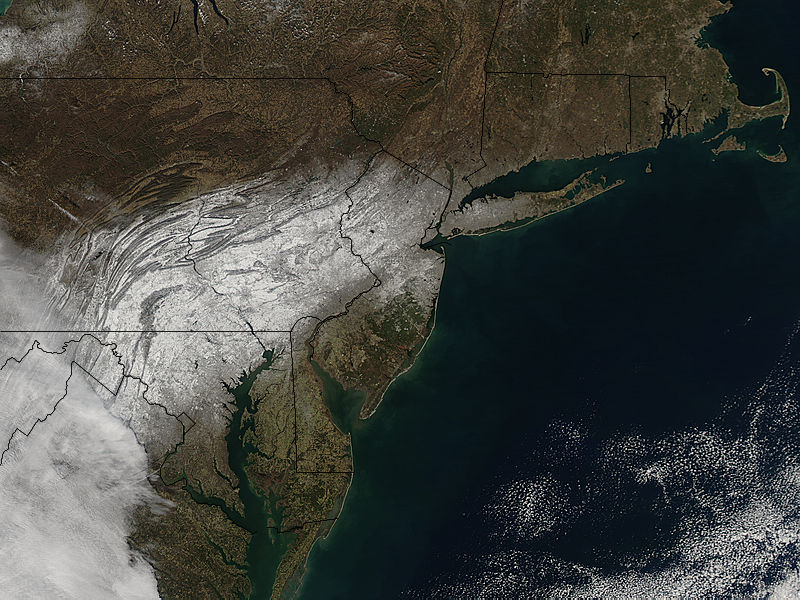
