
Images


May 3, 2016 - Snow in the Ural Mountains
 Tweet
Tweet
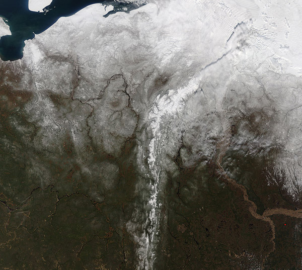
A storm system dropped snow across northcentral Russia and the Ural Mountains in the opening days of May 2016. The Moderate Resolution Imaging Spectroradiometer (MODIS) aboard NASA's Terra satellite captured this true-color image on May 2 as it passed over the region.
The Ural Mountains run roughly along a north-south axis through Russia for approximately 1,550 mi (2,500 km) and form the dividing line between Europe (west of the Urals) and Asia. The Urals also mark the boundary of Siberia, which is a portion of Russia lying east of the Ural Mountains.
The northernmost section of the Ural Mountains are known as the Polar Urals, with the Nether-Polar Urals just to their south. The Nether-Polar Urals contains the highest peaks in the entire range. The highest is Mount Narodnaya, reaching to 6,217 feet (1,895 meters). Both the Polar and Nether-Polar Urals have been captured in this image and are marked by glaciers and known as permafrost regions.
Northwest of the Ural Mountains the blue waters of the Barents Sea can be seen. The large, round island in the Barents Sea is Kolguyev Island. Bugrino, the main village on the island and the only settlement there is home to 300 people. Only a trace of sea ice clings to the coastline of mainland Russia, suggesting an early ice-out and warm temperatures.
Accuweather data confirm that temperatures have been significantly higher than normal in Bugrino for much of the winter, with the daily high above freezing since March 23, and nineteen days in April showing highs near or above 50˚F (10˚C). The high temperature on April 30 read 69˚F (20.5˚C), which was 19˚F (10.5˚C) higher than the daily average for that date. Temperatures are predicted to return to near freezing or below freezing for the next several weeks - a drop to sub-normal temperatures which would be more typical of March and April. The average highs for early- and mid-May are typically in the mid- to high-50s ˚F.
Image Facts
Satellite:
Terra
Date Acquired: 5/2/2016
Resolutions:
1km (581.7 KB), 500m (2.2 MB), 250m (5.3 MB)
Bands Used: 1,4,3
Image Credit:
Jeff Schmaltz, MODIS Land Rapid Response Team, NASA GSFC
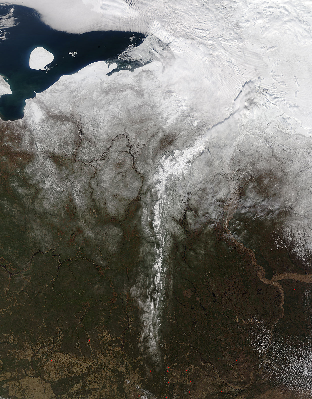
