
Images


August 21, 2016 - Tropical Storm Fiona (06L) in the eastern Atlantic Ocean
 Tweet
Tweet
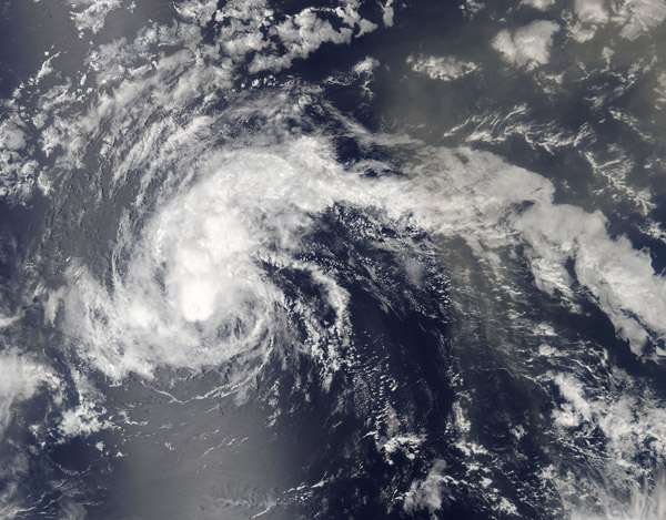
The sixth tropical storm of the 2016 Atlantic Hurricane Season formed as Tropical Depression 6 on August 16 over the warm waters about 900 mi (1448 km) west of the Cape Verde Islands. On August 17 the system had strengthened, prompting the National Hurricane Center (NHC) to upgrade it to Tropical Storm Fiona that same evening. The storm reached maximum strength on August 19 carrying maximum sustained winds of approximately 83 mph (133 km/h) despite facing increasing wind shear.
By August 20 the wind shear had begun to take a toll on the storm, causing the center to become partially exposed and the wind speeds to drop. At 2100 UTC (5:00 p.m. EDT) the NHC issued an advisory on Fiona and reported that continued hostile upper-level winds along with dry air along the path of the storm should cause weakening, with Fiona expected to become a tropical depression by August 21.
The Moderate Resolution Imaging Spectroradiometer (MODIS) aboard NASA’s Aqua satellite captured a true-color image of Tropical Storm Fiona on August 18. The image showed that the strong thunderstorms and deep convection (rising air that forms thunderstorms) circled the center of the storm, although they were being pushed to the northeast of the center.
Image Facts
Satellite:
Aqua
Date Acquired: 8/18/2016
Resolutions:
1km (580.5 KB), 500m (1.9 MB), 250m (4.6 MB)
Bands Used: 1,4,3
Image Credit:
Jeff Schmaltz, MODIS Land Rapid Response Team, NASA GSFC
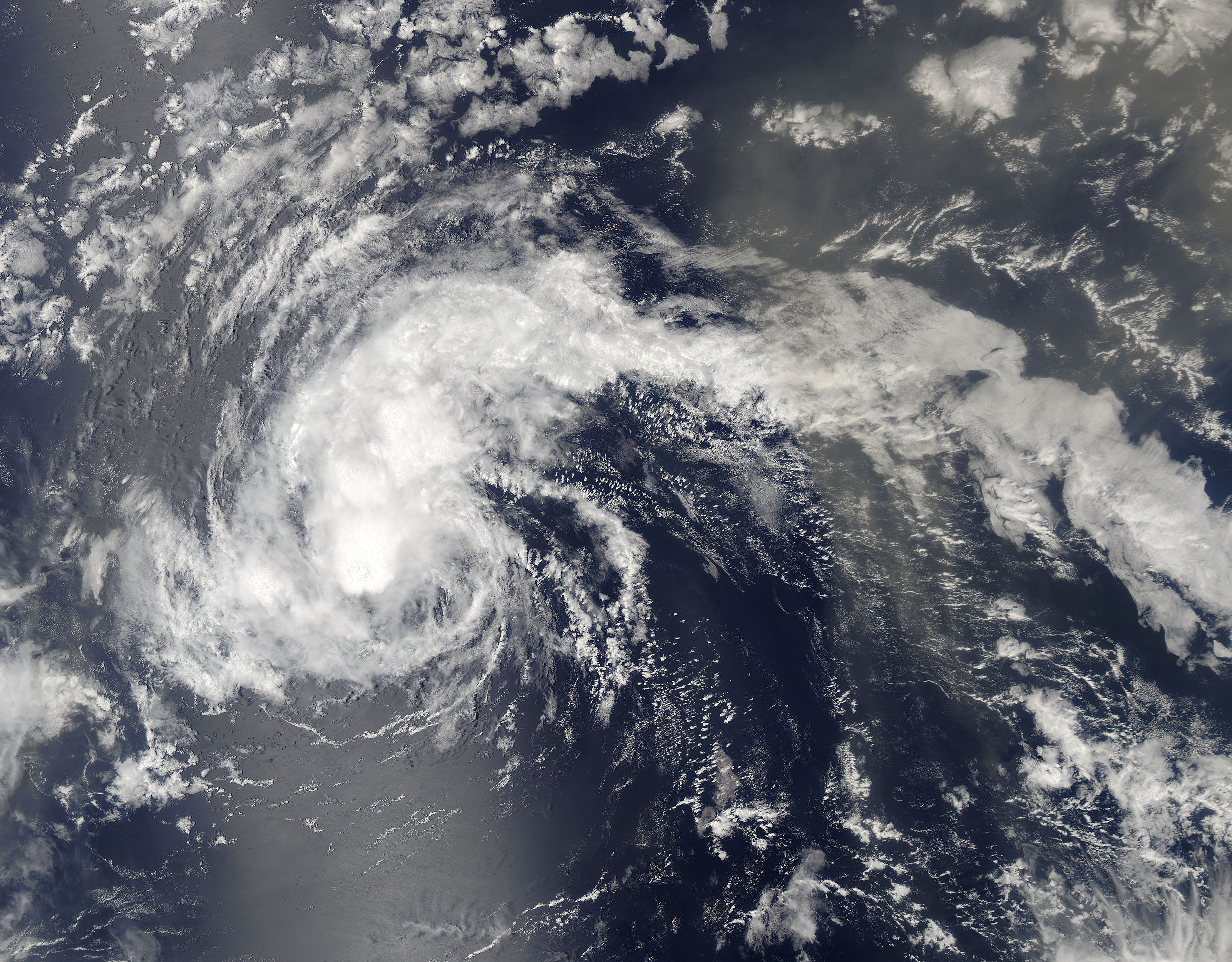
