
Images


December 15, 2018 - Snow across the Southeastern United States
 Tweet
Tweet
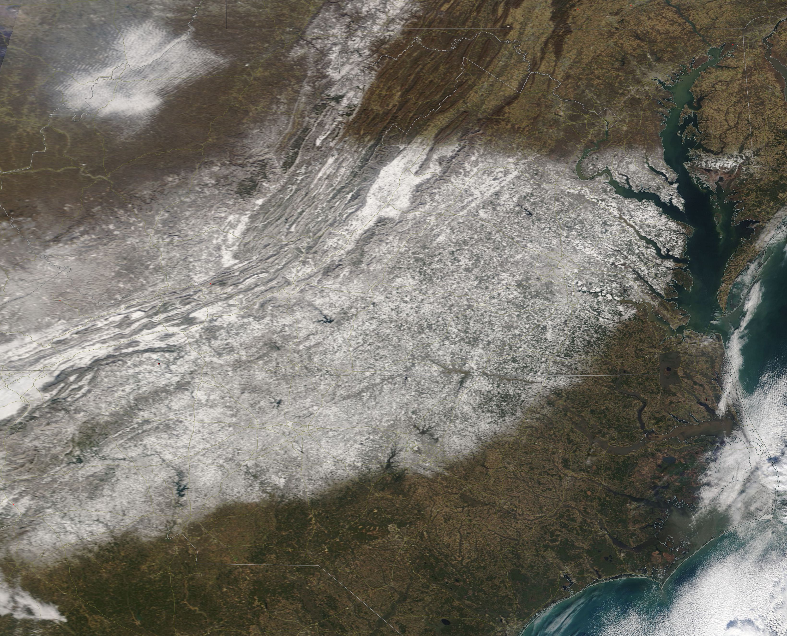
A strong winter storm swathed the Southeastern United States with ice and snow from December 8 – 9, 2018. The heaviest band of snow began in southwestern North Carolina and reached the Chesapeake Bay in far southern Maryland and eastern Virginia. Snow also fell in southeastern West Virginia. Mount Mitchell, in North Carolina recorded the highest fresh snow at 34 in (86 cm). Whitetop, a town Virginia situated close to the North Carolina border, received 24 in (61 cm). More than 400,000 people lost power during the height of the storm.
The Moderate Resolution Imaging Spectroradiometer (MODIS) on board NASA’s Terra satellite acquired a true-color image of snow across the North Carolina, Virginia, West Virginia and far southern Maryland on December 11.
Image Facts
Satellite:
Terra
Date Acquired: 12/11/2018
Resolutions:
1km (587.6 KB), 500m (1.5 MB), 250m (1.5 MB)
Bands Used: 1,4,3
Image Credit:
MODIS Land Rapid Response Team, NASA GSFC
