
Images


December 17, 2018 - Northern Italy and the Alps
 Tweet
Tweet
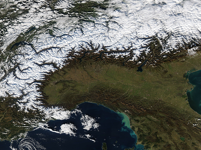
On December 11, 2018, NASA’s Aqua satellite passed over Northern Italy, allowing the Moderate Resolution Imaging Spectroradiometer (MODIS) on board NASA’s Aqua satellite to acquire a beautiful true-color image of a sunny, clear-sky day across the region.
At the far south, the green northern tip of the island of Corsica juts into the Ligurian Sea, which sits between Corsica and the Italian Riviera. The tans and greens that swirl in the coastal waters of the Ligurian Sea are sediment, primarily flowing from the Magra River. Moving inland, the Italian landscape quickly rises from the coast, folding upwards to the peaks of the Apennine Mountains. The Apennines drop towards the broad and green Po River Valley, an area rich in agriculture. To the north the high Alps are covered with heavy snow. Italy shares an Alpine boundary with France, Switzerland, Lichtenstein, and Austria.
Image Facts
Satellite:
Aqua
Date Acquired: 12/11/2018
Resolutions:
1km (613.1 KB), 500m (1.7 MB), 250m (1.6 MB)
Bands Used: 1,4,3
Image Credit:
MODIS Land Rapid Response Team, NASA GSFC
