
Images


January 17, 2019 - Ice in Strait of Tartary, Russia
 Tweet
Tweet
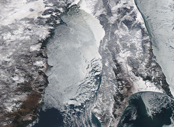
The Strait of Tartary separates mainland Russia from its largest island, Sakhalin Island. The narrow strait—which constricts to only 4.5 mi (7.3 km) wide—connects the Sea of Okhotsk in the north with the Sea of Japan to the south. Although it theoretically is the shortest shipping route between the southern coast of Russia to the northern coast, most commercial ships travel longer routes rather than pass through the Strait, likely because the very shallow depth (13-66 feet/4-20 meters) makes travel only practical for lightly loaded or smaller vessels. In the winter, the Strait freezes early, which also precludes shipping for nearly half the year.
On January 13, 2019, the Moderate Resolution Imaging Spectroradiometer (MODIS) on board NASA’s Aqua satellite acquired a true-color image of ice in the Strait of Tartary. The image focuses on heavy ice in the southern section of the Strait, where the waters are relatively wide. The Strait can be need to begin to sharply narrow at the top edge of the image.
Image Facts
Satellite:
Aqua
Date Acquired: 1/13/2019
Resolutions:
1km (303.6 KB), 500m (890.1 KB), 250m (885.6 KB)
Bands Used: 1,4,3
Image Credit:
MODIS Land Rapid Response Team, NASA GSFC
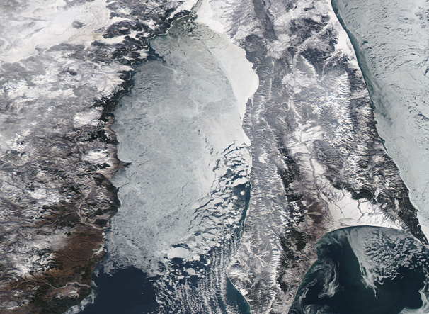
