
Images


February 17, 2019 - Anchorage, Alaska
 Tweet
Tweet
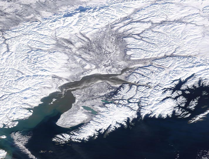
The city of Anchorage, Alaska, originated in 1914 as a port for the construction of the Alaska Railroad. Railroad construction continued until 1923, when it was finally completed. Anchorage was incorporated in 1920 and the city’s economy centered on rail transportation through the 1930’s. The name was taken from the port’s origins—the anchorage at the mouth of Ship Creek.
The city is located in South Central Alaska, north of the Kenai Peninsula, northwest of Prince William Sound and south of Mount McKinley. It sits in the Anchorage “Bowl”, a strop of coastal lowland extending to the slopes of the Chugach Mountains to the east. Knik Arm is a tidal inlet which lies to the west and north of the city. The Turnagin Arm, a fjord known for extremely high tides, sits south of Anchorage.
The Moderate Resolution Imaging Spectroradiometer (MODIS) on board NASA’s Terra satellite acquired a true-color centered on Anchorage, Alaska. The Kenai Peninsula sits on the Gulf of Alaska in the southern section of the image. North of the Kenai Peninsula, Anchorage sits on the point of land formed by the Turnagin Arm and the Knik Arm.
Image Facts
Satellite:
Terra
Date Acquired: 2/14/2019
Resolutions:
1km (130.5 KB), 500m (319.5 KB), 250m (998.1 KB)
Bands Used: 1,4,3
Image Credit:
MODIS Land Rapid Response Team, NASA GSFC
