
Images


February 22, 2019 - Central America
 Tweet
Tweet
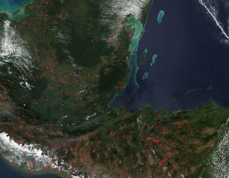
Many dozens fires dotted the landscape of Central America in mid-February 2019. The Moderate Resolution Imaging Spectroradiometer (MODIS) on board NASA’s Aqua satellite acquired a true-color image of fire and smoke over part of Mexico, Belize, Guatemala, and Honduras on February 19. Red “hot spots” mark areas where the thermal bands on the instrument detected temperatures higher than expected. When combined with typical smoke, as in this image, such hot spots are diagnostic for actively burning fire.
The fires are scattered throughout the image and are most prominent where the land appears light tan or light green and in agricultural areas. Only one large area remains fire-free, and that is a large dark green region on the Yucatan Peninsula. This dark green color marks two contiguous forest reserves—the Maya Biosphere Reserve in Guatemala (south) and the Calakmul Biosphere Reserve in Mexico.
The number, widespread distribution, location, and time of years strongly suggests these fires have been deliberately set to manage agricultural land. In many parts of the world, farmers use fire to clear debris from old crops, open new land for cropland, and renew pastures. While such fires prove useful for the small-scale farmer’s immediate needs, the smoke and particulate matter released into the atmosphere can have wide-ranging health effects, especially for people with pre-existing respiratory problems, the very young and the very old.
Image Facts
Satellite:
Aqua
Date Acquired: 2/18/2019
Resolutions:
1km (76.8 KB), 500m (265.6 KB), 250m (856.3 KB)
Bands Used: 1,4,3
Image Credit:
MODIS Land Rapid Response Team, NASA GSFC
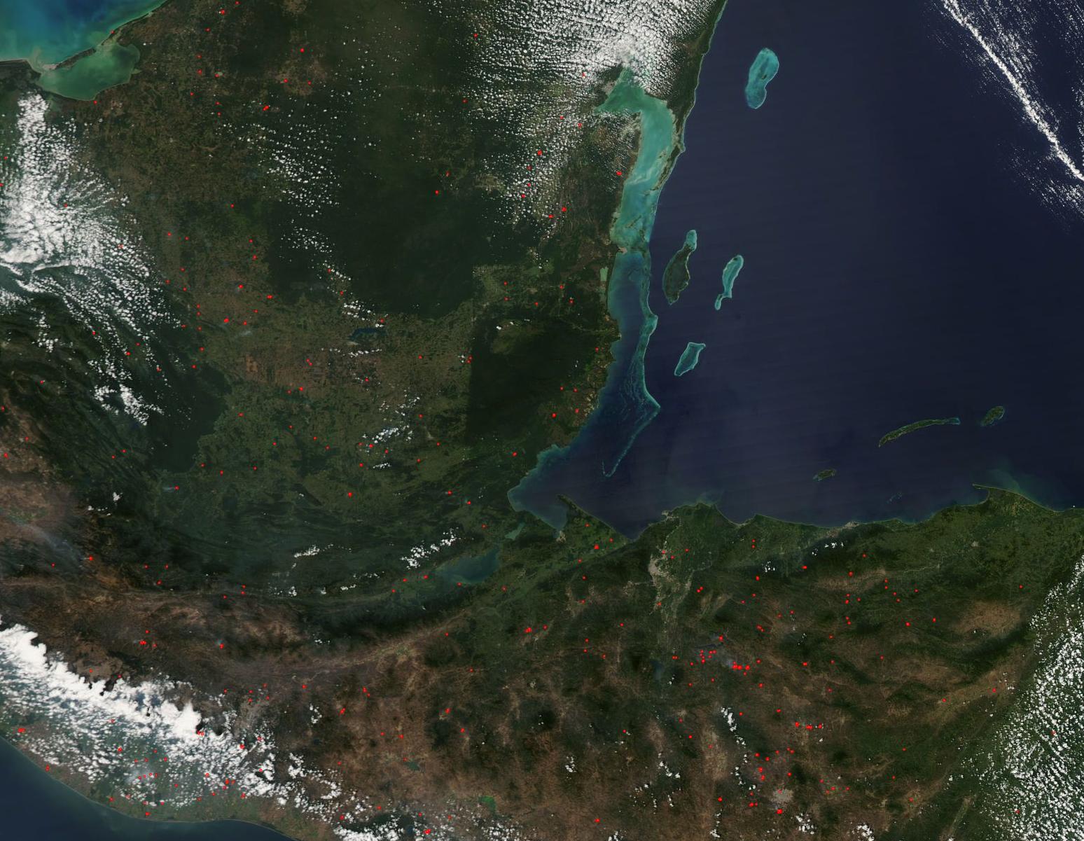
