Images
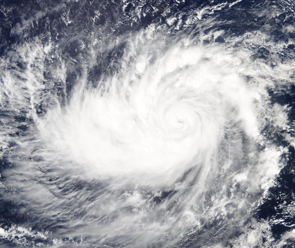
February 23, 2019 - Tropical Cyclone Wutip
Tweet
On February 22, 2019, the Moderate Resolution Imaging Spectroradiometer (MODIS) on board NASA’s Aqua satellite acquired a true-color image of Tropical Cyclone Wutip as it spun over the Philippine Sea southwest of Guam.
At 10:00 a.m. EDT (1500 UTC) on February 22 the eye of Typhoon Wutip was located near 10.1 degrees North and 144.7 degrees East, or about 105 miles north of Faraulep and 230 miles south of Guam. It was moving northwest at 15 mph. According to the Joint Typhoon Warning Center (JTWC) maximum sustained winds were estimated at 121 mph (194.7 km/h).
Tropical Cyclone Wutip is expected to continue on a northwest track today and tonight with decreasing forward speed. After that time, the storm is expected to turn and take a north-northwest course by February 24-25. This approach takes the center of Witup about 160 miles (257.5 km) southwest of Guam at the present strength, then a slow weakening trend is expected.
Image Facts
Satellite:
Aqua
Date Acquired: 2/22/2019
Resolutions:
1km (440.1 KB), 500m (1.3 MB), 250m (4 MB)
Bands Used: 1,4,3
Image Credit:
MODIS Land Rapid Response Team, NASA GSFC


