
Images


April 18, 2019 - Rio Negro
 Tweet
Tweet
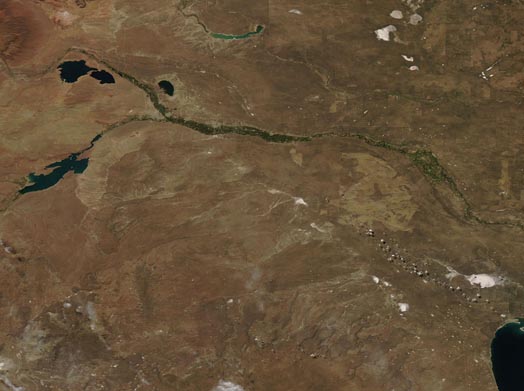
Argentina’s Rio Negro flows generally southeast approximately 395 miles (635 km) from the Andes Mountains to the Atlantic Ocean. Its floodplain once was famous for the masses of willows that flourished there, giving rise to the earlier name of “River of Willows”. Today the floodplain supports the biggest pear- and apple-growing region of Argentina.
The Rio Negro is one of the most meandering rivers in South America, with a number of braided channels twisting around each other. In some areas, the entire floodplain (mostly about 6 mi wide) are filled with curved relicts of channels. Also known as meander scars, these old channels were produced as the river snaked across the plain in very recent geological past (100 years or so) and are a dramatic reminder of how mobile a river can be.
The Moderate Resolution Imaging Spectroradiometer (MODIS) on board NASA’s Aqua satellite acquired a true-color image of the Rio Negro on April 11, 2019. In the west the Rio Limay (south) and the more northern Neuquén River meet to form the Rio Negro. The wide floodplain appears green, flush with vegetation and agriculture, thanks to the life-giving waters. The braided nature of the floodplain is most easily seen in the east.
Image Facts
Satellite:
Aqua
Date Acquired: 4/11/2019
Resolutions:
1km (47.6 KB), 500m (132.3 KB), 250m (337.9 KB)
Bands Used: 1,4,3
Image Credit:
MODIS Land Rapid Response Team, NASA GSFC
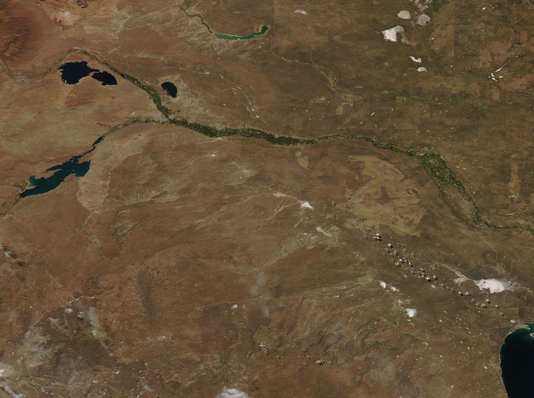
