
Images


April 22, 2019 - The Top of the World
 Tweet
Tweet
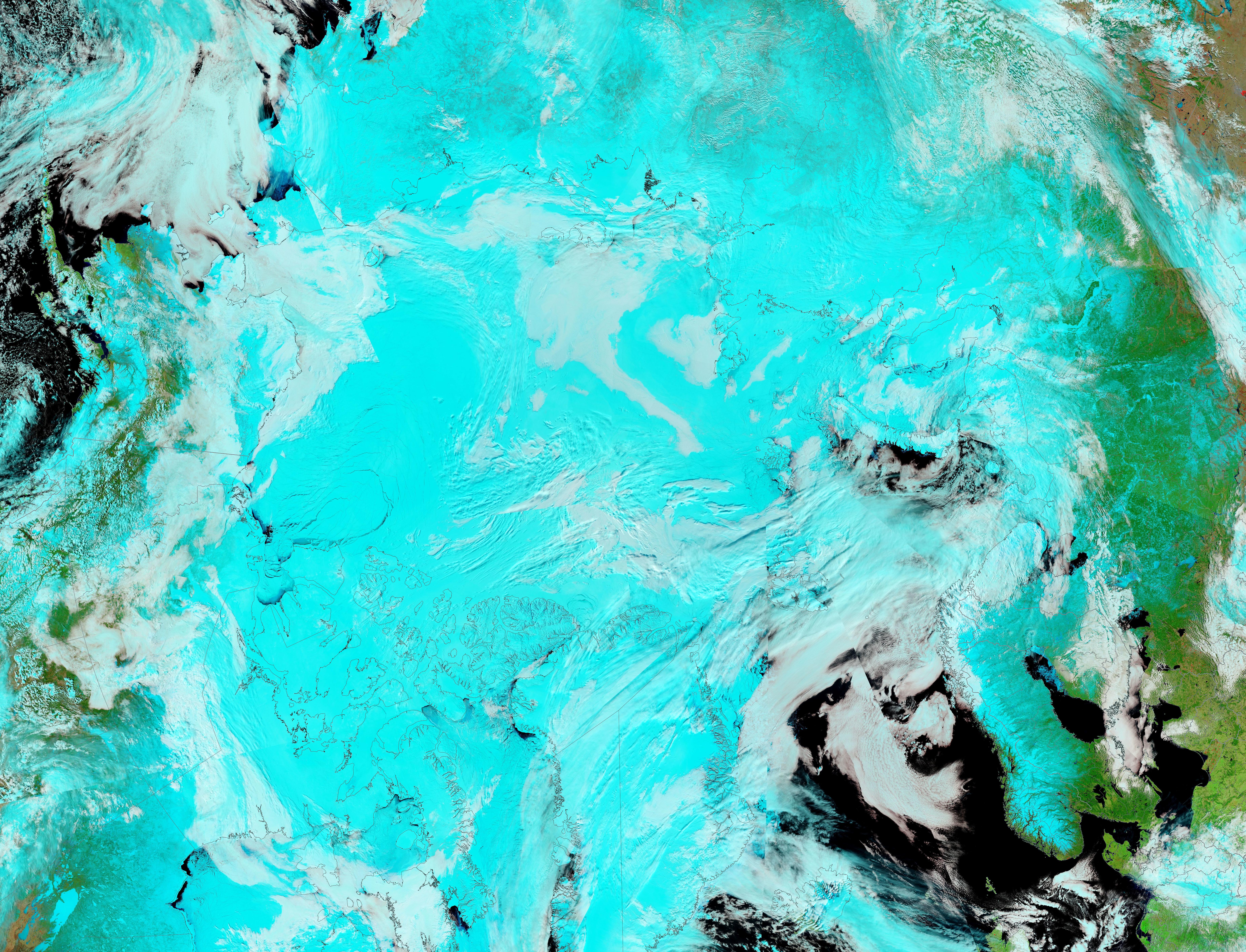
On April 14, 2019, NASA’s Terra satellite acquired stunning false-color imagery showing a sunny spring day over the “Top of the World”—the Arctic. This false-color image uses visible and infrared light to help define cloud from ice, both of which appear very similar in true-color images. Here ocean water appears dark black, cloud is white, vegetation is bright green, and ice and snow appear electric blue.
The electric blue of the frozen Arctic Ocean—which surrounds the geographic North Pole—fades into the ice and snow covering the northern landmasses before giving way to bright green vegetation as the snow thins further south. The snow-covered land that surrounds the Arctic Ocean includes, from the top of the image and moving clockwise, parts of Russia, Europe, Greenland, and North America.
Winters are long and frigid at the top of the world as well as very dark—there are six months of continuous night at the North Pole, followed by six months of continuous daylight. The duration of continuous day and night are shorter as one moves from the North Pole to the Arctic Circle. The frigid conditions creates a layer of thick, enduring sea ice over the Arctic waters. Of the approximately 15 million square kilometers (5.8 million square miles) of sea ice that exist in the Arctic during winter, on average, 7 million square kilometers (2.7 million square miles) remain at the end of the summer melt season.
The sea ice extent (maximum) and the sea ice minimum vary from year to year, and are measured and reported by the National Snow and Ice Data Center (NSIDC). This year, the NSIDC reported that Arctic sea ice extent appears to have reached its maximum extent on March 13, marking the beginning of the sea ice melt season. Arctic sea ice extent for March averaged 14.55 million square kilometers (5.62 million square miles), tying with 2011 for the seventh lowest extent in the 40-year satellite record.
This image was created from multiple MODIS images captured during repetitive passes of the Terra satellite over the Arctic on April 14. These images were put together using the NASA Worldview application to create a smooth, nearly seamless view of a very large region. Worldview is a part of the NASA Earth Observing System Data and Information System (EOSDIS).
Image Facts
Satellite:
Terra
Date Acquired: 4/14/2019
Resolutions:
1km (7.3 MB),
Bands Used: 7,2,1
Image Credit:
MODIS Land Rapid Response Team, NASA GSFC
