
Images


April 24, 2019 - Western Australia
 Tweet
Tweet
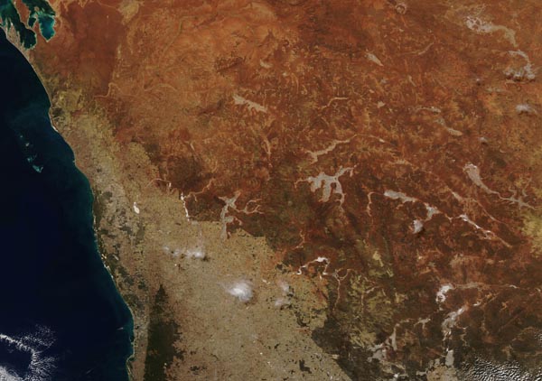
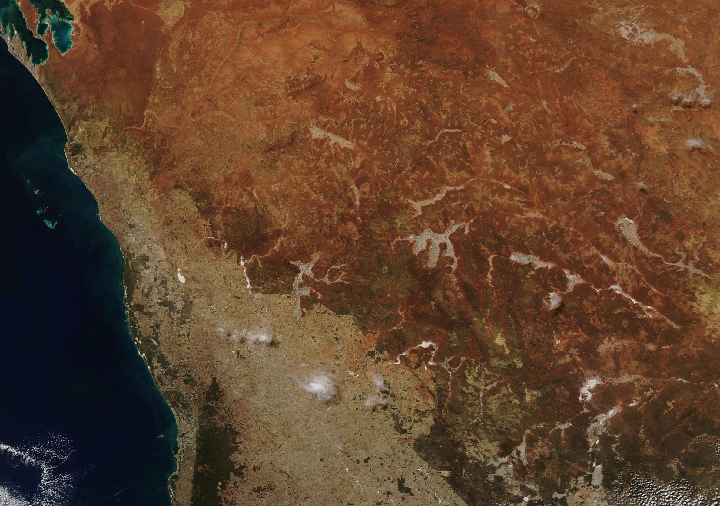
On April 21, 2019, the Moderate Resolution Imaging Spectroradiometer aboard NASA’s Terra satellite acquired a beautiful true-color image of a warm, sunny autumn day in south-western Western Australia.
The vibrant landscape, colored in ochres and burnt sienna and punctuated by white salt lakes, marks the arid landscape of the interior of southwestern Western Australia. Near the coast the soil appears more tan, with flushes of green in some areas, indicating less dry conditions in the Swan Coastal Plain. A very dark green area west of the Swan Coastal Plain in the southwest (lower left) section of the image is the Darling Scarp, or the Darling Range, and is a low escarpment. The city of Perth, marked by gray pixels, sits between the Indian Ocean and the Darling Scarp.
Image Facts
Satellite:
Terra
Date Acquired: 4/21/2019
Resolutions:
1km (207.4 KB), 500m (529.3 KB), 250m (1.8 MB)
Bands Used: 1,4,3
Image Credit:
MODIS Land Rapid Response Team, NASA GSFC
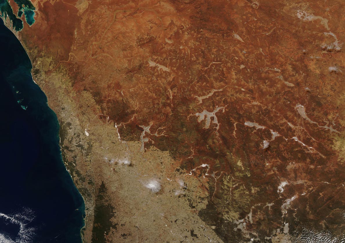
