
Images


April 25, 2019 - Scotland
 Tweet
Tweet
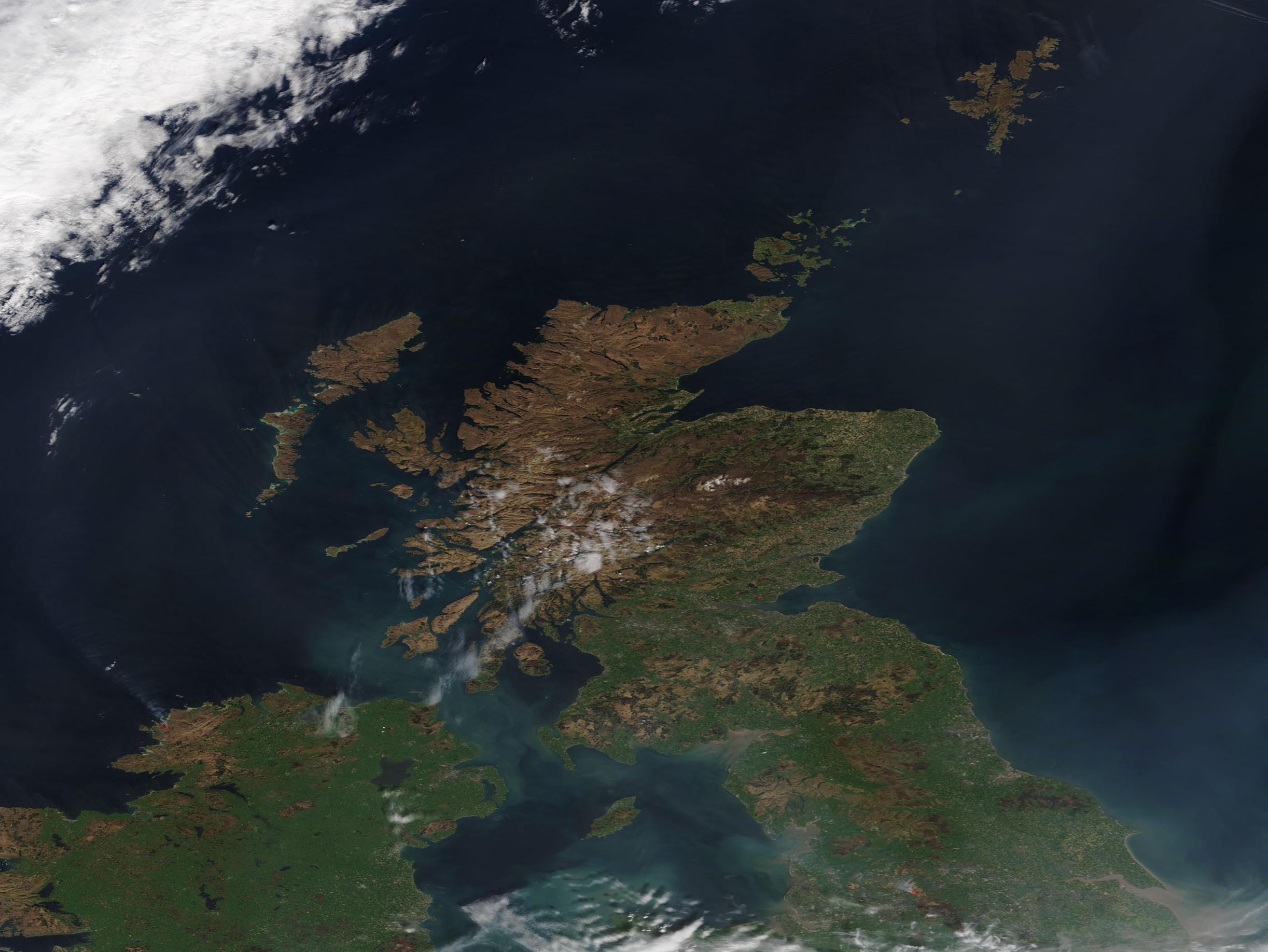
On April 22, 2019, the Moderate Resolution Imaging Spectroradiometer (MODIS) on board NASA’s Terra satellite acquired a true-color image centered on Scotland.
Part of the United Kingdom, Scotland occupies roughly the northern one-third of the island of Great Britain. Besides the mainland, Scotland has more than 790 islands including the Shetlands, Orkney Islands, and Inner and Outer Hebrides. The jagged, extensive coastline covers about 2,000 miles (3,218 km).
Nearly bisecting the mainland and easily visible from space is Glen Mor, a fault zone marked by numerous elongated lakes (or lochs), one of which is the famous Loch Ness. The rugged topography of the Scottish Highlands was created by geological processes over billions of years. The mountains north of Glen Mor include some of the oldest rocks in Europe which have been exposed and rearranged by tectonic forces many millions of years ago. The region was also shaped by glaciers as they slowly scraped the stony outcroppings in the more recent Ice Ages.
Image Facts
Satellite:
Terra
Date Acquired: 4/22/2019
Resolutions:
1km (124.9 KB), 500m (312.8 KB), 250m (1 MB)
Bands Used: 1,4,3
Image Credit:
MODIS Land Rapid Response Team, NASA GSFC
