
Images


May 24, 2019 - Southern Utah
 Tweet
Tweet
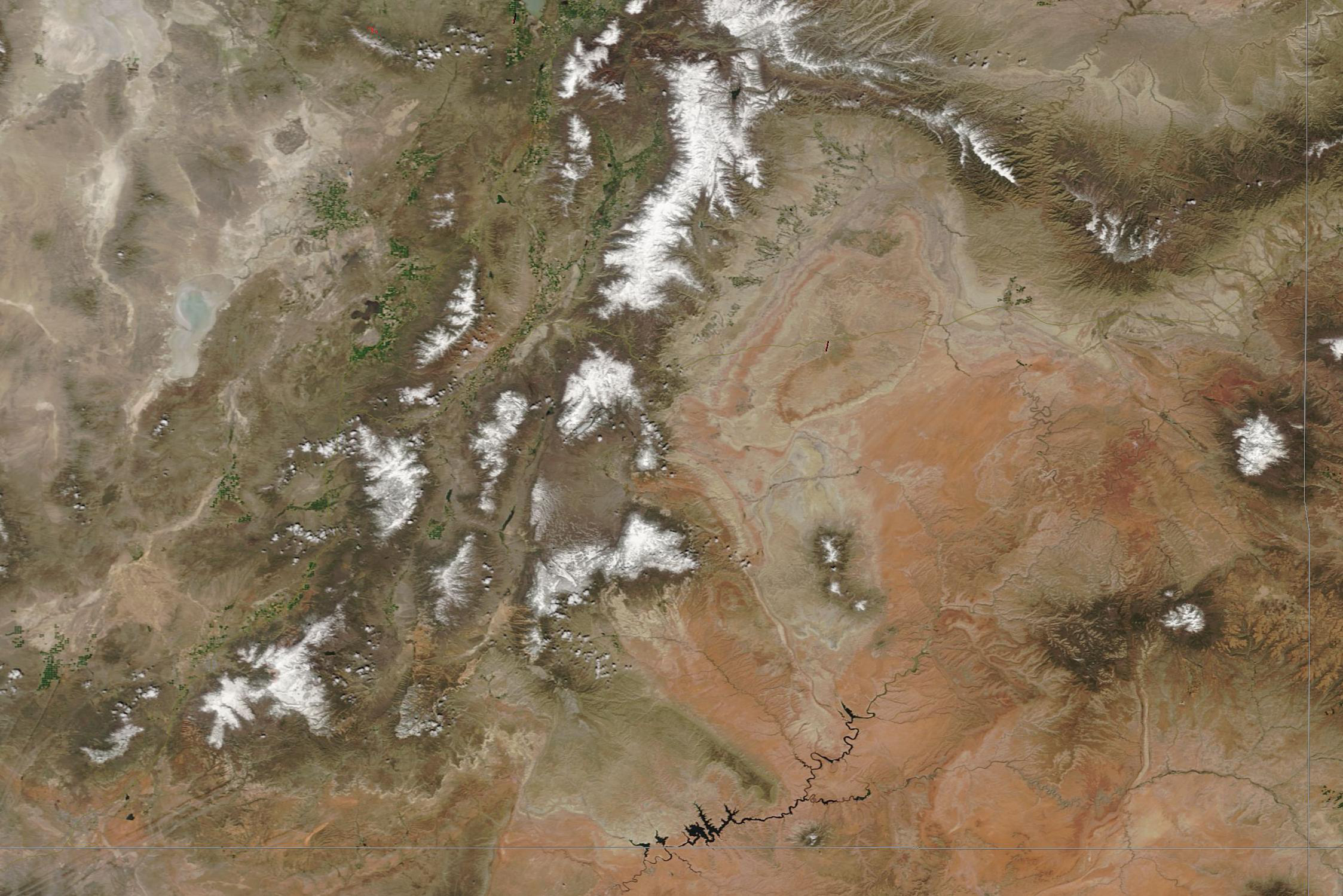
With red-rock canyons, dark forested mountains, slick rock trails, dry desert, sere salt flats, and superb ski slopes, Utah has been called “nature’s most perfect playground”. Home to 13 national parks and monuments, including the “Mighty Five” parks (Arches, Canyonlands, Capitol Reef, Bryce, and Zion), more than 65% of the land is federally owned, most of which is open to the public. Tourism is important to the economy of Utah—according to a report by the University of Utah’s Kem C. Gardner Policy Report, travelers spent a record $8.54 million dollars in calendar year 2016 while enjoying the spectacular sights of the “Beehive State”.
On May 3, 2019, the Moderate Resolution Imaging Spectroradiometer (MODIS) on board NASA’s Terra satellite acquired a true-color image of the stunning sights of southern Utah.
The white-washed tan area in the northwest is part of the Great Salt Lake Dessert, a region once covered by Lake Bonneville. Bonneville once covered much of northern and western Utah. Today the lake has nearly dried up, with white mineral deposits and a few lakes (Great Salt Lake, Utah Lake and Sevier Lake) the only remnants.
Snow caps the peaks of Utah’s portion of the Rocky Mountains, which includes ranges such as the Wasatch and Pavant. Not only do skiers enjoy the lingering snow, the precipitation stored in the snowpack is essential to the region, bringing much-needed moisture to the otherwise arid land as it melts.
To the southeast, one can see the reddish-orange rocks of the northernmost section of the Colorado Plateau. Utah’s well-known desert attractions, including Arches National Park, Canyonlands National Park, and Glen Canyon, are located in this region. The long, narrow lake is Lake Powell, created after the construction of Glen Canyon Dam in the 1950s.
Image Facts
Satellite:
Terra
Date Acquired: 5/3/2019
Resolutions:
1km (208.2 KB), 500m (616.3 KB), 250m (1.1 MB)
Bands Used: 1,4,3
Image Credit:
MODIS Land Rapid Response Team, NASA GSFC
