
Images


June 19, 2019 - Fires in Democratic Republic of the Congo and Tanzania
 Tweet
Tweet
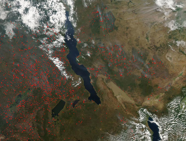
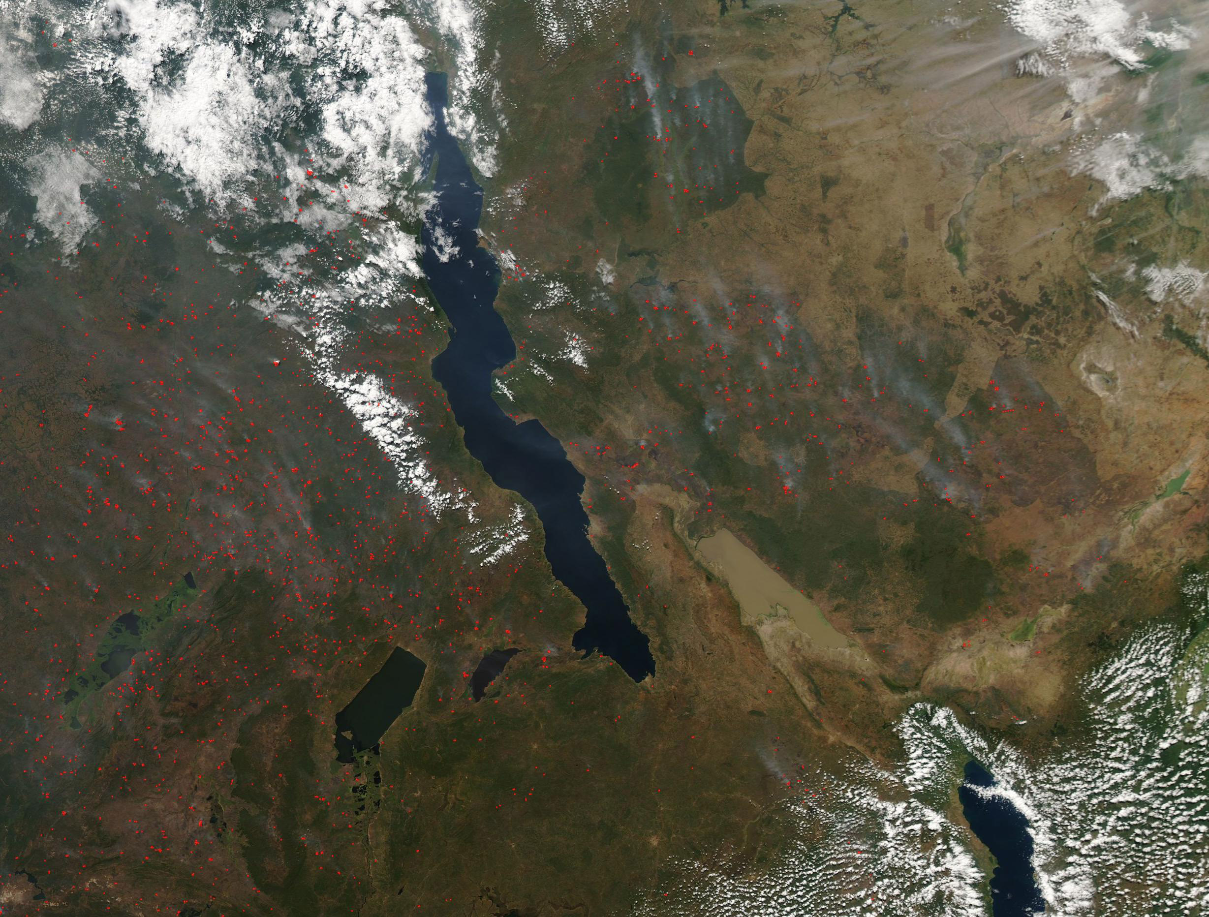
Hundreds of thousands of fires continued to burn across the Democratic Republic of the Congo and Tanzania in mid-June 2019. The Moderate Resolution Imaging Spectroradiometer (MODIS) on board NASA’s Aqua satellite acquired a true-color image of the region on June 16.
The image is centered on Lake Tanganyika, the world’s longest freshwater lake. Numerous red hot spots cover much of the dark green areas both in the Democratic Republic of the Congo (west) and also in Tanzania (east). Dark green represents heavy vegetation, especially forest. Few fires are seen in tan (non-vegetated or lightly vegetated) areas. A haze of smoke covers the region and plumes of heavy blue-gray smoke can be seen in many areas.
Each red hot spot marks an area where the thermal bands on the MODIS instrument detected high temperatures. When combined with typical smoke, as in this image, such hot spots are diagnostic actively burning fire. Given the time of year, location, and widespread nature of the fires, they are likely agricultural in origin and have been deliberately set to clear forest for crops or pasture, to renew pasture, to prepare cropland for planting or other land management. Called “slash and burn” agriculture, this practice is common in many poorer agrarian regions.
According to Global Forest Watch, from June 10 through June 17 there were 20,528 fire alerts in Tanzania alone. In the same time period, the Democratic Republic of the Congo had 149,991 fire alerts.
Image Facts
Satellite:
Aqua
Date Acquired: 6/16/2019
Resolutions:
1km (326.3 KB), 500m (950.7 KB), 250m (2.9 MB)
Bands Used: 1,4,3
Image Credit:
MODIS Land Rapid Response Team, NASA GSFC
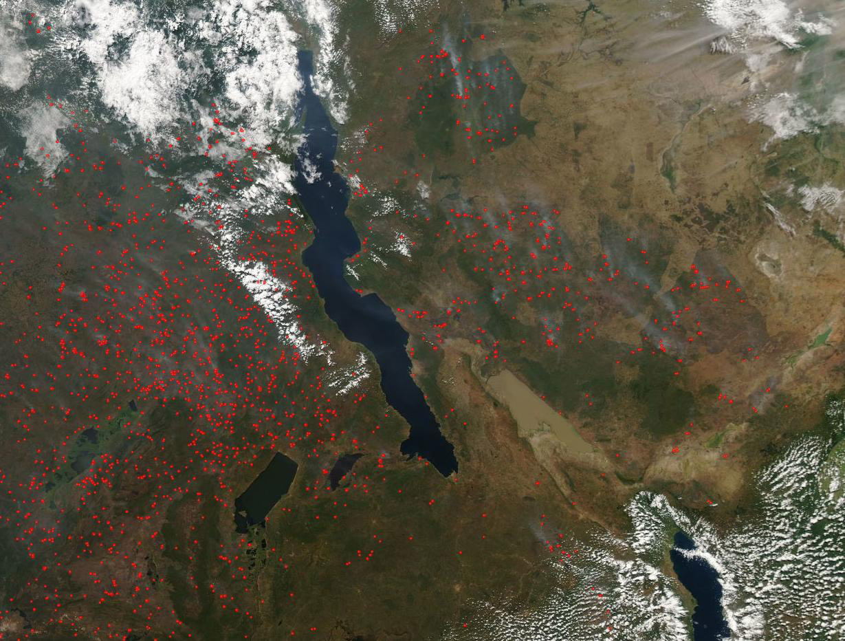
