
Images


August 13, 2019 - Tropical Storm Henriette off Mexico
 Tweet
Tweet
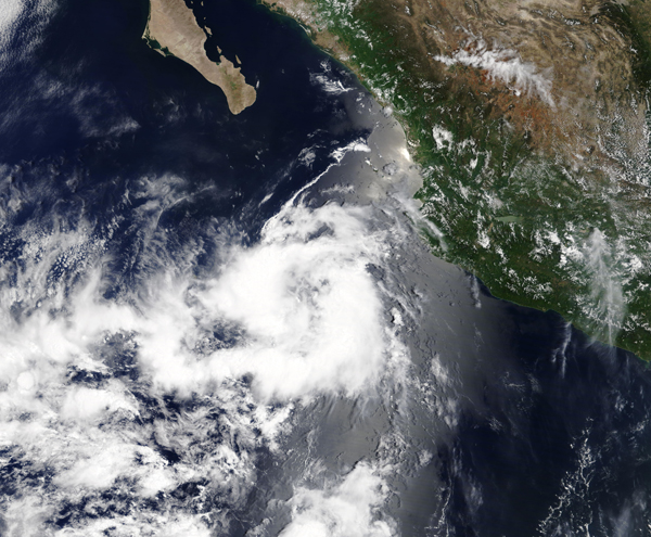
Tiny Tropical Storm Henrietta is the newest addition to the tropical cyclone line-up in the Eastern Pacific Ocean. The storm developed early on August 12 and soon afterwards the Moderate Resolution Imaging Spectroradiometer (MODIS) on board NASA’s Terra satellite acquired a true-color image of the storm as it spun off of Mexico.
At 11:00 a.m. EDT (1500 UTC) the National Hurricane Center (NHC) reported that the center of Tropical Storm Henrietta was located near latitude 19.7 degrees north and longitude 112.2 degrees west. The storm is far enough away from land that there are no coastal warnings in effect. It is about 265 miles (430 km) southwest of the southern tip of Baja California, Mexico.
Henrietta is moving toward the west-northwest near 12 mph (19 km/h) and this general motion is expected to continue for the next couple of days. Maximum sustained winds are near 40 mph (65 kn/h) with higher gusts. Tropical-storm-force winds extend outward up to 35 miles (55 km) from the center. The estimated minimum central pressure is 1005 millibars.
Henrietta is expected to begin weakening by Tuesday, August 13 and degenerate into a remnant low pressure area by Tuesday night.
Image Facts
Satellite:
Terra
Date Acquired: 8/11/2019
Resolutions:
1km (1.9 MB), 500m (5.6 MB), 250m (4.5 MB)
Bands Used: 1,4,3
Image Credit:
MODIS Land Rapid Response Team, NASA GSFC
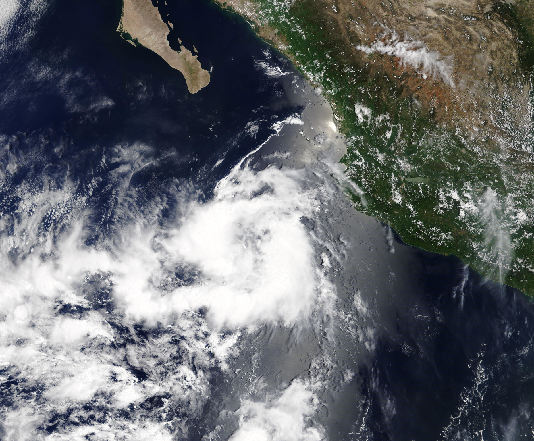
