
Images


October 15, 2019 - Haze in the Po Valley
 Tweet
Tweet
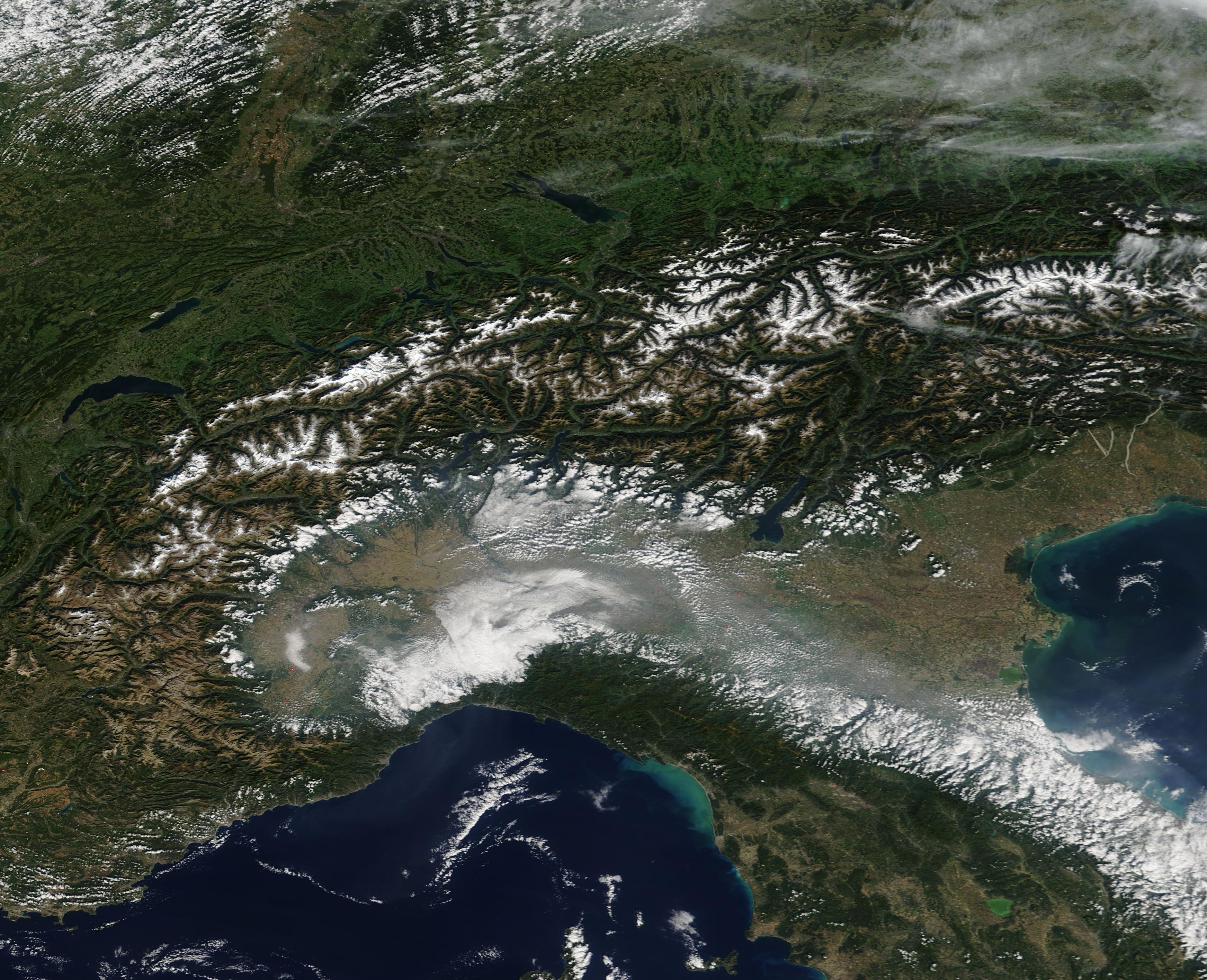
On October 11, 2019, the Moderate Resolution Imaging Spectroradiometer (MODIS) on board NASA’s Terra satellite acquired a true-color image of the snow-capped Alps and along with haze hanging over the Po River Valley.
The Po River, Italy’s longest river, runs approximately 650 kilometers (400 miles) from the southwestern Alps to the Adriatic Sea, passing indirectly through Milan, and through Turin. As Turin is an industrial center of a heavily urbanized region, pollutants often cloud the skies overhead. In fact, northern Italy is one of Europe’s pollution hotspots, and the smog often grows thick enough to be seen from space. The region is also rich in agriculture and, from time to time, fires are set to manage crops or pastures, a practice which adds smoke to the atmosphere.
The valley is also known for naturally occurring fog which frequently forms in fall and winter when temperature inversions trap cool, moist (and sometimes polluted) air near the surface. Fog and humidity can accelerate the process of converting gaseous pollutants into haze-causing aerosols. When fog forms, sulfur oxides, nitrogen oxides, and other polluting gases are taken up or ‘scavenged’ by fog water droplets. Once absorbed into the droplets, the gases oxidize more rapidly than they otherwise would, becoming sulfates, nitrates, and other types of aerosol particles.
Fog (also known as low cloud) typically appears white in true-color images and often has a granular appearance. Smog and smoke tend to appear light blue or gray. This image appears to capture all fog, smoke, and smog. A few red hot spots mark what are, most likely, actively burning fires. While haze and fog were trapped in the Po Valley, the air over the Alps remained clear.
Image Facts
Satellite:
Terra
Date Acquired: 10/11/2019
Resolutions:
1km (632.1 KB), 500m (1.7 MB), 250m (1.5 MB)
Bands Used: 1,4,3
Image Credit:
MODIS Land Rapid Response Team, NASA GSFC
