
Images


October 17, 2019 - Southern Caspian Sea
 Tweet
Tweet
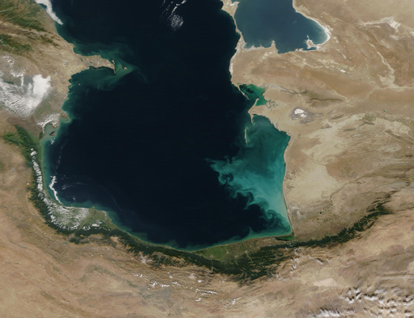
On October 15, 2019, the Moderate Resolution Imaging Spectroradiometer (MODIS) aboard NASA’s Terra satellite captured a striking true-color image of the southern Caspian Sea on a clear-sky day in early autumn.
Measured by surface area, the Caspian Sea is the world’s largest inland sea, covering about 143,200 square miles (371,000 sq. km). Five countries share the seacoast. Those captured in this image include (listed clockwise, from the north): Turkmenistan, Iran, and Azerbaijan.
The beautiful deep blue waters of the Caspian Sea are stained with swirls of color ranging from dark green to milky blue. The greens hugging the shorelines are likely predominantly caused by sediment carried from the shore into the waters. Sediment appears tan when it is close to the surface but as it sinks the reflectivity changes, causing it to appear green when viewed in true-color from space. Certain types of microscopic plant-like organisms (some phytoplankton and algae) may also appear green in color, while other species may appear blue or milky-blue. The streaks of green in deeper waters, away from shore, are likely caused primarily by phytoplankton, rather than sediment, as are the milky blues in the southeastern waters near Turkmenistan.
Image Facts
Satellite:
Terra
Date Acquired: 10/15/2019
Resolutions:
1km (465.3 KB), 500m (1.1 MB), 250m (2.1 MB)
Bands Used: 1,4,3
Image Credit:
MODIS Land Rapid Response Team, NASA GSFC
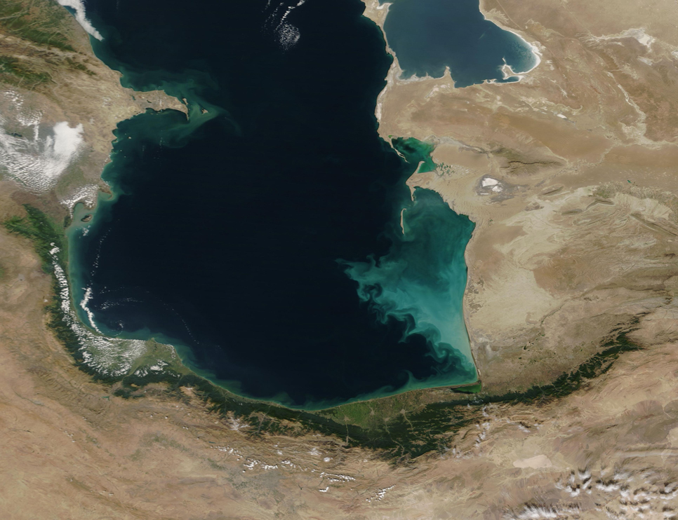
