
Images


November 10, 2019 - Tropical Cyclone Matmo approaching landfall
 Tweet
Tweet
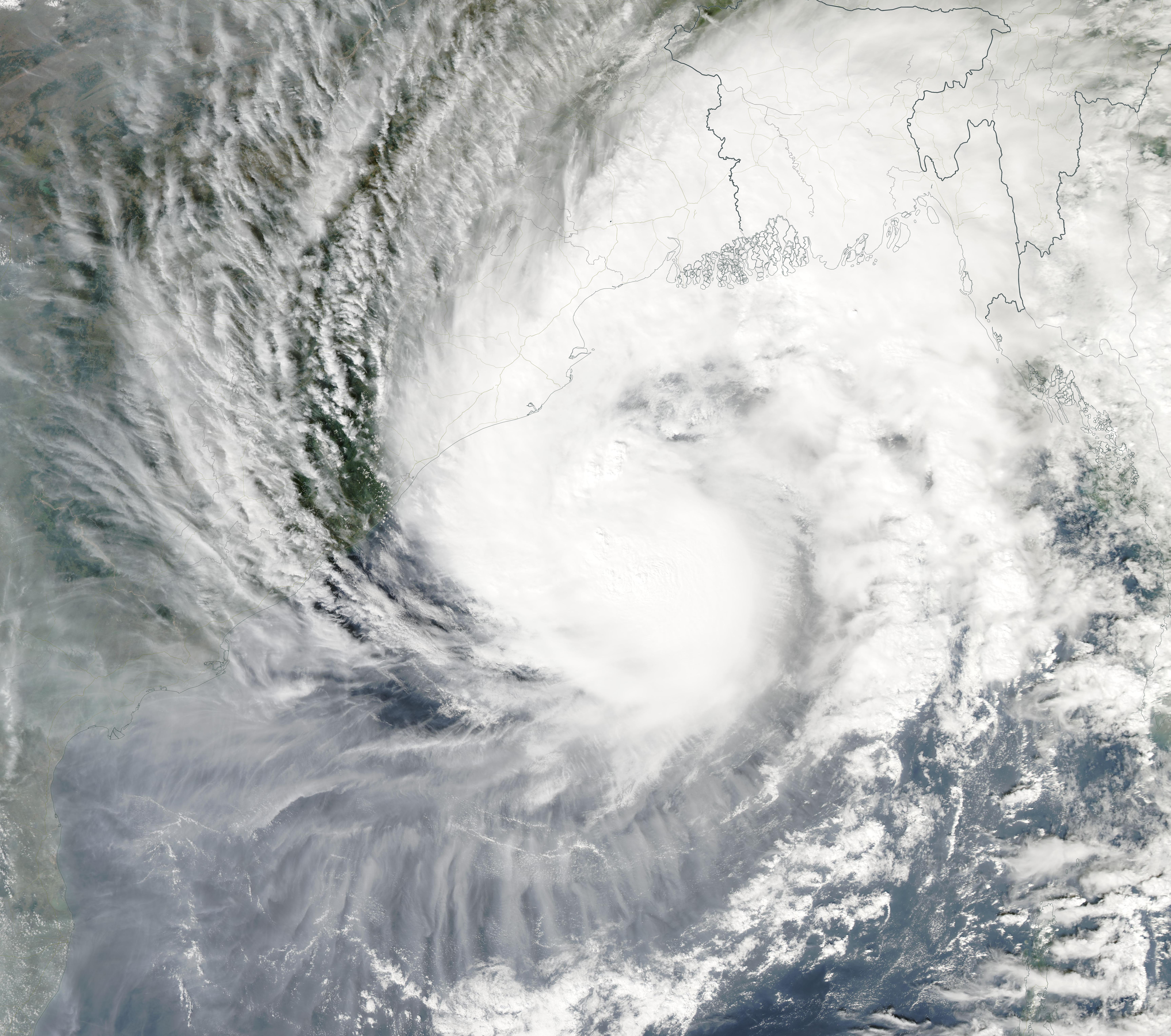
On November 8, 2019, the Moderate Resolution Imaging Spectroradiometer (MODIS) on board NASA’s Aqua satellite acquired a true-color image of Tropical Cyclone Matmo as spinning over the Bay of Bengal on a track towards Bangladesh and India.
Tropically Cyclone Matmo, known locally as Bulbul, strengthened from a tropical storm to a tropical cyclone packing hurricane-force winds in the overnight hours of November 7 into November 8. Sustained winds on November 7 were about 63 mph (102 km/h). On November 8 at 10 a.m. EST (1500 UTC), Matmo’s maximum sustained winds had increased to about 98 mph (157 km/h). At that time, Matmo was located near latitude 19.1 degrees north and longitude 88.1 degrees east, about 235 nautical miles south of Kolkata, India, and was moving northward.
According to several local media reports, Matmo (Bulbul) made landfall at Sagar Island, West Bengal, India about 8:00 pm India Standard Time (14:30 UTC or 9:30 am EST) on November 9. Winds at landfall remained close to 98 mph (157/km/h), making it a “severe cyclonic storm”. As it interacted with land, Matmo began to weaken quickly. Two deaths were reported as the storm initially made landfall. The storm is expected to continue to weaken as it moves northwards, impacting both India and Bangladesh before dissipating.
Image Facts
Satellite:
Aqua
Date Acquired: 11/8/2019
Resolutions:
1km (1.5 MB), 500m (4.2 MB), 250m (3.1 MB)
Bands Used: 1,4,3
Image Credit:
MODIS Land Rapid Response Team, NASA GSFC
