
Images


February 19, 2020 - Sea Ice in the Gulf of Sakhalin and the Tartar Strait
 Tweet
Tweet
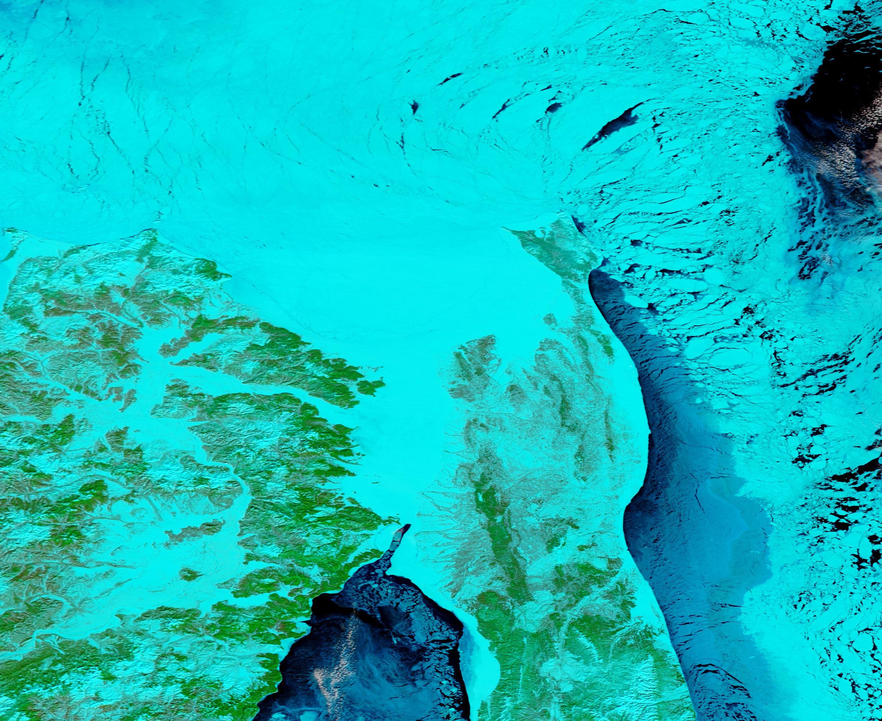
The waters of the Gulf of Sakhalin and the Tartary Strait wore a cover of ice by mid-February 2020. The Moderate Resolution Imaging Spectroradiometer (MODIS) on board NASA’s Terra satellite acquired a false-color image of the icy scene on February 17.
True-color images use red, green, and blue light to create an image that looks very much like we could see if we looked with our own vision. False-color images add infrared light to the mix. Infrared is invisible to our eyes, but not to satellites. By assigning a mix of red, green, and blue to visible and infrared light, scientists can see some things more clearly than true-color—such as sea ice.
In this particular type of false-color image, using bands 7, 2 and 1, areas with plants look bright green while open land appears tan. Cold things appear blue, and the colder something is, the brighter blue it will appear. Ice and snow on the ground show up as bright turquoise, while clouds may range from white, to baby-blue, to bright turquoise. Deep water appears dark blue or black.
The Gulf of Sakhalin is the southern gulf of the Sea of Okhotsk and sits between northern Sakhalin Island and mainland Russia, north of the Amur River. The Tartar Strait connects the Gulf of Sakhalin and the Sea of Japan. The narrow Strait runs about 560 miles (900 km) long and separates Sakhalin Island from the mainland by only 4.5 miles (7.3 km) at the narrowest point.
Image Facts
Satellite:
Terra
Date Acquired: 2/17/2020
Resolutions:
1km (548.4 KB), 500m (1.4 MB), 250m (950.7 KB)
Bands Used: 7,2,1
Image Credit:
MODIS Land Rapid Response Team, NASA GSFC
