
Images


April 4, 2020 - Tropical Cyclone Harold
 Tweet
Tweet
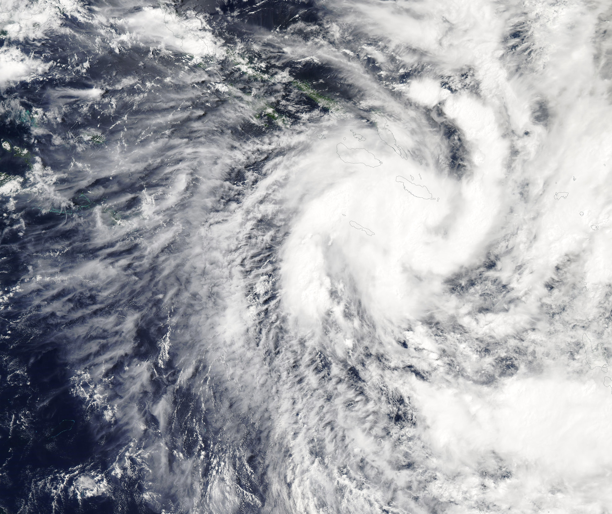
On April 1, 2020, a storm formed over the Solomon Sea between Papua New Guinea and the Solomon Islands. The system moved eastward and on April 2 it made landfall on San Cristobal Island, South Solomon Islands. According to the Global Disaster Alert and Coordination System (GDACS), on April 3 at 0.00 UTC (April 2 8:00 p.m. EST), the center of Tropical Cyclone Harold was located over San Cristobal with maximum sustained winds of 75 km/h (46.6 mph).
On April 4 at 4:00 UTC (April 3 at 11:00 p.m. EST) the Joint Typhoon Warning Center (JWTC) reported that Tropical Cyclone Harold’s maximum sustained winds had increased to about 103.6 mph (167 km/h). The storm was located about 388 miles (624 km) northwest of Port Vila, Vanuatu and was tracking to the southeastward at about 4.6 mph (7.4 km/h).
The JTWC noted that Tropical Cyclone Harold is going through a period of rapid intensification, with deep convective bands and very cold cloud tops wrapping into a pinhole eye. It has slowed its forward motion, and sits in a highly favorable environment with robust outflow, warm sea surface temperatures, and low to moderate vertical wind shear.
The storm is expected to continue rapid intensification over the next 24 to 36 hour, reaching peak intensity of 138 mph (222 km/h) in 48 hours. This is the equivalent of a Category 4 storm on the Saffir-Simpson Hurricane Wind Scale. GDACS expects a close approach to Espiritu Santo’s western coast from April 4-5 and a possible landfall on Malakula Island (Vanuatu) on the morning of April 6. GDACS marks this storm as a Red Alert, with more than 60 thousand people potentially affected by winds of Category 1 or higher.
Oh April 3, 2020, the Moderate Resolution Imaging Spectroradiometer (MODIS) on board NASA’s Aqua satellite acquired a true-color image of Tropical Cyclone Harold. In this image, the eye sits to the west of San Cristobal Island, South Solomons Islands.
Image Facts
Satellite:
Aqua
Date Acquired: 4/3/2020
Resolutions:
1km (720.8 KB), 500m (2.2 MB), 250m (4.2 MB)
Bands Used: 1,4,3
Image Credit:
MODIS Land Rapid Response Team, NASA GSFC
