
Images


April 8, 2020 - Spring Thaw in Adirondack State Park and New England
 Tweet
Tweet
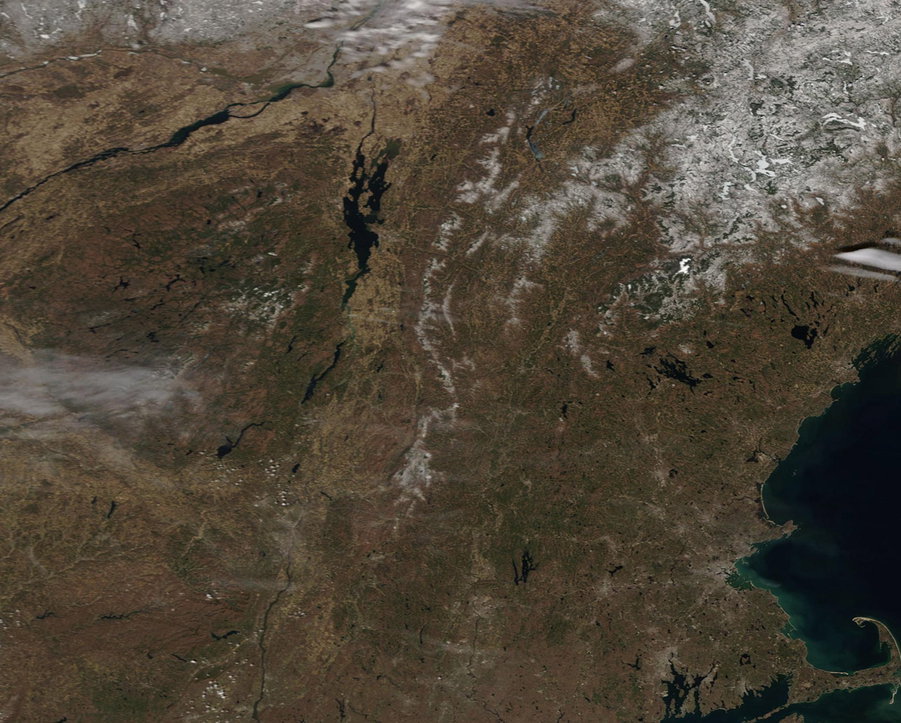
Each spring, warming weather sweeps across North America, wiping away the residue of winter’s chill. By April, even the more northerly regions of American’ Lower 48 states have begun to shed their snowy coats, opening the way for greening vegetation and the warmer days of summer to come.
On April 6, 2020, the Moderate Resolution Imaging Spectroradiometer (MODIS) on board NASA’s Terra satellite acquired a true-color image of remnants of winter’s snow lingering in the Adirondack Mountains and parts of New England.
The round, forested area in the west marks the Adirondacks, where only a slight puff of snow remains in a few areas. Moving eastward, snow still lingers on the mountains of Vermont and New Hampshire. To the south, the rest of New York State as well as Massachusetts, Rhode Island, and Connecticut are snow-free.
While a single snapshot can allow a view of snow lingering on a given day, spring melt is not a one-time event, but a process that occurs over many weeks. To gain a better understanding of how snowpack melts over time, it is helpful to compare images over several days. Thanks to the NASA Worldview app, a roll-over comparison of MODIS images of the same area on April 6 and March 15 can be viewed HERE.
The NASA Worldview app provides a satellite's perspective of the planet as it looks today and as it has in the past through daily satellite images. Worldview is part of NASA’s Earth Observing System Data and Information System. EOSDIS makes the agency's large repository of data accessible and freely available to the public.
Image Facts
Satellite:
Terra
Date Acquired: 4/6/2020
Resolutions:
1km (134.8 KB), 500m (410.9 KB), 250m (660.2 KB)
Bands Used: 1,4,3
Image Credit:
MODIS Land Rapid Response Team, NASA GSFC
