
Images


May 30, 2020 - Tropical Storm Bertha
 Tweet
Tweet
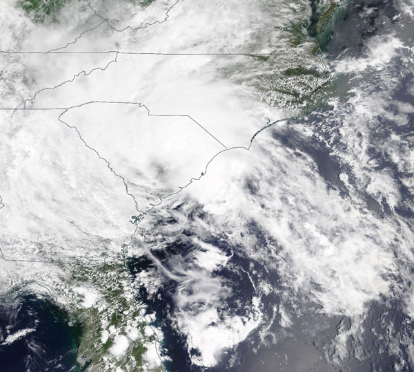
Bertha formed into a tropical storm on May 27, about 30 miles off the South Carolina coast. By 9:30 a.m. EDT, roughly one hour after formation, Bertha made landfall along the coast of South Carolina, east of Charleston. Data acquired from buoys placed by National Oceanic and Atmospheric Administration (NOAA) and Coastal Ocean Research and Monitoring Program (CORMP) indicated that maximum sustained winds increased to near 50 mph (80 km/h) before landfall.
By 2 p.m. EDT, Bertha had weakened to a tropical depression but was still bringing heavy rainfall across the Carolinas. By 11 p.m. EDT, heavy rainfall had spread across western North Carolina and southwest Virginia into West Virginia. At that time, the center of Bertha was located about 95 miles (150 km) south-southwest of Roanoke, Virginia.
May 28 at 11 am EDT, the National Hurricane Center (NHC) issued its last advisory on the system. At that time, Bertha was located about 150 miles (280 km) south-southwest of Buffalo, New York. Maximum sustained winds were 25 mph (35 km/h) as the system moved north towards Canada at about 30 mph (48 km/h).
The Moderate Resolution Imaging Spectroradiometer (MODIS) on board NASA’s Terra satellite acquired a true-color image of Tropical Storm Bertha as the center of the storm was located over South Carolina. Bertha is the second named storm that formed ahead of the Atlantic hurricane season. That season officially begins on June 1 and runs to November 30.
Image Facts
Satellite:
Terra
Date Acquired: 5/27/2020
Resolutions:
1km (275.1 KB), 500m (996.1 KB), 250m (2.9 MB)
Bands Used: 1,4,3
Image Credit:
MODIS Land Rapid Response Team, NASA GSFC
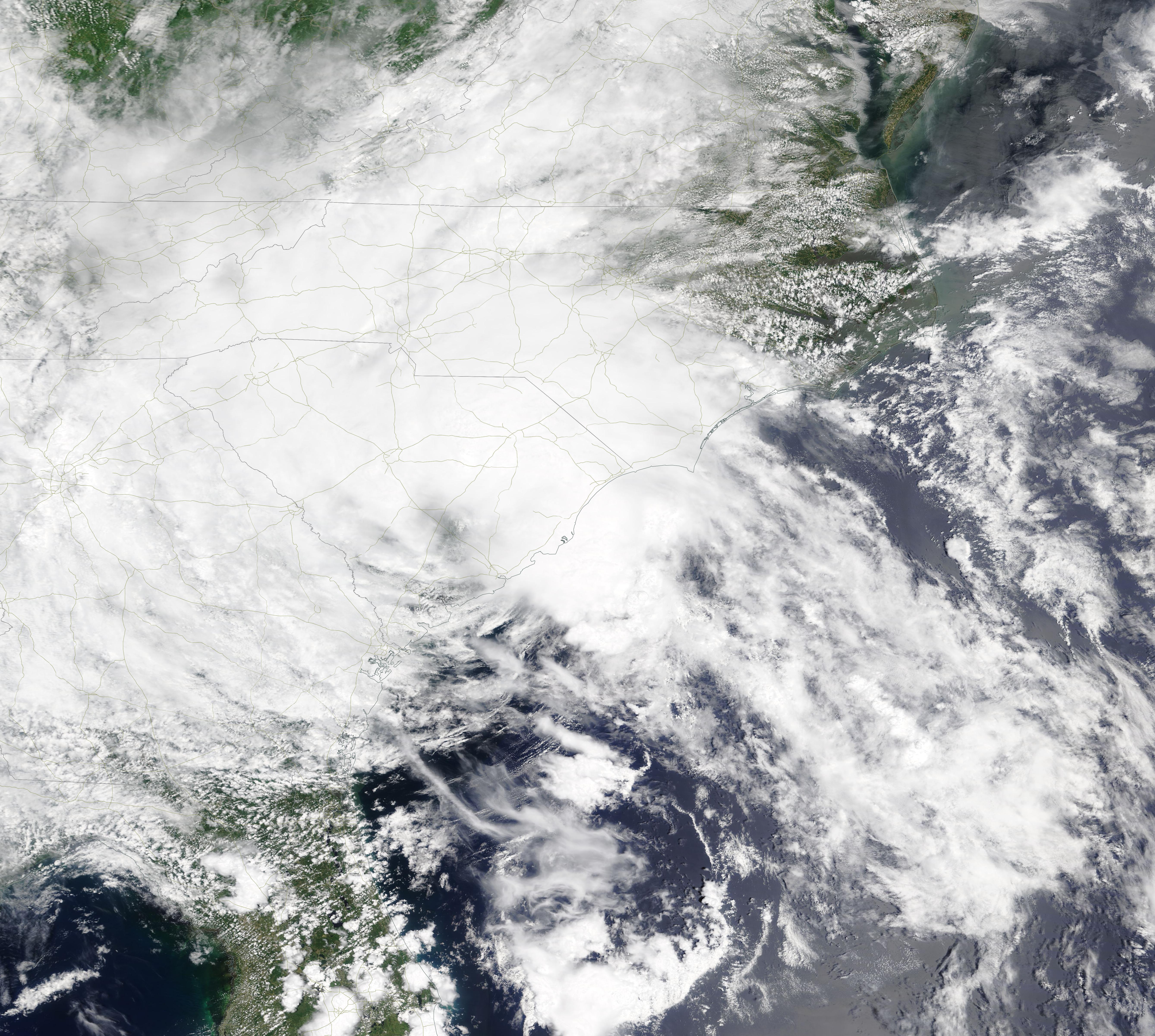
