
Images


July 11, 2020 - Tropical Storm Fay
 Tweet
Tweet
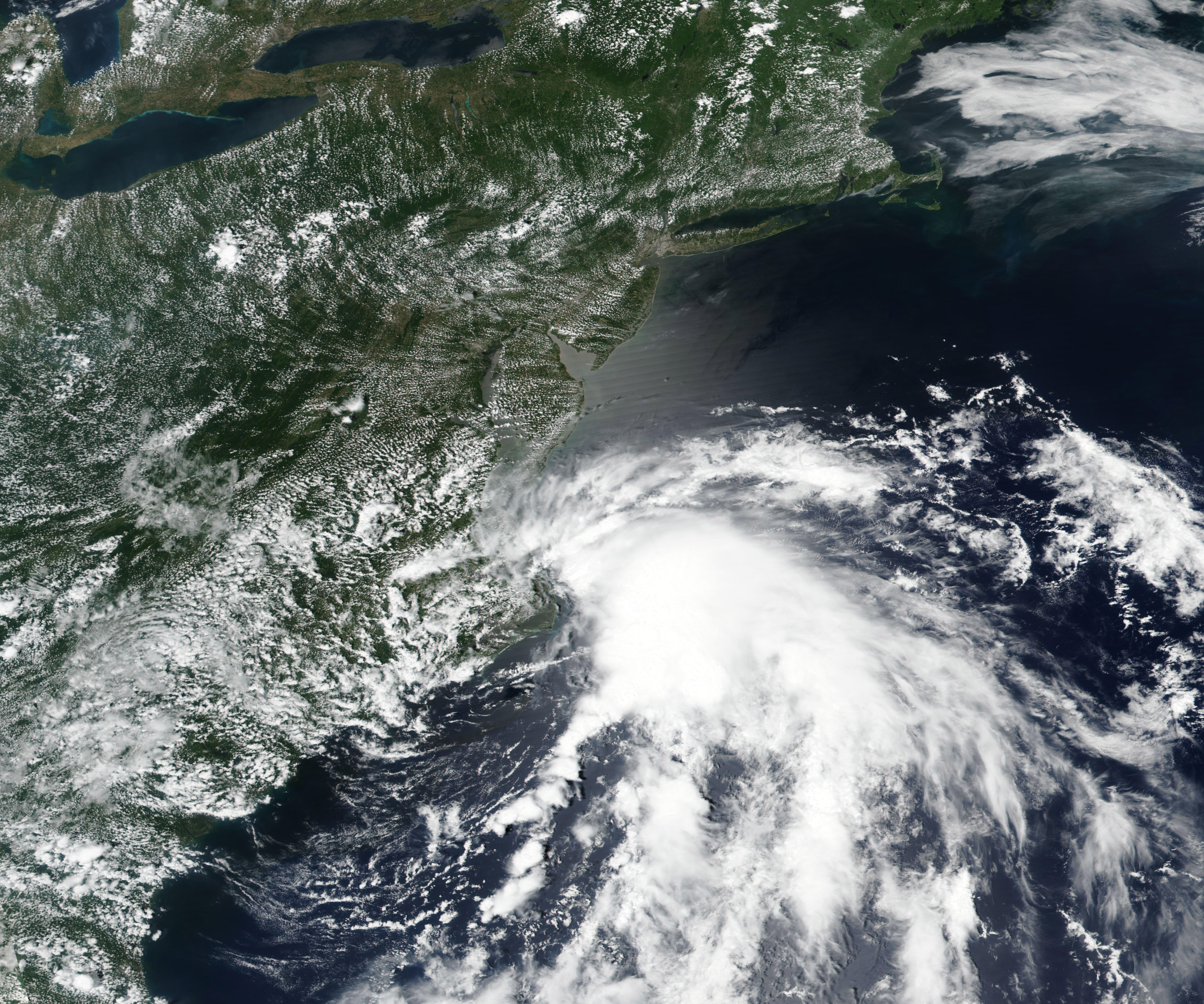
Tropical Storm Fay was streaking northwestward over the Atlantic Ocean on July 9, 2020, when the Moderate Resolution Imaging Spectroradiometer (MODIS) on board NASA’s Terra satellite acquired this true-color image. At 11 p.m. EDT (0300 UTC) on July 9, the National Hurricane Center (NHC) reported that Fay was located about 85 miles (145 km) north northeast of Cape Hatteras, North Carolina and about 140 mi (270 km) south of Ocean City, Maryland. It was carrying maximum sustained winds of 45 mph (75 km/h) and moving north at 8 mph (13 km/h).
At 5:00 p.m. EDT (2100 UTC) on July 10, Tropical Storm Fay had made landfall along the coast of New Jersey about 10 miles (15 km) north-northeast of Atlantic City, New Jersey near latitude 39.5 north, longitude 74.3 West. It was carrying maximum sustained winds of about 50 mph (85 km/h). Heavy rains, strong wind and widespread flooding were reported on the Delmarva Peninsula (encompasses parts of Delaware, Maryland, and Virginia), New Jersey, and New York on July 9-10.
The weakening storm system is predicted to continue moving inland over southwestern New York and western New England through July 11. Additional weakening is expected as Fay moves further inland, and the NHC expects the system to become a post-tropical low late on July 11 and dissipate on July 12.
Image Facts
Satellite:
Terra
Date Acquired: 7/9/2020
Resolutions:
1km (994.4 KB), 500m (2.7 MB), 250m (5 MB)
Bands Used: 1,4,3
Image Credit:
MODIS Land Rapid Response Team, NASA GSFC
