
Images


September 14, 2020 - Libya
 Tweet
Tweet
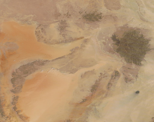
Located in North Africa, Libya enjoys a long strip of coastline along the Mediterranean Sea while the interior is dominated by arid seas of sand and dry Saharan Desert. According to the CIA World Factbook, over 90 percent of Libya’s population lives along the Mediterranean coast, while over 90 percent of the country is desert or semi-desert.
On September 10, 2020, the Moderate Resolution Imaging Spectroradiometer (MODIS) on board NASA’s Terra satellite acquired a true-color image of southwestern Libya.
Two large, orange-colored sand seas are separated by a long outcrop of sandstone. The Erg Ubari sits in the northwestern corner, while the Erg Murzuq glows orange in the southwestern section. The deep orange area in the northwestern part of Erg Murzuq are tall sand dunes. It is easiest to view the distinct ripples that mark these large dunes in the 250 km resolution image. The circular, dark brown area to the northeast of the sand seas marks the Haruj volcanic field. Created at a time when volcanic eruptions regularly sent lava spilling across the landscape, the dark basalt layers spread across a 17,000-square-mile (45,000-square-kilometer) plateau and stand out in sharp contrast to the orange sand seas and the tan pebbles and rocky terrain nearby.
Image Facts
Satellite:
Terra
Date Acquired: 9/10/2020
Resolutions:
1km (118.8 KB), 500m (284.2 KB), 250m (513.4 KB)
Bands Used: 1,4,3
Image Credit:
MODIS Land Rapid Response Team, NASA GSFC
