
Images


September 18, 2020 - England and Wales
 Tweet
Tweet
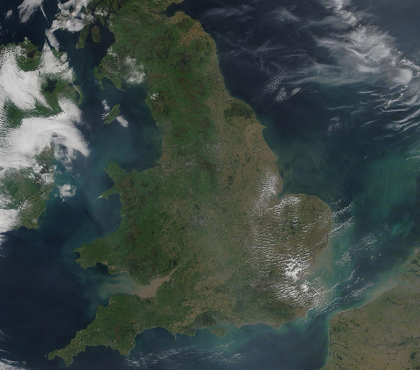
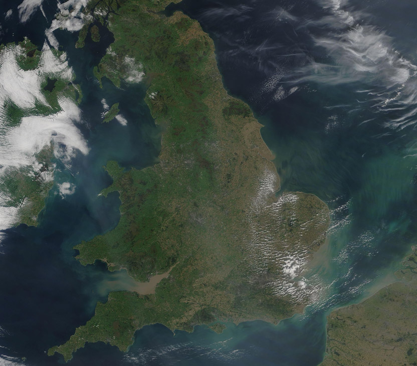
On September 17, 2020, the Moderate Resolution Imaging Spectroradiometer (MODIS) on board NASA’s Terra satellite acquired a true-color image of a sunny summer day over England and Wales.
Heavy sediment fills Bristol Bay between England and Wales. Both countries sit on the island of Great Britain, with Wales bounded by Bristol Bay in the south and the Irish Sea in the west. England makes up the greater part of the island, with Scotland (not seen in this image) sitting in the north.
Not only does sediment fill Bristol Bay, but sediment clings to the coastlines in the southeast, especially near the outflow of the River Thames. Tans and greens swirls are also seen in all the water surrounding the island, including the North Sea, the English Channel, and the Irish Sea. The greenish color may represent either sediment, which changes reflectivity as it sinks and thus can appear green, or blooms of phytoplankton. Or a mix of both. Phytoplankton are microscopic, plant-like organisms that live in the waters in this region year-round. When conditions are right, they can reproduce in huge numbers, creating blooms that can be easily seen from space.
Image Facts
Satellite:
Terra
Date Acquired: 9/17/2020
Resolutions:
1km (166 KB), 500m (450.8 KB), 250m (1.3 MB)
Bands Used: 1,4,3
Image Credit:
MODIS Land Rapid Response Team, NASA GSFC
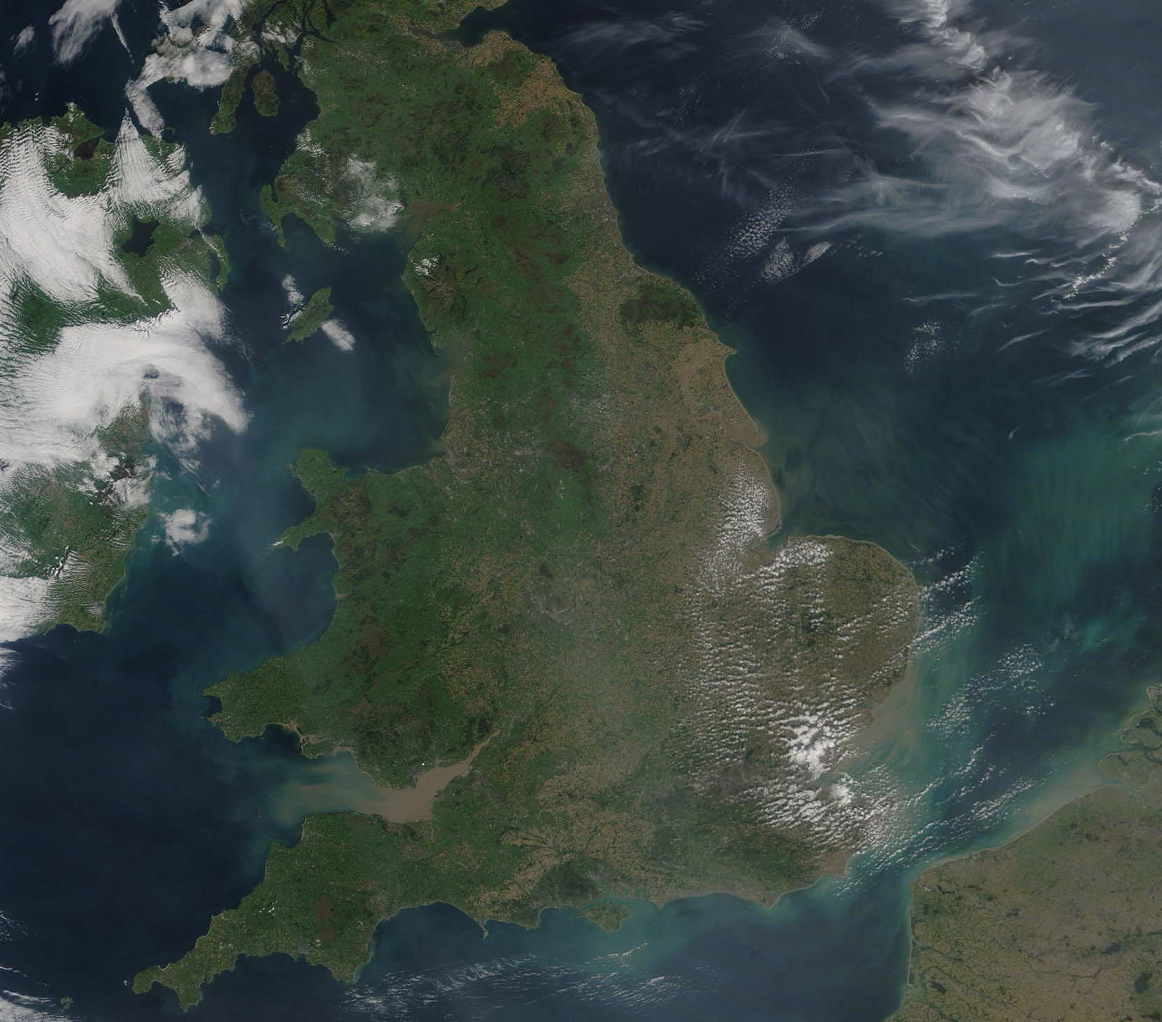
