
Images


November 20, 2020 - New Mexico
 Tweet
Tweet
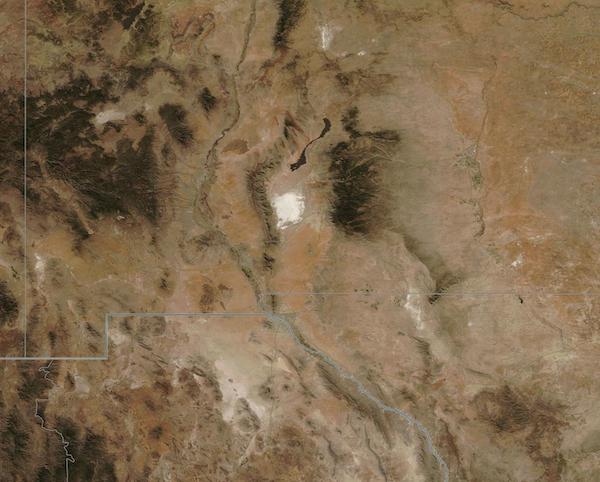
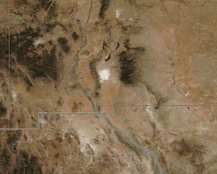
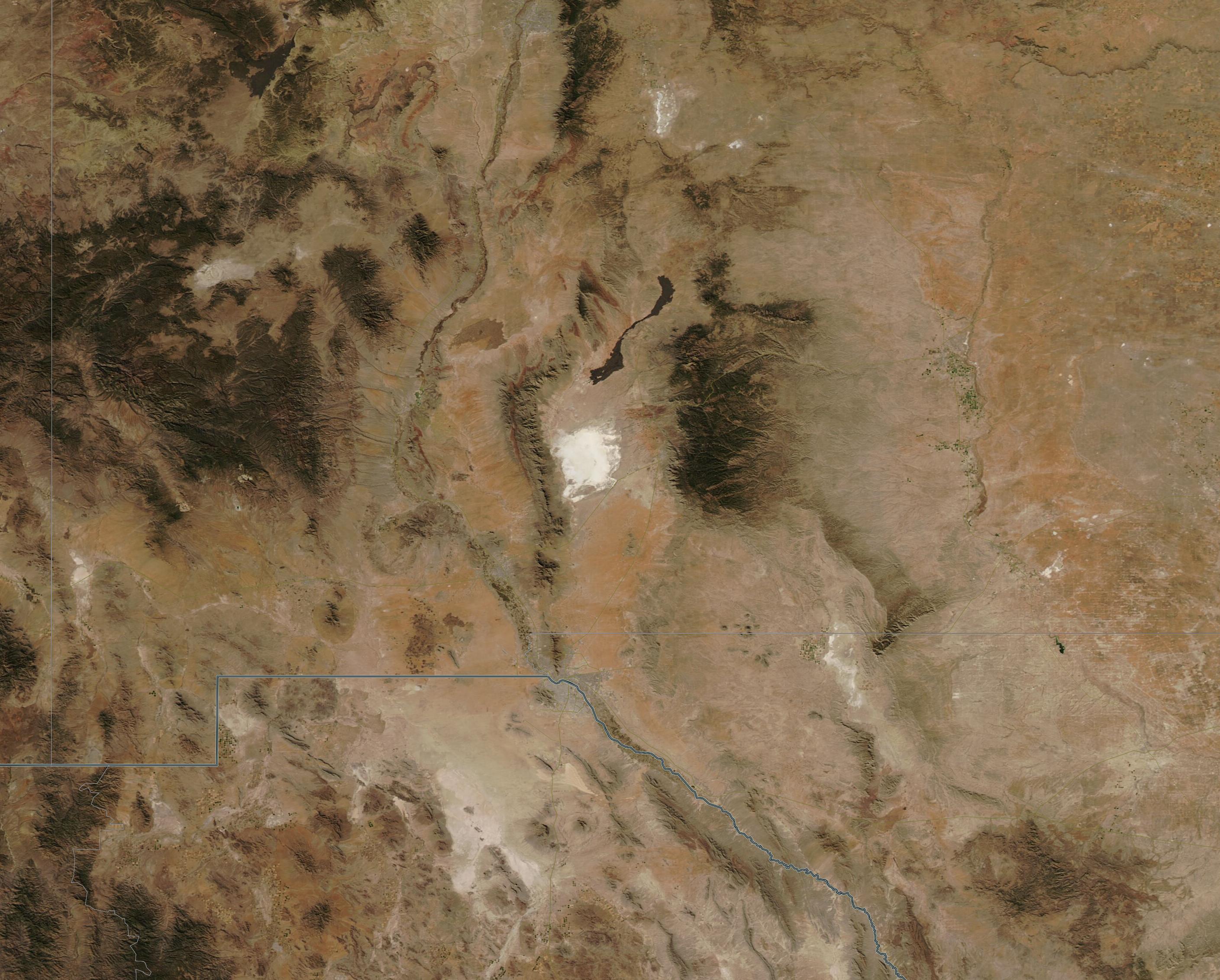
On November 16, 2020, the Moderate Resolution Imaging Spectroradiometer (MODIS) on board NASA’s Aqua satellite acquired a true-color image centered on the state of New Mexico. Gray lines have been overlain on the image to mark boundaries. A bit of eastern Arizona can be seen west of New Mexico and the country of Mexico sits in the south.
Most of New Mexico is colored in tans and browns, testament to the arid to semi-arid climate where few plants grow. Most of the dark green forests bunch together in higher elevations while a few areas washed in pale green color regions with some recent precipitation. In southern New Mexico, sitting between the San Andres and Sacramento Mountains, a 275-square mile patch of desert glistens bright white. This is the world’s largest gypsum dune field, also known as the White Sands. White Sands National Park protects a major portion of this dune field.
According to the U.S. Drought Monitor on November 17, Exceptional D4 Drought now extends across large sections of New Mexico as well as Arizona and Utah. Across most of Nevada, Utah, and New Mexico, precipitation totals have reached among the driest 5 percent on record at many locations. In New Mexico, 39.56 percent of the land is in D4 drought – the highest possible category, 72.99 percent is in D3-D4 status (Extreme to Exceptional Drought), and 99.54 percent is categorized as D2-D4 (Severe to Exceptional). More than two million people are currently estimated to live in the drought-stricken areas.
Image Facts
Satellite:
Aqua
Date Acquired: 11/16/2020
Resolutions:
1km (60.5 KB), 500m (231.7 KB), 250m (806.9 KB)
Bands Used: 1,4,3
Image Credit:
MODIS Land Rapid Response Team, NASA GSFC
