
Images


January 18, 2021 - Fire on Baja California Peninsula
 Tweet
Tweet
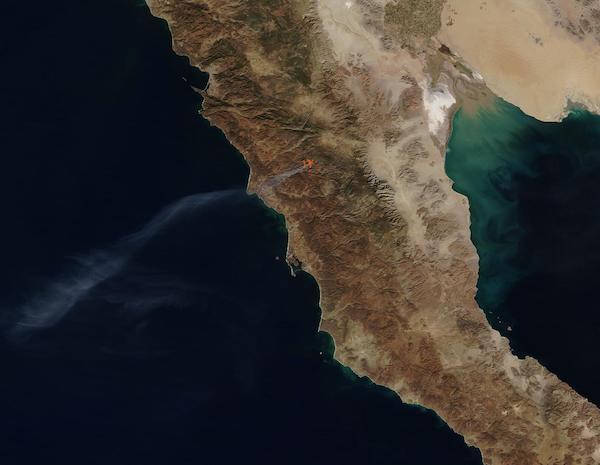
On January 14, 2021, the Moderate Resolution Imaging Spectroradiometer (MODIS) on board NASA’s Terra satellite acquired a true-color image of a large fire burning in the state of Baja California, Mexico.
Red “hot spots” mark areas where the thermal bands on the MODIS instrument detected high temperatures. When accompanied by typical smoke, as in this image, such hot spots strongly suggest actively burning fire.
A hot spot was first detected in this area on January 12, and the fire expanded through January 14, when the area engulfed in flame measured roughly 4 miles (6.4 km) wide and covered about 20 square miles (52 square kilometers) and a thick plume of smoke stretched 130 miles (209 km) to the southwest. On January 15, MODIS imagery revealed the affected area had diminished in size and by January 16 the fire appeared to be extinguished, with no hot spots or smoke seen since that date.
Image Facts
Satellite:
Terra
Date Acquired: 1/14/2021
Resolutions:
1km (21.4 KB), 500m (74.8 KB), 250m (233.2 KB)
Bands Used: 1,4,3
Image Credit:
MODIS Land Rapid Response Team, NASA GSFC
