
Images


May 11, 2021 - Ice clings to Lakes Winnipeg and Winnipegosis
 Tweet
Tweet
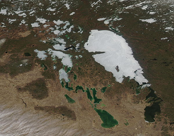
On May 8, 2021, the Moderate Resolution Imaging Spectroradiometer (MODIS) acquired a true-color image of ice across Lake Winnipeg, Lake Winnipegosis, and most of Manitoba’s northern lakes. Manitoba, a province with about 100,000 lakes, is found in central Canada.
Lake Winnipeg claims the title of the tenth-largest freshwater lake in the world, stretching over a total area of about 9,420 square miles (24,400 sq km). Measuring 133 miles (214 km) long, the lake is separated into two basins—a large northern basin reaching 62 miles (100 km) wide and a smaller southern side that is only 25 miles (40 km) wide. The two basins are connected by a 1.5 mile- (2.5 km)-wide channel which is called, appropriately, “The Narrows”.
Each winter, frigid temperatures across Manitoba ensure a thick layer of ice forms across the myriad of lakes, including Lakes Winnipeg (east) and Winnipegosis (west). As warm temperatures return, thawing begins in the south of the province and moves northward. The two large lakes are typically ice-free in early June.
Image Facts
Satellite:
Aqua
Date Acquired: 5/8/2021
Resolutions:
1km (466.1 KB), 500m (1.1 MB), 250m (752.9 KB)
Bands Used: 1,4,3
Image Credit:
MODIS Land Rapid Response Team, NASA GSFC
