
Images


October 15, 2021 - October Snowstorm Blankets the Intermountain West
 Tweet
Tweet
An autumn snowstorm struck the Intermountain West in early October 2021, dropping enough snow that some residents needed a yardstick to measure the white powder. With temperatures forecast to drop well below freezing, a call for families and farmers to “harvest or cover your crops” was issued ahead of the incoming storm over much of the region.
Dropping temperatures and white flakes were seen in Idaho, Montana, and Nevada on October 11, with several parts of Montana reporting a foot of snow that evening and one town confirming a 20-inch (50.8 cm) accumulation. By the next day the impact was felt along a wide swath from Montana to Arizona. By October 13, snow accumulation of more than a half-foot were widespread, with high mountain areas layered under two feet or more of the white stuff, according to data from the National Weather Service’s National Snow Analyses maps.
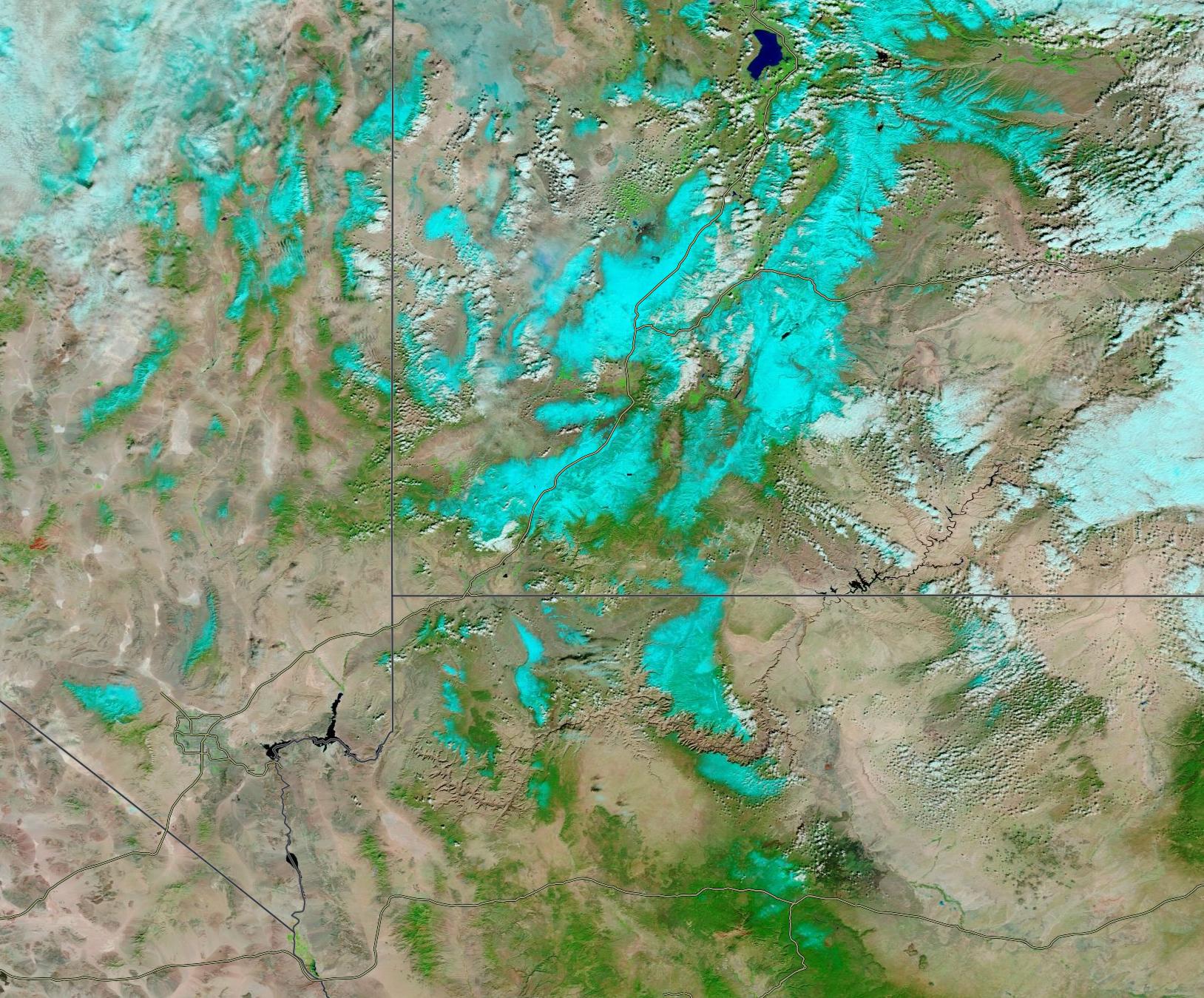
On October 13, the Moderate Resolution Imaging Spectroradiometer (MODIS) on board NASA’s Terra satellite acquired a false-color image of freshly-fallen snow across Nevada, Utah, and Arizona. This type of image uses a combination of infrared and visible light (MODIS bands 7,2,1) that helps differentiate white snow from white cloud and also from the non-snow-covered landscape. Here we see snow colored electric blue while cloud remains white. Vegetated areas are bright green and open areas with little or no vegetation appears in shades of tan or brown. Water appears deep blue or black. With this band combination, it’s east to see that widespread snow clings to ridges and high elevation with small banks cloud also tending to float near the ridgelines.
Image Facts
Satellite:
Terra
Date Acquired: 10/13/2021
Resolutions:
1km (128.6 KB), 500m (478.4 KB), 250m (1.5 MB)
Bands Used: 7,2,1
Image Credit:
MODIS Land Rapid Response Team, NASA GSFC
An autumn snowstorm struck the Intermountain West in early October 2021, dropping enough snow that some residents needed a yardstick to measure the white powder. With temperatures forecast to drop well below freezing, a call for families and farmers to “harvest or cover your crops” was issued ahead of the incoming storm over much of the region.
Dropping temperatures and white flakes were seen in Idaho, Montana, and Nevada on October 11, with several parts of Montana reporting a foot of snow that evening and one town confirming a 20-inch (50.8 cm) accumulation. By the next day the impact was felt along a wide swath from Montana to Arizona. By October 13, snow accumulation of more than a half-foot were widespread, with high mountain areas layered under two feet or more of the white stuff, according to data from the National Weather Service’s National Snow Analyses maps.
On October 13, the Moderate Resolution Imaging Spectroradiometer (MODIS) on board NASA’s Terra satellite acquired a false-color image of freshly-fallen snow across Nevada, Utah, and Arizona. This type of image uses a combination of infrared and visible light (MODIS bands 7,2,1) that helps differentiate white snow from white cloud and also from the non-snow-covered landscape. Here we see snow colored electric blue while cloud remains white. Vegetated areas are bright green and open areas with little or no vegetation appears in shades of tan or brown. Water appears deep blue or black. With this band combination, it’s east to see that widespread snow clings to ridges and high elevation with small banks cloud also tending to float near the ridgelines.
Image Facts
Satellite:
Terra
Date Acquired: 10/13/2021
Resolutions:
1km (128.6 KB), 500m (478.4 KB), 250m (1.5 MB)
Bands Used: 7,2,1
Image Credit:
MODIS Land Rapid Response Team, NASA GSFC
