
Images


October 19, 2021 - Persian Gulf
 Tweet
Tweet
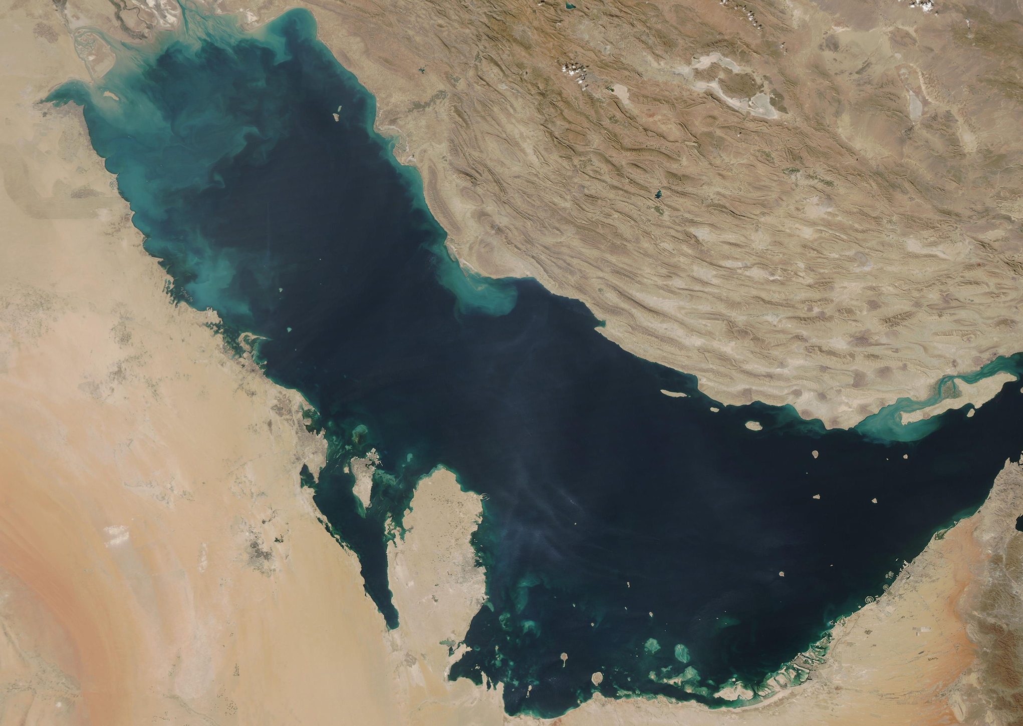
On October 17, 2021, the Moderate Resolution Imaging Spectroradiometer (MODIS) on board NASA’s Aqua satellite acquired a true-color image of the Persian Gulf.
The Persian Gulf (also known as the Arabian Gulf) is a shallow marginal sea of the Indian Ocean, flanked by the steep, rugged, and dry mountains on its northeast side, the wetlands of Mesopotamia on the north, and the pastel-hued deserts of the Arabian Peninsula in the southwest. The countries huddled along the coast of the 615-mile- (990-km)-long Gulf include Iran, Oman, United Arab Emirates, Qatar, Bahrain, Saudi Arabia, Kuwait, and Iraq.
Clouds of tan, blue, and green swirl in the dark waters of the Persian Gulf, especially along the northern shores. Closest to the coastlines, the colors are almost certainly sediment washing into the Gulf. Sediment appears mud-colored tan when floating near the surface, but as it sinks the colors change to green and then to blue as it begins to disperse. Some of the color may also be sediment churned up from the Gulf’s shallow bed in the north near Iraq and along its southwestern shore. In addition, growth of algae or phytoplankton (microscopic plant-like organisms) may add some color to the waters.
The primary source of sediment in the northern Persian Gulf comes from the Shatt al Arab River, which enters the Gulf in the north along the Iran-Iraq border. The river drains the combined waters of the Euphrates and Tigris Rivers of Iraq and the Karun River of Iran. Though other rivers empty into the Persian Gulf, most of the fresh water that enters the gulf comes from the Shatt al Arab.
Image Facts
Satellite:
Aqua
Date Acquired: 10/17/2021
Resolutions:
1km (539.5 KB), 500m (1.3 MB), 250m (825.1 KB)
Bands Used: 1,4,3
Image Credit:
MODIS Land Rapid Response Team, NASA GSFC
