
Images


August 16, 2022 - Six Rivers Lightning Complex Fire
 Tweet
Tweet
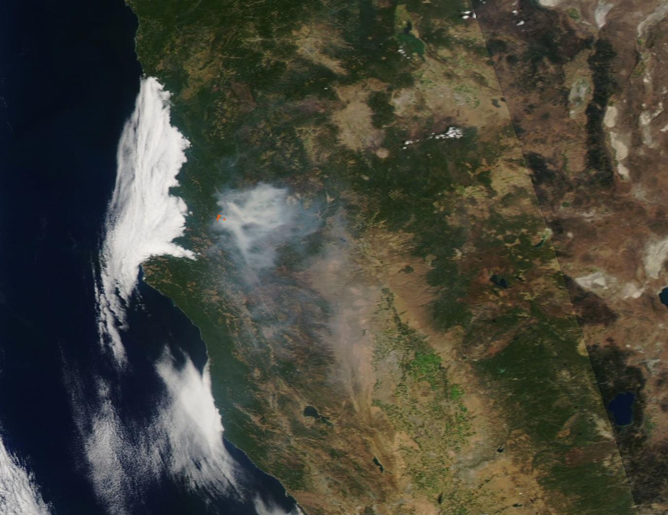
On August 5, 2022, thunderstorms rolled across the rugged, forested mountains of Six Rivers National Forest in Humboldt and Trinity Counties, located the northwest corner of California. Multiple lightning strikes sparked twelve individual fires in the forests located roughly between Redding and Eureka, California. Evacuations of multiple at-risk locations began immediately.
Aggressive firefighting, focused on protecting public safety and full suppression, reduced the number of individual fires to eight by August 6. Although all fires are being handled under the wider name of Six Rivers Lightning Complex Fire, the eight individual fires were all burning in the Six River National Forest and had the following names: Waterman, Cedar, Bremer, Friday, Oak, Charlie, Corral, and Campbell. The fires were burning in steep and sometimes nearly inaccessible terrain with accumulated dead and downed timber from a winter ice storm. A few days later, two more fires had been extinguished, leaving only six individual areas within the Complex.
As of 9:00 p.m. EDT on August 15, the Six Rivers Lightning Complex Fire had burned 20,052 Acres to become the second-largest fire in California this year. This follows behind the McKinney Fire, which has burned more than 60,000 acres in Klamath National Forest, Siskiyou County since July 29. According to Inciweb Incident Management System, the Six Rivers Lightning Complex Fire was 19 percent contained on August 15, with more than 2,000 personnel actively engaged fighting the fires. The report stated that a strong inversion kept smoke low to the ground and increasing through the morning hours, but in the afternoon northwest winds allowed smoke to gradually lift from the northwest end of the fire although smoke remained thick on the downwind side.
The Moderate Resolution Imaging Spectroradiometer (MODIS) on board NASA’s Aqua satellite acquired a true-color image of the Six Rivers Lightning Complex Fires on August 14. Red “hot spots” mark areas where the thermal bands on the image detected high temperatures, which in this case shows actively burning fire. Thick smoke—most of it so thick that it obscures the land from view— covers roughly 5,370 square kilometers (2,073 square mi). That’s larger than the state of Delaware. A large but much thinner veil of smoke pours southwestward into the Central Valley. Meanwhile, a thick bank of fog stretches over Eureka and the coastal valleys west of the smoke and fire.
Image Facts
Satellite:
Aqua
Date Acquired: 8/14/2022
Resolutions:
1km (49.6 KB), 500m (158.6 KB), 250m (453.6 KB)
Bands Used: 1,4,3
Image Credit:
MODIS Land Rapid Response Team, NASA GSFC
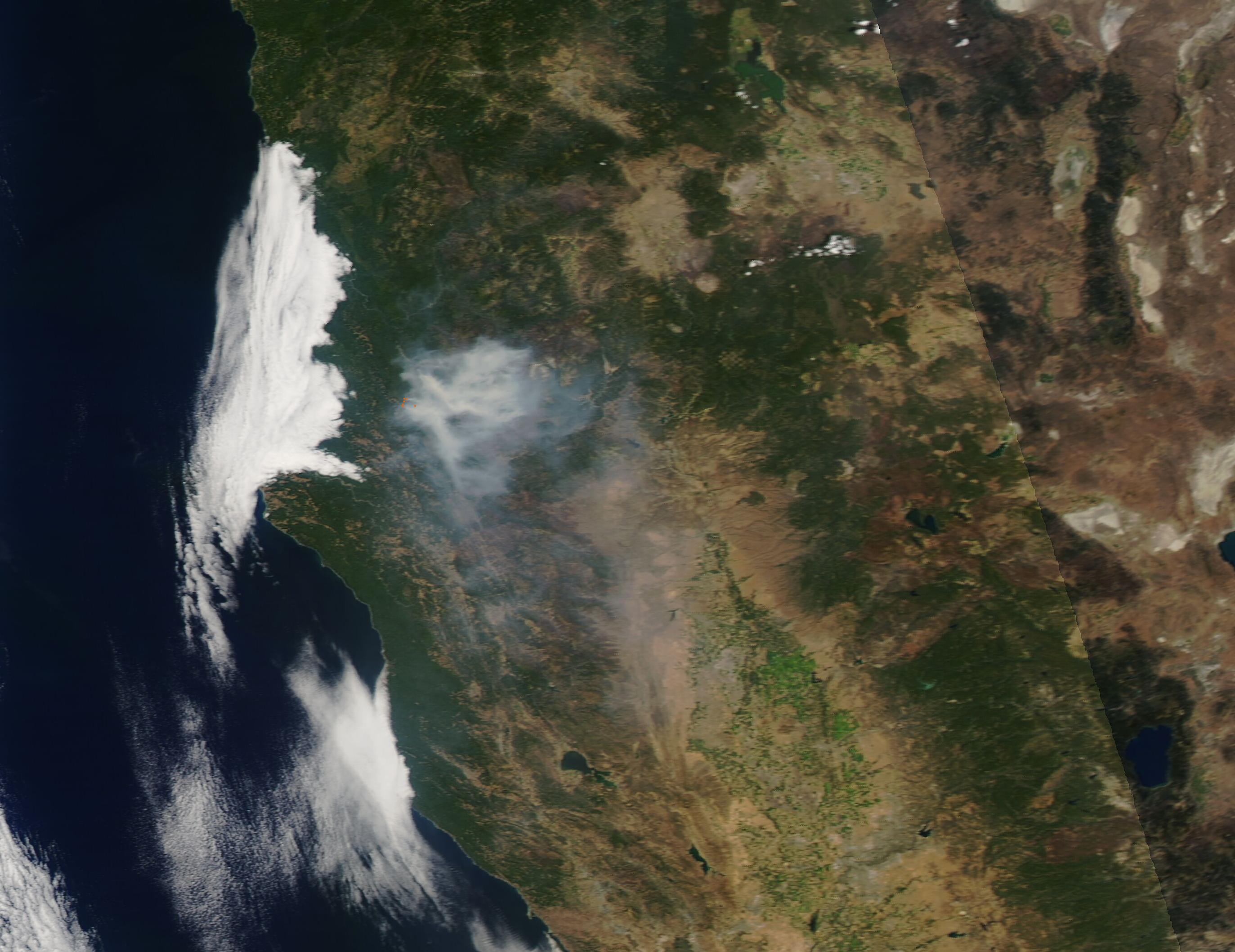
