
Images


December 3, 2022 - Sea Ice and Clouds over the Sea of Okhotsk
 Tweet
Tweet
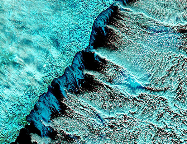
The Sea of Okhotsk has been called a “cloud and ice factory”, thanks to the prevailing frigid and dry northwesterly winds blowing out from Siberia over the relatively warm and moist waters. On December 2, 2022, the Moderate Resolution Imaging Spectroradiometer (MODIS) on board NASA’s Aqua satellite acquired a stunning false-color image illustrating the dramatic results of that factory—filigrees of forming sea ice and dramatic cloud streets over the Sea of Okhotsk.
In this type of false-color image, snow appears bright electric blue and high, cold cloud filled with ice crystals sports a similar color. Floating sea ice looks darker blue and deep waters look inky-black. It is easy to see that Siberia is covered with snow and patches of cloud and that sea ice has begun to form along the coast, where steady winds have begun to freeze the shallowest surface waters. Later in the season the entire surface of the Sea of Okhotsk will become laden with a layer of ice. The most striking feature of this image is the pattern of parallel rows of clouds (cloud streets) that cover the dark waters.
Cloud streets typically form when cold air blows over warmer waters, picking up heat and moisture. As this air becomes warmer and wetter, it starts to rise in columns until its hit a warmer air layer, which makes the rising thermals roll over and loop back on themselves, creating parallel cylinders of rotating air. On the upper edge of these cylinders, clouds form. On the falling side (descending air), cloud formation is difficult, and the skies will appear clear or—as in this image—thin. Thanks to strong, cool land breezes and warmer Pacific waters to the east, the Sea of Okhotsk is covered by clouds (with or without streets) for much of the year.
Image Facts
Satellite:
Aqua
Date Acquired: 12/2/2022
Resolutions:
1km (2.6 MB), 500m (7.8 MB), 250m (22.5 MB)
Bands Used: 1,4,3
Image Credit:
MODIS Land Rapid Response Team, NASA GSFC
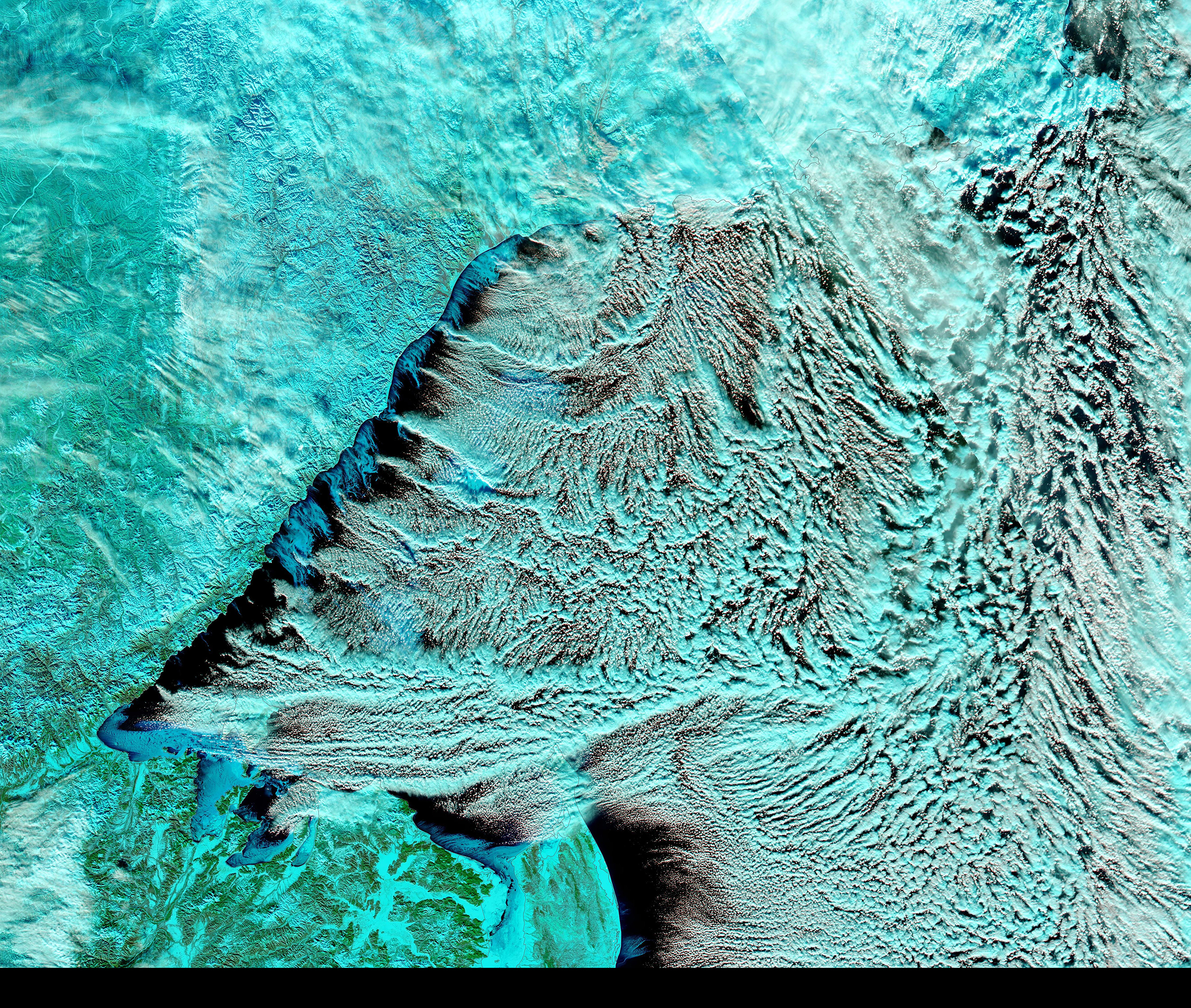
