
Images


September 20, 2024 - United Kingdom and Ireland
 Tweet
Tweet
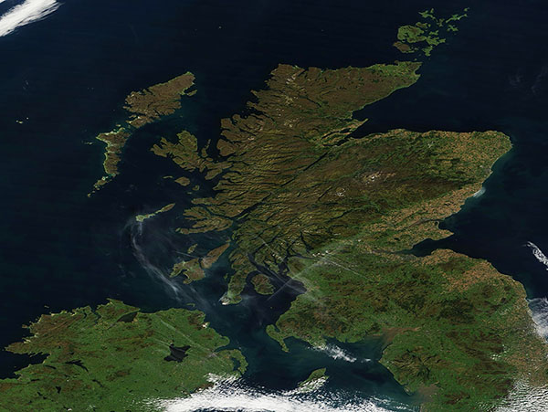
On September 18, 2024, the Moderate Resolution Imaging Spectroradiometer (MODIS) on NASA's Terra satellite acquired this true-color image of a late summer day across the United Kingdom and Ireland.
The United Kingdom includes England, Scotland, and Wales—all located on the island of Great Britain—and Northern Ireland, which spans about one-sixth of the northern part of the island of Ireland. The country of Ireland takes up the remaining five-sixths of the island, which sits west of Great Britain.
This image captures primarily captures Scotland, northern England, and Northern Ireland. Scotland sits at the northern tip of Great Britain and includes the island groups known as the Inner and Outer Hebrides (Western Isles) on the extreme northwest and the Orkney Islands in the northeast. The Irish Sea separates the island of Great Britain from the island of Ireland.
Although the skies are clear and the weather was sunny on the day this image was acquired, the weather had taken an autumnal turn during the prior week. Temperatures dropped across much of Scotland and northern England. Ben Wyvis, a large ridge that peaks at 1,046 meters (3,432 feet) in the Highlands north of Loch Ness, received the first scattering snow of the season on September 11. With warmer temperatures and plentiful sunshine, no visible snow remained when this image was acquired.
Image Facts
Satellite:
Terra
Date Acquired: 9/18/2024
Resolutions:
1km (152.2 KB), 500m (384.6 KB), 250m (1017.6 KB)
Bands Used: 1,4,3
Image Credit:
MODIS Land Rapid Response Team, NASA GSFC
