
Images


February 23, 2015 - Dust storms across the western Sahara
 Tweet
Tweet
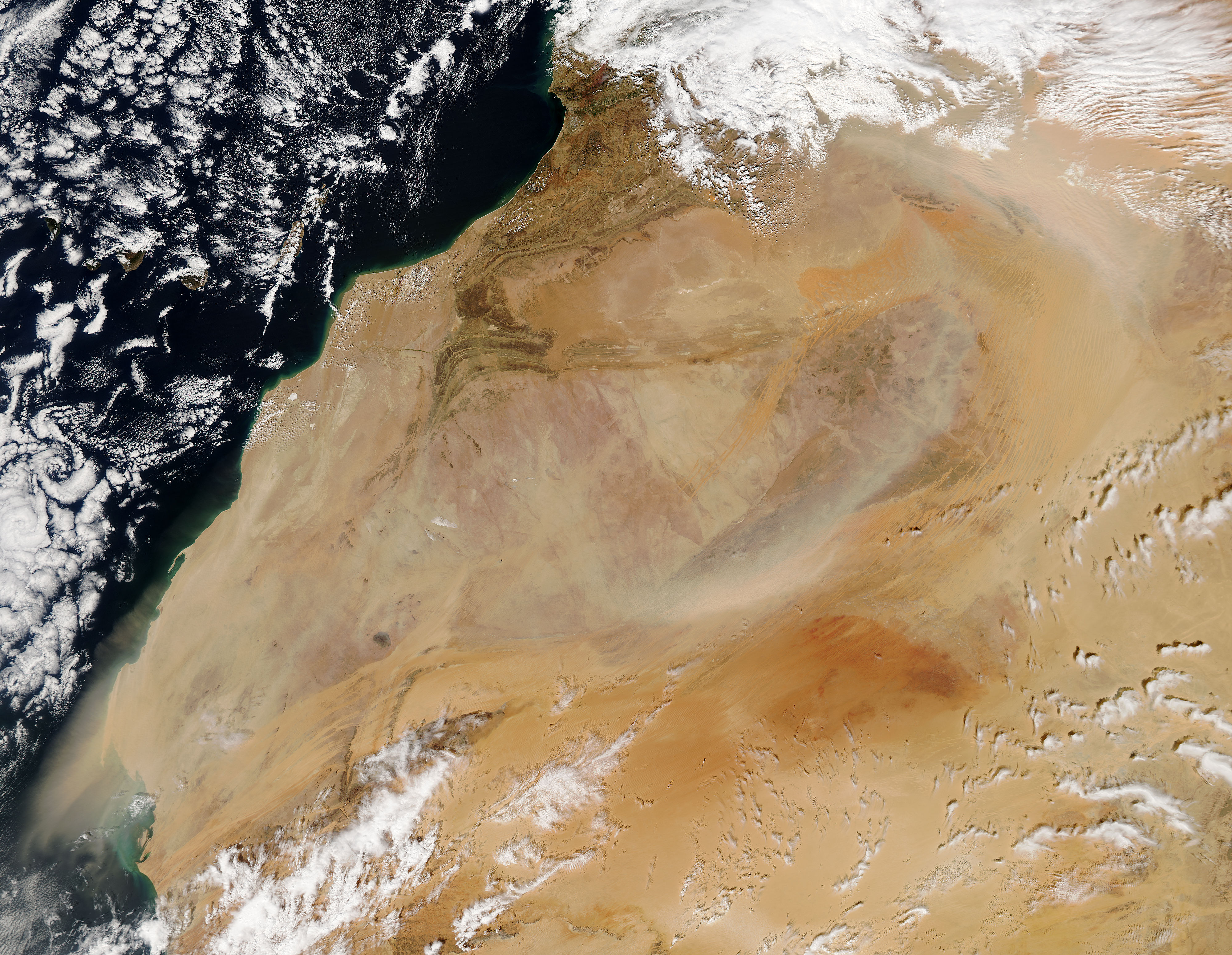
The Sahara Desert is an arid, broad expanse featuring primarily sand and barren, hard, rocky plateaus. It stretches over most of northern Africa, covering about 3.6 million square mi (9.4 million square km) and covers parts of Tunisia, Niger, Morocco, Mauritania, Western Sahara, Mali, Egypt, Libya, Chad, Sudan and Algeria.
Dust storms are the major natural hazard occurring in the Sahara region, and they occur with regularity, especially in the spring. The month of February, 2015 has been especially active, with several storms occurring throughout the month. One such storm, deemed an “Epic Sandstorm” by ABC News, followed cyclonic winds which crossed the Atlas Mountains. The storm lasted for over three days, and by February 1, it caused a massive sea of dust to pour from Africa to Turkey.
February continued to be dusty late into the month, as evidenced by this true-color image captured by the Moderate Resolution Imaging Spectroradiometer (MODIS) aboard NASA’s Aqua satellite on February 18. Heavy clouds over the Atlas Mountains suggest a storm system has kicked up winds. The northwesterly winds lofts heavy bands of dust and sand aloft, drive them to the south and east initially, then the dust and sand curves southwestward and out over the Atlantic Ocean.
Image Facts
Satellite:
Aqua
Date Acquired: 2/18/2015
Resolutions:
1km (854.4 KB), 500m (2.8 MB), 250m (6.6 MB)
Bands Used: 1,4,3
Image Credit:
Jeff Schmaltz, MODIS Land Rapid Response Team, NASA GSFC
