
Images


March 5, 2015 - Dust storms in the western Sahara
 Tweet
Tweet
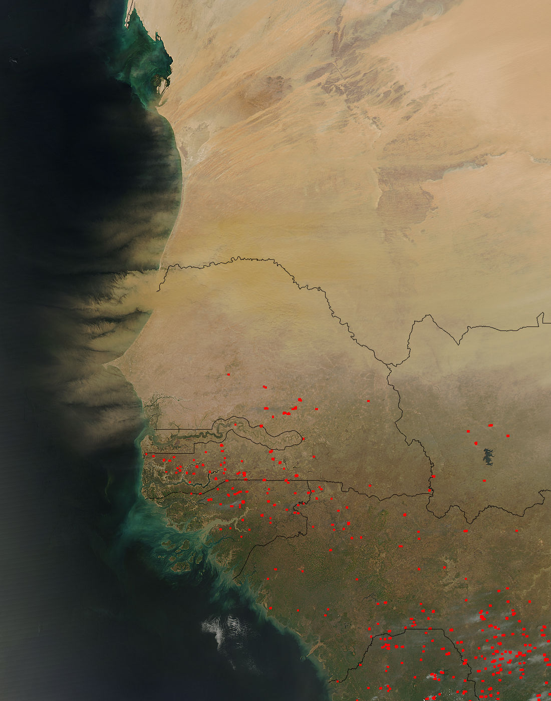
On February 26, 2015, the Moderate Resolution Imaging Spectroradiometer (MODIS) on NASA’s Aqua satellite captured a true-color image of Saharan dust embarking on a trans-Atlantic journey. In this image, vast amounts of dust rise up from Senegal, Mauritania, and Gambia. The plumes are thick and brown, suggesting that he dust is still compact and that it probably arose close to the coast—not from a more distant location in the North African interior. Some of the dust also appears to be settling into the waters just offshore, adding to the darkening effect in the satellite view.
Further south, red hotspots are scattered over the Sahel. The Sahel is the semi-arid region that lies between the Sahara desert and the African savanna region and appears tan, brown and green. In the far south, the grasslands appear green, although clouded by smoke. Each red hotspot marks an area where the thermal bands on the MODIS instrument detected areas where the temperature is higher than background. When combined with typical smoke, such hotspots mark actively burning fires.
Image Facts
Satellite:
Aqua
Date Acquired: 2/26/2015
Resolutions:
1km (228.1 KB), 500m (761 KB), 250m (1.9 MB)
Bands Used: 1,4,3
Image Credit:
Jeff Schmaltz, MODIS Land Rapid Response Team, NASA GSFC
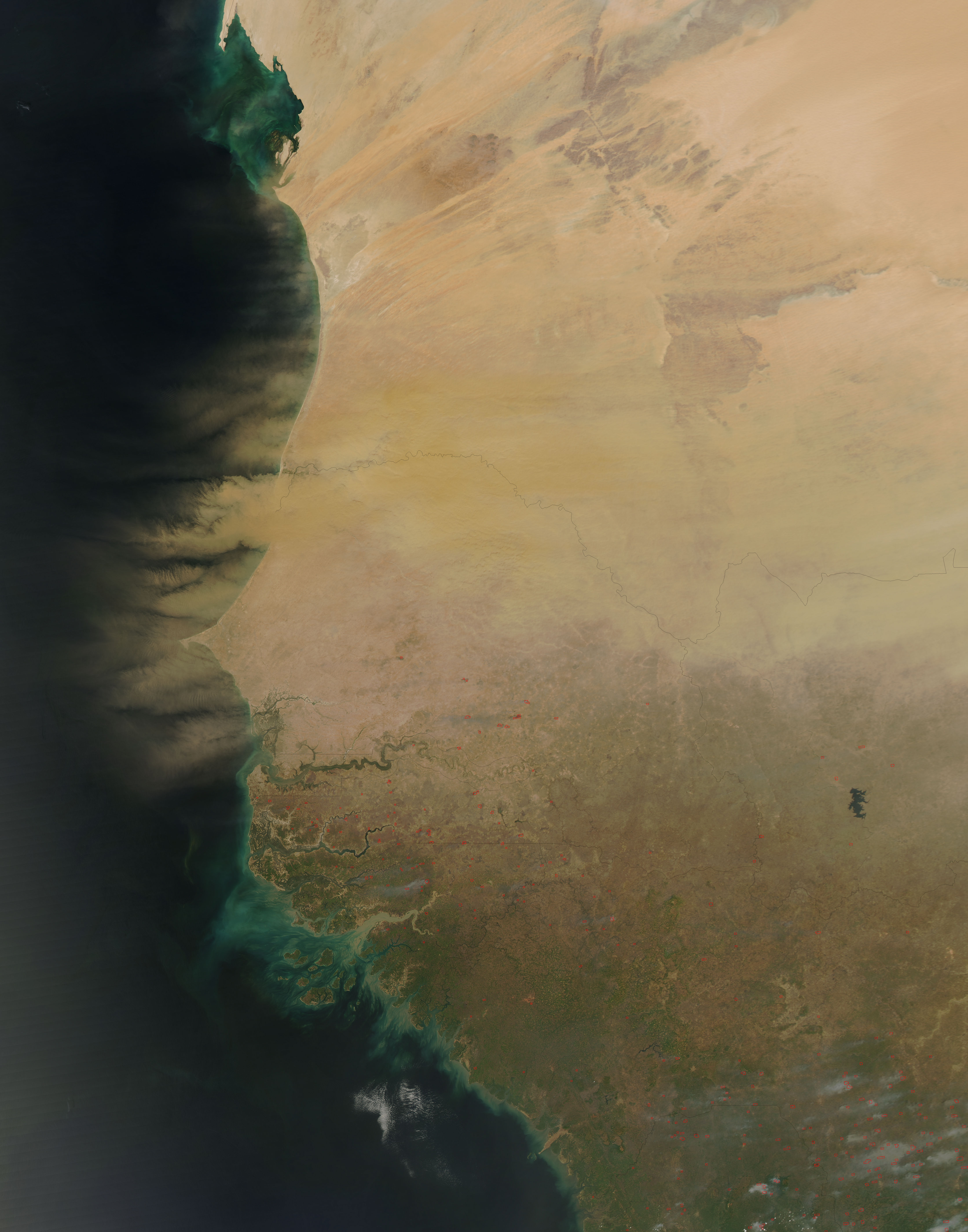
